Difference between revisions of "2013-07-06 28 -82"
imported>DrCanadianNinja (Success!) |
m |
||
| (3 intermediate revisions by 2 users not shown) | |||
| Line 1: | Line 1: | ||
| + | {{Advert}} | ||
| + | |||
{{meetup graticule | {{meetup graticule | ||
| map=<map lat="28" lon="-82" date="2013-07-06" /> | | map=<map lat="28" lon="-82" date="2013-07-06" /> | ||
| Line 13: | Line 15: | ||
=== The Geohashers === | === The Geohashers === | ||
| − | * [[user: | + | * [[user:Geoffistopheles|Geoff]] |
* [[user:NinjaBait|Erica]] | * [[user:NinjaBait|Erica]] | ||
| Line 24: | Line 26: | ||
== Gallery == | == Gallery == | ||
| − | + | <gallery caption="Photo Gallery" widths="200px" heights="200px" perrow="4"> | |
| + | Image:2013-07-06 28 -82_GPS.jpg|Success! | ||
| + | Image:2013-07-06 28 -82_GeohashNW.jpg|Looking northwest from the hashpoint. The boy who said hi is visible from here. | ||
| + | Image:2013-07-06 28 -82_Geohashers.jpg|Success! | ||
| + | Image:2013-07-06 28 -82_Geohash.jpg|The hash tree. | ||
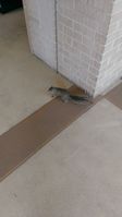
| + | Image:2013-07-06 28 -82_Marker.jpg|J♠ | ||
| + | Image:2013-07-06 28 -82_MarkerLocation.jpg|In by the vending machines at Cooper Hall | ||
| + | Image:2013-07-06 28 -82_Squirrel.jpg|SQUIRREL! | ||
| + | Image:2013-07-06 28 -82_Cooper.jpg|USF tour! This is Cooper Hall and where I ended up taking a majority of my classes for my history degree. It's a pretty central area on campus, second to the administrative building/food court. | ||
| + | Image:2013-07-06 28 -82_Science.jpg|This is the science lab that almost killed me! More accurately, I found out a grad student had drilled through an active gas line while I was walking by, and the only thing anyone could say was "at least nothing sparked." | ||
| + | Image:2013-07-06 28 -82_Water.jpg|USF: Now sponsored by Disney. Or it's a set of water molecules above a fountain thing near the science lab. I like the Disney answer better. | ||
| + | </gallery> | ||
| Line 30: | Line 43: | ||
[[Category:Expeditions]] | [[Category:Expeditions]] | ||
[[Category:Coordinates reached]] | [[Category:Coordinates reached]] | ||
| + | [[Category:Expeditions with photos]] | ||
| + | {{location|US|FL|HL}} | ||
Latest revision as of 17:09, 24 March 2021
| Have you seen our geohashing marker? We'd love to hear from you! Click here to say "hi" and tell us what you've seen!
Curious about what geohashing is? Read more! |
| Sat 6 Jul 2013 in Tampa, Florida: 28.0623966, -82.3639936 geohashing.info google osm bing/os kml crox |
Expedition
The Plan
Between I-75 and USF, on a subcommunity road. Plan is to gather our forces, then leave around 10:00 AM. We'd go for the 4:00 meetup, except there have recently been storms starting around 2:00 and lasting for quite a while; worst case scenario, I'd rather not get caught in that.
The Geohashers
The Adventure
Pope Flactem I opted out of this one. While not the quickest route, we got on Tampa Road, which turns into Hillsborough, pretty much right up to University of South Florida. Erica realized early that she forgot her good camera and cursed that decision twenty minutes later. Hillsborough is perpendicular to Tampa International Airport, and a few planes were coming in to land. She hadn't known about TIA being that close, but when the more knowledgeable person about the area isn't freaking out about the 747 hovering over the road, there's probably more to the story.
The geohash was anticlimactic. I tried to take the corner at 30 MPH for a Speed Racer, but since there were people around, I decided against it. As it turned out, that was a good idea; the hash was on the sidewalk instead. We got our bearings straight, then said hello to a small child racing through on a Big Wheel, followed by his mother.
The next question: Where to leave the Jack of Spades? I decided there was no better location than USF. We parked a ways away and I took her on a tour, pointing out the buildings I used to live in, the main buildings I studied or at least pretended to in, the lab that almost killed me, the library I was rarely in... fun times. We left it by some pretty crowded bulletin boards and went on our way.
Gallery
- Photo Gallery
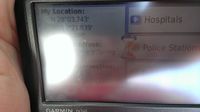
Success!
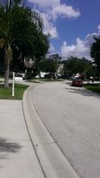
Looking northwest from the hashpoint. The boy who said hi is visible from here.
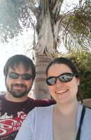
Success!

The hash tree.
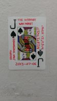
J♠
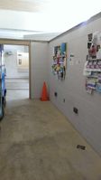
In by the vending machines at Cooper Hall
SQUIRREL!
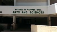
USF tour! This is Cooper Hall and where I ended up taking a majority of my classes for my history degree. It's a pretty central area on campus, second to the administrative building/food court.
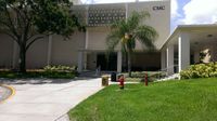
This is the science lab that almost killed me! More accurately, I found out a grad student had drilled through an active gas line while I was walking by, and the only thing anyone could say was "at least nothing sparked."
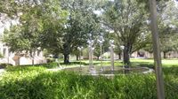
USF: Now sponsored by Disney. Or it's a set of water molecules above a fountain thing near the science lab. I like the Disney answer better.


