Difference between revisions of "2008-07-02"
From Geohashing
imported>Tjtrumpet2323 (Tuesday's coords announcement) |
imported>ReletBot m (moving from Template:auto gallery to Template:auto gallery2) |
||
| (11 intermediate revisions by 5 users not shown) | |||
| Line 1: | Line 1: | ||
<noinclude>{{date navigation}}</noinclude> | <noinclude>{{date navigation}}</noinclude> | ||
| − | + | {{auto coordinates}} | |
| − | + | {{auto gallery2|2008-07-02}} | |
| − | |||
| − | |||
| − | |||
| − | |||
=== Expeditions === | === Expeditions === | ||
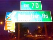
| − | + | [[2008-07-02 1 103|2008-07-02 Singapore]] -- In the outermost lane of the Central Expressway, southbound on the Moulmein flyover just a few meters after Exit 7D (Balestier Road). | |
| − | + | <noinclude>{{expedition summaries|2008-07-02}}</noinclude> | |
| − | |||
| − | {{ | ||
Latest revision as of 22:17, 23 August 2010
Expedition Archives from July 2008
Tuesday 1 July 2008 | Wednesday 2 July 2008 | Thursday 3 July 2008
See also: Category:Meetup on 2008-07-02
Coordinates
West of -30°: .2805084, .9275776
East of -30°: .3212162, .8560437
Globalhash:
-32.181076844226,128.175748309540
Photo Gallery
Expeditions
2008-07-02 Singapore -- In the outermost lane of the Central Expressway, southbound on the Moulmein flyover just a few meters after Exit 7D (Balestier Road).
Expeditions and Plans
| 2008-07-02 | ||
|---|---|---|
| Singapore, Singapore | r0d3n7z | 1.3212162397543017, 103.85604374530429 In the outermost lane of the Centra... |
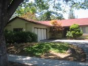
| San Jose, California | User:Tapin, Buxley | Somewhere |
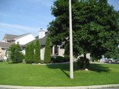
| Ottawa, Ontario | Logopolis | A house in Stittsville, a suburb to the west of Ottawa. |
| London West, United Kingdom | Mudskipper40 | Cycled past today's geohashing co-ords on A30 by Blackbushe Airport. |
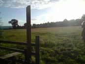
| Bristol, United Kingdom | Bluecont, Goldcont | A field on the outskirts of Banwell, North Somerset. |


