Difference between revisions of "2017-05-24 64 25"
imported>Pastori (→Achievements) |
m |
||
| (2 intermediate revisions by 2 users not shown) | |||
| Line 44: | Line 44: | ||
}} | }} | ||
{{Multihash2 | count = 2 | date = 2017-05-24 | name = Pastori|Pastori]] and The Wife | image = 2017-05-24 64 25DSC 0588 1500px.jpg }} | {{Multihash2 | count = 2 | date = 2017-05-24 | name = Pastori|Pastori]] and The Wife | image = 2017-05-24 64 25DSC 0588 1500px.jpg }} | ||
| + | |||
| + | [[Category:Expeditions]] | ||
| + | [[Category:Expeditions with photos]] | ||
| + | [[Category:Coordinates reached]] | ||
| + | {{location|FI|14}} | ||
Latest revision as of 11:57, 23 September 2021
| Wed 24 May 2017 in 64,25: 64.2331964, 25.4144432 geohashing.info google osm bing/os kml crox |
Location
Haapavesi, Ainali village. The point lies in a young group of pine saplings.
Participants
- Pastori
- The Wife
Expedition
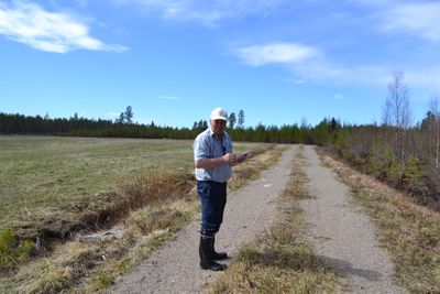
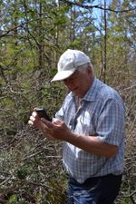
They've now eaten their apples and drank a cup of coffee with pastries and are closing in on the next hashpoint. There was a 81 km drive between the points, after which they parked their car at the side of the road. The point was 223 m away as the bird flies. Approaching this point was far easier than the previous one and not just because it was only half as far. They were able to walk at the side of a field on a tractor track and then the point was only 30 m into the forest, which was also very easy to walk in. They reached the point with a 1.215 m accuracy. At this point it was 11:59 am and the temperature was +15 degrees Celsius and Pastori and Wife got hot and the summer continues towards new challenges. This trip to the point only took 20 min.
Photos
Achievements
Pastori earned the Land geohash achievement
|
Pastori earned the Multihash Achievement
|


