Difference between revisions of "File:2012-05-08 33 -117 LeaveNoTrace.jpg"
From Geohashing
(Maintenance script uploaded File:2012-05-08 33 -117 LeaveNoTrace.jpg) |
m (Adding categories) |
||
| Line 1: | Line 1: | ||
This is a snapshot from Google Earth showing why this hashpoint is not accessible. It lies 100m off a path in a front country State Park. | This is a snapshot from Google Earth showing why this hashpoint is not accessible. It lies 100m off a path in a front country State Park. | ||
| + | [[Category:Meetup on 2012-05-08]] | ||
| + | [[Category:Meetup in 33 -117]] | ||
Latest revision as of 18:00, 13 October 2021
This is a snapshot from Google Earth showing why this hashpoint is not accessible. It lies 100m off a path in a front country State Park.
File history
Click on a date/time to view the file as it appeared at that time.
| Date/Time | Thumbnail | Dimensions | User | Comment | |
|---|---|---|---|---|---|
| current | 15:36, 30 January 2020 | 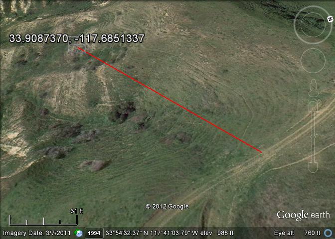 | 672 × 480 (60 KB) | Maintenance script (talk | contribs) |
- You cannot overwrite this file.
File usage
The following page links to this file: