Difference between revisions of "2008-08-17 -35 149"
imported>Nemo (first writeup) |
Felix Dance (talk | contribs) (Created user links) |
||
| (8 intermediate revisions by 4 users not shown) | |||
| Line 7: | Line 7: | ||
== A Canberra Geohash in several easy steps == | == A Canberra Geohash in several easy steps == | ||
| − | # Llandorin and Deb park at the nearest spot to the hashpoint | + | # [[User:Llandorin|Llandorin]] and Deb park at the nearest spot to the hashpoint |
#* Geohash point is on the northern slopes of Mt Stromlo | #* Geohash point is on the northern slopes of Mt Stromlo | ||
| − | # Nemo arrives a minute later | + | # [[User:Nemo|Nemo]] arrives a minute later |
#* He had been investigating the inability to drive to the roads on the other side of the bardwire fences | #* He had been investigating the inability to drive to the roads on the other side of the bardwire fences | ||
# The three of them trek over a barbwire fence and to a dirt road which is reckoned by dodgy phone GPS as the point. | # The three of them trek over a barbwire fence and to a dirt road which is reckoned by dodgy phone GPS as the point. | ||
#* Yay Nokia | #* Yay Nokia | ||
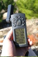
| − | # Psud arrives with superior GPS-fu, and leads another 50 to a | + | # [[User:Psud|Psud]] arrives with superior GPS-fu, and leads another 50 to a mountain bike trail through the edge of the pine trees, and this indeed WAS the geohash point. |
#* This was more in line with what google maps thought too | #* This was more in line with what google maps thought too | ||
| + | #* Despite being on a bike trail, we did NOT achieve a bicycle geohash, nor were we run over by bicycles | ||
# Picnic and photos taken | # Picnic and photos taken | ||
| + | #* Gastronomical discovery of the picnic: Liquorice and salsa. Taste to your own imagination and/or experimentation. | ||
#* No robo-camera though | #* No robo-camera though | ||
# ??? | # ??? | ||
| Line 23: | Line 25: | ||
== Photos == | == Photos == | ||
| − | ... | + | [{{fullurl:{{FULLPAGENAME}}|action=purge}} Refresh the cache] |
| + | <gallery caption="The hash" widths="200px" heights="200px" perrow="3"> | ||
| + | Image:2008-08-17-pict5457 Sunny day.jpg|It was a sunny day. | ||
| + | Image:2008-08-17-pict5425 Psud arrives late.jpg|Psud arrived late. | ||
| + | Image:2008-08-17-pict5426 Llandorin Deb and Nemo.jpg|Llandorin, Deb and Nemo were already there, but 50 metres from the hash. | ||
| + | Image:2008-08-17-pict5427 At the geohash.jpg|We reached the hash point. | ||
| + | Image:24072008 psudcamera.jpg|Psud left the tripod in the car, so tied the camera to a tree for a 100% natural monopod | ||
| + | Image:2008-08-17-pict5432 Group shot with treepod.jpg|We stood as straight up as we could | ||
| + | Image:2008-08-17-pict5435 Picnic.jpg|This is a picnic. | ||
| + | Image:2008-08-17-pict5434 A caramello koala.jpg|This is a caramello koala. | ||
| + | Image:2008-08-17-pict5437 Caramello koala with salsa.jpg|This is a naked caramello koala dipped in salsa. An acquired taste. | ||
| + | Image:2008-08-17-pict5438 The area around the hash.jpg|The hash was in the Mt Stromlo pine forest which was destroyed by bushfire in 2003. | ||
| + | Image:2008-08-17-pict5442 Tower Civic and the Capt Cook Memorial Water Jet.jpg|Oblig tower shot, plus a little bit of Canberra City, and the Captain Cook Memorial Water Jet as seen from the hash point. | ||
| + | Image:2008-08-17-pict5452 Frisbee.jpg|Nemo's frisbee was flung. | ||
| + | Image:2008-08-17-pict5459 Returning over the fence.jpg|We left the same way we came - over a barbed wire fence. | ||
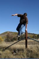
| + | Image:2008-08-17-pict5463 over the fence.jpg|Nemo jumped it well. | ||
| + | Image:2008-08-17-pict5466 Psud over the fence.jpg|Psud Climbed it carefully. | ||
| + | Image:2008-08-17-pict5467 and over.jpg|And both got over. Llandorin and Deb had left earlier. | ||
| + | Image:2008-08-17-pict5481 No ducks were seen.jpg|The sign warned of ducks. None were seen. | ||
| + | </gallery> | ||
| + | |||
| + | [[Category:Expeditions]] | ||
| + | [[Category:Expeditions with photos]] | ||
| + | [[Category:Coordinates reached]] | ||
| + | [[Category:Meetup on 2008-08-17]] | ||
| + | {{location|AU|ACT}} | ||
Latest revision as of 02:36, 20 January 2022
| Sun 17 Aug 2008 in -35,149: -35.3047357, 149.0104490 geohashing.info google osm bing/os kml crox |
A Canberra Geohash in several easy steps
- Llandorin and Deb park at the nearest spot to the hashpoint
- Geohash point is on the northern slopes of Mt Stromlo
- Nemo arrives a minute later
- He had been investigating the inability to drive to the roads on the other side of the bardwire fences
- The three of them trek over a barbwire fence and to a dirt road which is reckoned by dodgy phone GPS as the point.
- Yay Nokia
- Psud arrives with superior GPS-fu, and leads another 50 to a mountain bike trail through the edge of the pine trees, and this indeed WAS the geohash point.
- This was more in line with what google maps thought too
- Despite being on a bike trail, we did NOT achieve a bicycle geohash, nor were we run over by bicycles
- Picnic and photos taken
- Gastronomical discovery of the picnic: Liquorice and salsa. Taste to your own imagination and/or experimentation.
- No robo-camera though
- ???
- But seriously, ???
- PROFIT!!!
- We will try not to spend it all on beer and hookers. Honestly.
Photos
- The hash
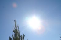
It was a sunny day.

Psud arrived late.
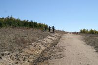
Llandorin, Deb and Nemo were already there, but 50 metres from the hash.
We reached the hash point.
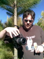
Psud left the tripod in the car, so tied the camera to a tree for a 100% natural monopod
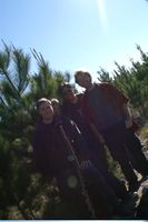
We stood as straight up as we could
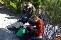
This is a picnic.
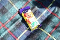
This is a caramello koala.
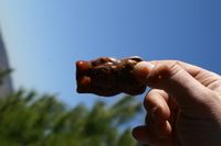
This is a naked caramello koala dipped in salsa. An acquired taste.

The hash was in the Mt Stromlo pine forest which was destroyed by bushfire in 2003.
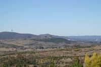
Oblig tower shot, plus a little bit of Canberra City, and the Captain Cook Memorial Water Jet as seen from the hash point.
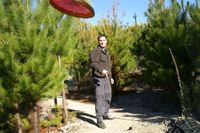
Nemo's frisbee was flung.

We left the same way we came - over a barbed wire fence.

Nemo jumped it well.
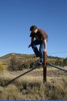
Psud Climbed it carefully.
And both got over. Llandorin and Deb had left earlier.

The sign warned of ducks. None were seen.


