Difference between revisions of "2022-01-25 52 0"
PeterRoder (talk | contribs) (Created page with "{{subst:Expedition}}") |
PeterRoder (talk | contribs) m |
||
| (2 intermediate revisions by 2 users not shown) | |||
| Line 1: | Line 1: | ||
| − | + | {{meetup graticule | |
| − | + | | lat=52 | |
| − | + | | lon=0 | |
| − | + | | date=2022-01-25 | |
| − | + | }} | |
| − | |||
| − | |||
| − | |||
| − | |||
| − | | lat= | ||
| − | | lon= | ||
| − | | date= | ||
| − | }} | ||
__NOTOC__ | __NOTOC__ | ||
== Location == | == Location == | ||
| − | + | A field between Linton and Great Chesterford | |
== Participants == | == Participants == | ||
| − | + | [[User:PeterRoder|PeterRoder]] | |
| − | |||
| − | |||
| − | |||
| − | |||
== Expedition == | == Expedition == | ||
| − | + | This wasn't a sensible idea. I had work I needed to do on Monday, and told myself I wasn't allowed to start planning the geohash until I'd finished the work. If I didn't finish the work in time, I wouldn't let myself go to this hash. What actually happened was that I finished the work, but without enough time spare to plan properly. I wanted to reach the hash before dark, so I left at about 13:00 with a vague image of the google maps recommended route in my head, and two waypoints in my gps: the hash itself, a a point I needed to turn right at in order to get there. | |
| − | + | Fortunately, the majority of the route followed one road, so navigation wasn't too difficult for the first 3 hours. Unfortunately, my assumption that google maps would take me along a route suitable for pedestrians was wrong. The pavement disappeared after about an hour and a half, leaving me to walk on grassss/mud verges. I pressed on, because I didn't have an alternate route and nothing was hurting yet so there was no point quitting. | |
| − | |||
| − | + | [[Image:2022-01-25 52 0 public footpath.jpg|thumb|left|upright|Clearly the start of a public footpath, even labelled as one, but no path visible beyond]] | |
| − | + | I eventually reached the turn-off point, where I couldn't see the path that had seemed so pronounced in my hasty glance at it on google street view. I continued instead to an alternate route I remembered, which in contrast was easier to find in real life. Once I was off the road, everything was much more peaceful, but navigation was now a concern. At every junction, there were more options than I remembered, and there were more total juntions than I remembered. I ended up just taking whatever looked vaguely like a path (or at least an animal track) and went closest to the direction I wanted to go. This got me there at a reasonably high pace, and once on the correct field I walked along tractor tracks, getting to the hash itself while it was still light enough to see what I was walking on. | |
| − | Image: | ||
| − | - | ||
| − | |||
| − | |||
| − | + | [[Image:2022-01-25 52 0 me.jpg|thumb|right|upright|Me, trying to point a light and a tablet camera at my face at the same time]] | |
| − | + | I quickly retreated and found what claimed to be a public bridleway. I followed it to a log under some tree cover, where I ate sausage sandwiches. By this point, it was mostly just my legs that were hurting, but also my shoulders slightly from carrying my bag. It was about 17:00, and dark, when I took a picture of myself then resumed my journey. Somehow, on my route back to the road, I managed to completely follow the planned route, until I got to where I hadn't been able to find the path from the road and went back the same way I came. | |
| − | |||
| − | + | [[Image:2022-01-25 52 0 stats.jpg|thumb|left|upright|Some statistics from the expedition]] | |
| − | + | I followed the same road back, but this time I at least had a better idea of which side of the road I should be on when. However, it was now dark, making the area with low overhanging trees even more annoying. My back and feet were now starting to hurt as well. I had plenty of time now to regret my decisions, but I knew that if I kept walking, I'd get back home eventually. As I was getting into Cambridge, benches started to make an appearance. I avoided letting myself be tempted, because I knew if I sat down I wouldn't get up for a long time, and I'd just delay getting home. I finally did reach home at about 21:00. This made my whole journey about 8 hours, slightly beating the google maps estimate that said 4:13 for the one-way route. | |
| − | |||
| − | + | == Tracklog == | |
| + | {{Tracklog|2022-01-25 52 0.gpx}}I actually started in the same place that I finished; the gps just took a while to find satellites. | ||
| − | + | == Achievements == | |
| − | + | {{#vardefine:ribbonwidth|800px}} | |
| − | [[ | + | {{Walk geohash |
| − | -- | + | |latitude=52 |
| + | |longitude=0 | ||
| + | |date=2022-01-25 | ||
| + | |name=[[User:PeterRoder|Peter]] | ||
| + | |distance=41km | ||
| + | }} | ||
| + | This beat [[2022-01-21 52 0|my previous record]] of 20km. | ||
| − | |||
| − | |||
[[Category:Expeditions]] | [[Category:Expeditions]] | ||
| − | |||
[[Category:Expeditions with photos]] | [[Category:Expeditions with photos]] | ||
| − | + | ||
| − | |||
| − | |||
| − | |||
| − | |||
[[Category:Coordinates reached]] | [[Category:Coordinates reached]] | ||
| − | + | {{location|GB|ENG|ESS}} | |
| − | |||
| − | |||
| − | |||
| − | |||
| − | |||
| − | |||
| − | |||
| − | |||
| − | |||
| − | |||
| − | |||
| − | |||
| − | |||
| − | |||
| − | |||
| − | |||
| − | |||
Latest revision as of 09:22, 27 January 2022
| Tue 25 Jan 2022 in 52,0: 52.0773553, 0.2396146 geohashing.info google osm bing/os kml crox |
Location
A field between Linton and Great Chesterford
Participants
Expedition
This wasn't a sensible idea. I had work I needed to do on Monday, and told myself I wasn't allowed to start planning the geohash until I'd finished the work. If I didn't finish the work in time, I wouldn't let myself go to this hash. What actually happened was that I finished the work, but without enough time spare to plan properly. I wanted to reach the hash before dark, so I left at about 13:00 with a vague image of the google maps recommended route in my head, and two waypoints in my gps: the hash itself, a a point I needed to turn right at in order to get there.
Fortunately, the majority of the route followed one road, so navigation wasn't too difficult for the first 3 hours. Unfortunately, my assumption that google maps would take me along a route suitable for pedestrians was wrong. The pavement disappeared after about an hour and a half, leaving me to walk on grassss/mud verges. I pressed on, because I didn't have an alternate route and nothing was hurting yet so there was no point quitting.
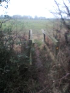
I eventually reached the turn-off point, where I couldn't see the path that had seemed so pronounced in my hasty glance at it on google street view. I continued instead to an alternate route I remembered, which in contrast was easier to find in real life. Once I was off the road, everything was much more peaceful, but navigation was now a concern. At every junction, there were more options than I remembered, and there were more total juntions than I remembered. I ended up just taking whatever looked vaguely like a path (or at least an animal track) and went closest to the direction I wanted to go. This got me there at a reasonably high pace, and once on the correct field I walked along tractor tracks, getting to the hash itself while it was still light enough to see what I was walking on.
I quickly retreated and found what claimed to be a public bridleway. I followed it to a log under some tree cover, where I ate sausage sandwiches. By this point, it was mostly just my legs that were hurting, but also my shoulders slightly from carrying my bag. It was about 17:00, and dark, when I took a picture of myself then resumed my journey. Somehow, on my route back to the road, I managed to completely follow the planned route, until I got to where I hadn't been able to find the path from the road and went back the same way I came.
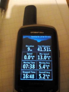
I followed the same road back, but this time I at least had a better idea of which side of the road I should be on when. However, it was now dark, making the area with low overhanging trees even more annoying. My back and feet were now starting to hurt as well. I had plenty of time now to regret my decisions, but I knew that if I kept walking, I'd get back home eventually. As I was getting into Cambridge, benches started to make an appearance. I avoided letting myself be tempted, because I knew if I sat down I wouldn't get up for a long time, and I'd just delay getting home. I finally did reach home at about 21:00. This made my whole journey about 8 hours, slightly beating the google maps estimate that said 4:13 for the one-way route.
Tracklog
I actually started in the same place that I finished; the gps just took a while to find satellites.
Achievements
Peter earned the Walk geohash Achievement
|
This beat my previous record of 20km.


