Difference between revisions of "2018-01-16 47 11"
From Geohashing
imported>Claralucia9 (→Plans) |
m |
||
| (3 intermediate revisions by 3 users not shown) | |||
| Line 22: | Line 22: | ||
== Participants == | == Participants == | ||
| − | claralucia9 | + | *[[User:clearlucid9|claralucia9]] |
== Expedition == | == Expedition == | ||
Terrible weather this afternoon with lots of heavy rain. Would this stop me from trying to reach this hashpoint? No way! And imagine the luck I had: the rain stops for like 5 minutes and that was when left the car and took my photos. Lucky day! | Terrible weather this afternoon with lots of heavy rain. Would this stop me from trying to reach this hashpoint? No way! And imagine the luck I had: the rain stops for like 5 minutes and that was when left the car and took my photos. Lucky day! | ||
| − | |||
| − | |||
| − | |||
== Photos == | == Photos == | ||
| Line 49: | Line 46: | ||
<!-- Add any achievement ribbons you earned below, or remove this section --> | <!-- Add any achievement ribbons you earned below, or remove this section --> | ||
| − | |||
| − | |||
| − | |||
| − | |||
| − | |||
| − | |||
| − | |||
| − | |||
| − | |||
| − | |||
| − | |||
| − | |||
| − | |||
| − | |||
[[Category:Expeditions]] | [[Category:Expeditions]] | ||
| − | |||
[[Category:Expeditions with photos]] | [[Category:Expeditions with photos]] | ||
| − | |||
| − | |||
| − | |||
| − | |||
| − | |||
[[Category:Coordinates reached]] | [[Category:Coordinates reached]] | ||
| − | + | {{location|DE|BY|M}} | |
| − | |||
| − | |||
| − | |||
| − | |||
| − | |||
| − | |||
| − | |||
| − | |||
| − | |||
| − | |||
| − | |||
| − | |||
| − | |||
| − | |||
| − | |||
| − | |||
| − | |||
Latest revision as of 13:22, 18 March 2022
| Tue 16 Jan 2018 in 47,11: 47.9834393, 11.7281373 geohashing.info google osm bing/os kml crox |
Location
On a forest road between Faistenhaar and Aying, south of Munich
Participants
Expedition
Terrible weather this afternoon with lots of heavy rain. Would this stop me from trying to reach this hashpoint? No way! And imagine the luck I had: the rain stops for like 5 minutes and that was when left the car and took my photos. Lucky day!
Photos
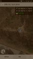
@the hashpoint

claralucia9 @ hashpoint
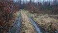
Looking west
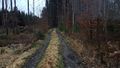
Looking east


