Difference between revisions of "2017-03-31 1 103"
From Geohashing
imported>R0d3n7z (Created page with "{{meetup graticule | map=<map lat="1" lon="103" date="2017-03-31" /> | lat=1 | lon=103 | date=2017-03-31 }} <!-- WIP --> Category:Expeditions") |
m |
||
| (3 intermediate revisions by 3 users not shown) | |||
| Line 6: | Line 6: | ||
}} | }} | ||
| − | < | + | == About == |
| + | |||
| + | Inside MacRitchie Reservoir Park, approx 70~80m off trail along Terentang Trail. | ||
| + | |||
| + | == Participants == | ||
| + | *[[User:R0d3n7z|R0d3n7z]] | ||
| + | |||
| + | == Plans == | ||
| + | |||
| + | With past expeditions in the graticule being of a predominantly urban nature (see what I did there), a hike in the nature reserve sure sounds nice! Google has been through there with the [https://www.google.com/streetview/trekker/ trekker backpack] so street view recce is possible. Trails appear to be well maintained. '''[https://www.nparks.gov.sg/~/media/nparks-real-content/gardens-parks-and-nature/parks-and-nature-reserve/central-catchment/cnr-macritchie-map.pdf Trail map pdf]''' | ||
| + | |||
| + | Potential side attractions: [https://www.nparks.gov.sg/gardens-parks-and-nature/parks-and-nature-reserves/central-catchment-nature-reserve/treetop-walk TreeTop Walk] (tame), [[wikipedia: Syonan Jinja|Syonan Jinja ruins]] (adventurous) | ||
| + | |||
| + | Weather forecast: possible thundery showers North and East regions in late morning / early afternoon. | ||
| + | |||
| + | == Expedition == | ||
| + | |||
| + | Foiled by heavy thunderstorm. | ||
| + | |||
| + | more writeup to come later | ||
| + | |||
| + | |||
| + | <gallery caption="Pictures" widths="200px" heights="200px" perrow="3"> | ||
| + | Image:2017-03-31_1_103_01_boardwalk.JPG| caption later | ||
| + | Image:2017-03-31 1 103 02 stream.JPG| caption later | ||
| + | Image:2017-03-31 1 103 03 path.JPG| caption later | ||
| + | Image:2017-03-31 1 103 04 flower.JPG| caption later | ||
| + | Image:2017-03-31 1 103 05 boardwalk.JPG| caption later | ||
| + | Image:2017-03-31 1 103 06 mrt.JPG| caption later | ||
| + | Image:2017-03-31 1 103 07 mapsign.JPG| caption later | ||
| + | Image:2017-03-31 1 103 07 waysign.JPG| caption later | ||
| + | Image:2017-03-31 1 103 08 cloudy.JPG| caption later | ||
| + | Image:2017-03-31 1 103 09 rain.JPG| caption later | ||
| + | Image:2017-03-31 1 103 rainmap1530.png| caption later | ||
| + | </gallery> | ||
| + | |||
[[Category:Expeditions]] | [[Category:Expeditions]] | ||
| + | [[Category:Expeditions with photos]] | ||
| + | [[Category:Coordinates not reached]] | ||
| + | [[Category:Not reached - Mother Nature]] | ||
| + | {{location|SG|CS}} | ||
Latest revision as of 13:27, 18 March 2022
| Fri 31 Mar 2017 in 1,103: 1.3545425, 103.8125139 geohashing.info google osm bing/os kml crox |
Contents
About
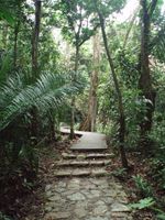
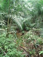
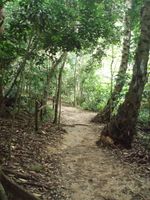
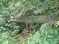
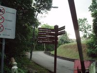
Inside MacRitchie Reservoir Park, approx 70~80m off trail along Terentang Trail.
Participants
Plans
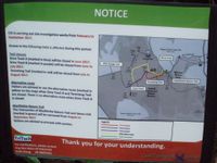
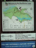
With past expeditions in the graticule being of a predominantly urban nature (see what I did there), a hike in the nature reserve sure sounds nice! Google has been through there with the trekker backpack so street view recce is possible. Trails appear to be well maintained. Trail map pdf
Potential side attractions: TreeTop Walk (tame), Syonan Jinja ruins (adventurous)
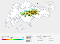
Weather forecast: possible thundery showers North and East regions in late morning / early afternoon.
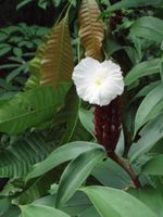
Expedition
Foiled by heavy thunderstorm.
more writeup to come later
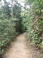
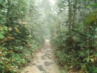
- Pictures
