Difference between revisions of "2008-05-24 45 -122"
From Geohashing
imported>Jiml m (Adjust formatting to apease APBot) |
m |
||
| (One intermediate revision by one other user not shown) | |||
| Line 13: | Line 13: | ||
== Participants == | == Participants == | ||
| − | * 7 Geohashers | + | * 7 Geohashers including [[User:Wil|Wil]] |
| Line 50: | Line 50: | ||
<!-- despite Friday fail discussion, I interpret this to be a Saturday success... --> | <!-- despite Friday fail discussion, I interpret this to be a Saturday success... --> | ||
| + | {{location|US|OR|CC}} | ||
Latest revision as of 12:12, 19 March 2022
| Sat 24 May 2008 in Portland: 45.1266480, -122.5475331 geohashing.info google osm bing/os kml crox |
Contents
Location
South of Molalla, Oregon
Participants
- 7 Geohashers including Wil
Expeditions
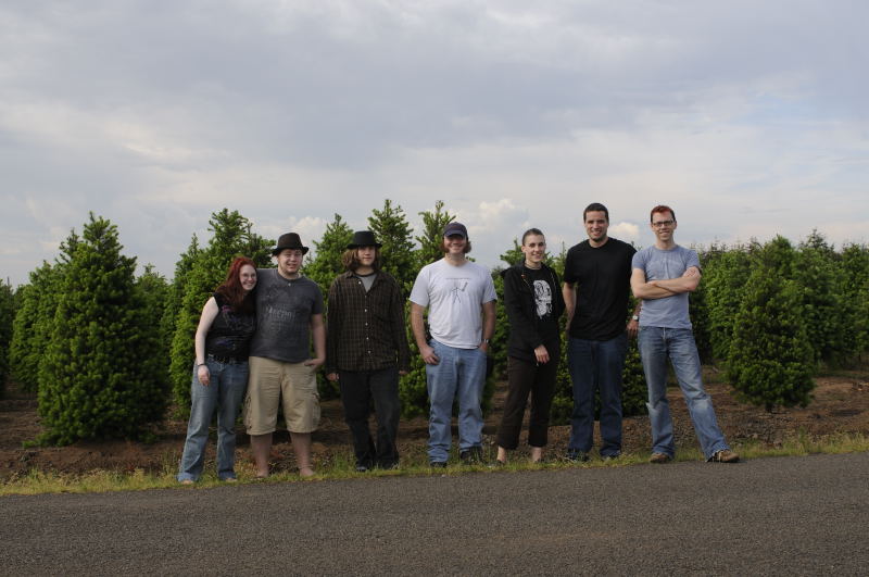
Seven of us made it.
Pictures
Here is the seven of us
Planning and Coordination Archives
5/24/2008 - Saturday
- Wait, don't you have to change the date to 2008-05-24? Then it changes to take place in the Molalla area. I might not make it to Saturday's, but how about Memorial Day's, in Vancouver?
- You're right, I was mistaken about Saturday's location.
- I might be down for Monday's location in Vancouver
- Saturday's location is PERFECT! Who wants to go to a dumb old neighborhood. We get to go trespassing in some farmer's field! WOO! We'll be there baby!
- I only know of one place to check ownership of Portland-area land, and I don't know how to interpret the lack of ownership information there. -wil
5/23/2008 - Friday
Lake Oswego neighborhood.
Too bad this would have been a better location for Saturday :(
Discussion
I believe that someone on Friday calculated the hashpoint using the Friday Dow and the Friday Date, instead of the Friday Dow and the Saturday date, and then thought that first point would be the Saturday point. Luckily for me, the former point is just the Friday point, which is in Lake Oswego, so that's the "wrong" location they are talking about. Jiml 05:32, 5 December 2010 (UTC)
