Difference between revisions of "2022-03-27 58 5"
From Geohashing
(→Expedition) |
(→Photos) |
||
| Line 39: | Line 39: | ||
Image:2022-03-27_58_5_Pica42_1648368182213.jpg|Tur til Hinna [https://openstreetmap.org/?mlat=58.91787760&mlon=5.71182900&zoom=16 @58.9179,5.7118] | Image:2022-03-27_58_5_Pica42_1648368182213.jpg|Tur til Hinna [https://openstreetmap.org/?mlat=58.91787760&mlon=5.71182900&zoom=16 @58.9179,5.7118] | ||
</gallery> | </gallery> | ||
| + | |||
| + | <gallery> | ||
| + | Example.jpg|Bildetekst1 | ||
| + | Example.jpg|Bildetekst2 | ||
| + | </gallery> | ||
| + | [[File:3 Jåttå.jpg|thumb]] | ||
== Achievements == | == Achievements == | ||
Revision as of 09:55, 27 March 2022
| Sun 27 Mar 2022 in 58,5: 58.9178479, 5.7118457 geohashing.info google osm bing/os kml crox |
Location
Participants
Pica42
Plans
Expedition
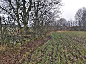
A morning trip to Jåttå, Stavanger, Norway on a slightly gray Sunday. The meadow was covered with natural fertilizer.
Tracklog
Photos
Tur til Hinna @58.9179,5.7118
- Example.jpg
Bildetekst1
- Example.jpg
Bildetekst2
Achievements

