Difference between revisions of "2022-05-20 42 -85"
Michael5000 (talk | contribs) (Created page with "{{subst:Expedition}}") |
Michael5000 (talk | contribs) |
||
| Line 1: | Line 1: | ||
| − | |||
| − | [[ | + | [[File:2022-05-20 42 -85 e.jpg|thumb|left]] |
| − | + | {{meetup graticule | |
| − | |||
| − | |||
| − | |||
| − | |||
| lat={{#explode:{{SUBPAGENAME}}| |1}} | | lat={{#explode:{{SUBPAGENAME}}| |1}} | ||
| lon={{#explode:{{SUBPAGENAME}}| |2}} | | lon={{#explode:{{SUBPAGENAME}}| |2}} | ||
| date={{#explode:{{SUBPAGENAME}}| |0}} | | date={{#explode:{{SUBPAGENAME}}| |0}} | ||
| − | }} | + | }} |
__NOTOC__ | __NOTOC__ | ||
== Location == | == Location == | ||
| − | + | ||
| + | On a dirt road south of Paw Paw. | ||
== Participants == | == Participants == | ||
| − | |||
| − | |||
| − | + | [[User:Michael5000|Michael5000]] ([[User talk:Michael5000|talk]]) 03:52, 21 May 2022 (UTC) | |
| − | |||
== Expedition == | == Expedition == | ||
| − | |||
| − | + | I looked at this hashpoint over breakfast, and it looked like it would probably be accessible. So, I got to the airport by about 8:30, and took Alaska Flight 686 to Chicago. Getting through Chicago at 5 p.m. on a Friday took quite a while, but I was able to catch I-94 just a few miles from O'Hare and follow it south around the southern end of Lake Michigan, through northwestern Indiana and then into the southwest of Michigan. | |
| − | + | ||
| + | It was well into dusk when I took the exit for Michigan Highway 51, then followed a succession of increasingly minor farm roads until I got to 64th Avenue. I stopped the car, got out, and walked up onto the shoulder to catch the hashpoint itself. It was very peaceful and still. Definitely worth the trip. | ||
| + | |||
== Photos == | == Photos == | ||
| − | + | ||
| − | |||
| − | |||
<gallery perrow="5"> | <gallery perrow="5"> | ||
| + | File:2022-05-20 42 -85 b.jpg|Entering the state only one state over from the hashpoint! | ||
| + | File:2022-05-20 42 -85 c.jpg|Turning onto 64th Avenue at last light. | ||
| + | File:2022-05-20 42 -85 d.jpg|What could possibly go wrong? | ||
| + | File:2022-05-20 42 -85 a.jpg|I made it! | ||
| + | File:2022-05-20 42 -85 e.jpg|Me, at the hashpoint | ||
</gallery> | </gallery> | ||
== Achievements == | == Achievements == | ||
{{#vardefine:ribbonwidth|800px}} | {{#vardefine:ribbonwidth|800px}} | ||
| − | |||
| − | |||
| − | |||
| − | |||
[[Category:New report]] | [[Category:New report]] | ||
Revision as of 03:52, 21 May 2022

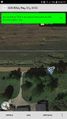
| Fri 20 May 2022 in 42,-85: 42.1861228, -85.9084595 geohashing.info google osm bing/os kml crox |
Location
On a dirt road south of Paw Paw.
Participants
Michael5000 (talk) 03:52, 21 May 2022 (UTC)
Expedition
I looked at this hashpoint over breakfast, and it looked like it would probably be accessible. So, I got to the airport by about 8:30, and took Alaska Flight 686 to Chicago. Getting through Chicago at 5 p.m. on a Friday took quite a while, but I was able to catch I-94 just a few miles from O'Hare and follow it south around the southern end of Lake Michigan, through northwestern Indiana and then into the southwest of Michigan.
It was well into dusk when I took the exit for Michigan Highway 51, then followed a succession of increasingly minor farm roads until I got to 64th Avenue. I stopped the car, got out, and walked up onto the shoulder to catch the hashpoint itself. It was very peaceful and still. Definitely worth the trip.
Photos
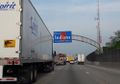
Entering the state only one state over from the hashpoint!
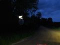
Turning onto 64th Avenue at last light.
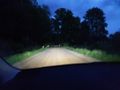
What could possibly go wrong?
I made it!
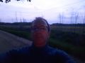
Me, at the hashpoint


Achievements