Difference between revisions of "2022-06-09 47 1"
(An expedition message sent via Geohash Droid for Android.) |
|||
| (10 intermediate revisions by 4 users not shown) | |||
| Line 1: | Line 1: | ||
| − | + | [[Image:{{{image|2022-06-09_47_1_EdBordin_1659837400221.jpg}}}|thumb|left]] | |
| − | + | {{meetup graticule | |
| − | |||
| − | |||
| − | |||
| − | |||
| − | |||
| − | |||
| lat=47 | | lat=47 | ||
| lon=1 | | lon=1 | ||
| Line 14: | Line 8: | ||
__NOTOC__ | __NOTOC__ | ||
== Location == | == Location == | ||
| − | + | In a field just outside of Blois. | |
== Participants == | == Participants == | ||
| − | + | [[User:EdBordin|Ed]] | |
| − | |||
== Plans == | == Plans == | ||
| − | + | I was in Blois ready to begin a 3-day tour on a hired bicycle. Everything seemed to be going very smoothly and I was making good time, so of course it was only logical to check for any nearby hashes and see if I could derail everything. When I saw the nearest hash was only a minor excursion of a few km out of town I was very tempted. Spurred on by friends in the geohashing group chat I decided I could probably fit it in! | |
== Expedition == | == Expedition == | ||
| − | + | I followed the directions from Google Maps out of town without any issue, although I was adjusting to being on the right-hand side of the road (rather than the left) which was mildly offputting - particularly on roundabouts. I was also monitoring the half-empty hiking pack which I'd strapped on top of the rear rack with occy (bungee for the North Americans?) straps. I later remembered I also had a ratchet strap which proved necessary to stop the pack trying to bungee off the rear of the bike for the rest of the trip. | |
| + | |||
| + | I arrived near the hash point and realised I was going to have to trample through someone's wheat crop. It was interesting to see they don't bother with fencing in France! After some deliberation I decided I was likely to be the only person doing this today and I wouldn't do that much damage if I walked in a straight line. I tried not to think too hard about the possibility of snakes or spiders (particularly given that unlike back home, they probably wouldn't kill me anyway) and started walking into the field. After what felt like about 20m away from the road I arrived at the hash, snapped a photo and scurried right back the way I came before any angry farmers could notice what I was up to! | ||
| + | |||
| + | At this point it was getting close to midday and I just needed to get back to town where I started and commence my planned ~80km of cycling with a couple of castles en route. I mentioned at the start that Google Maps gave me directions that worked with no issue to get there. For whatever reason, on the way back it decided to send me across a walking track in a field that it insisted was a road. You can see this in the GPS trace - I got to the edge of a forest and tried a couple of directions before I finally decided to stop trusting that Google would come through with a magic shortcut and turned around. I feel like this part delivered more on the promise of adventure than the actual geohashing bit! | ||
| + | |||
| + | Addendum: The rest of the day was excellent, the sun was shining and I crammed in a whirlwind tour of both Château Royal de Blois and Château Royal d'Amboise. I managed to arrive with less than 10 minutes to spare before check-in closed at my hotel, which vindicated my original decision that I had enough time to go geohashing. | ||
== Tracklog == | == Tracklog == | ||
<!-- if your GPS device keeps a log, you may use Template:Tracklog, post a link here, or both --> | <!-- if your GPS device keeps a log, you may use Template:Tracklog, post a link here, or both --> | ||
| + | {{tracklog | Edbordin Day 1 Blois to Tours.gpx}} | ||
== Photos == | == Photos == | ||
| Line 34: | Line 34: | ||
--> | --> | ||
<gallery perrow="5"> | <gallery perrow="5"> | ||
| + | Image:2022-06-09_47_1_EdBordin_1659837568829.jpg|Ready for an adventure! [https://openstreetmap.org/?mlat=47.58593333&mlon=1.32619444&zoom=16 @47.5859,1.3262] | ||
| + | |||
| + | Image:2022-06-09_47_1_EdBordin_1659837400221.jpg|I'm outstanding in my field [https://openstreetmap.org/?mlat=47.59905278&mlon=1.28228333&zoom=16 @47.5991,1.2823] | ||
| + | |||
| + | |||
| + | Image:2022-06-09_47_1_EdBordin_1659840502661.jpg|Château Royal d'Amboise [https://openstreetmap.org/?mlat=47.41420556&mlon=.98647778&zoom=16 @47.4142,.9865] | ||
</gallery> | </gallery> | ||
== Achievements == | == Achievements == | ||
{{#vardefine:ribbonwidth|800px}} | {{#vardefine:ribbonwidth|800px}} | ||
| − | |||
| − | |||
| − | |||
| − | |||
| − | |||
| − | + | {{bicycle geohash | |
| − | + | | latitude = 47 | |
| − | + | | longitude = 1 | |
| − | [[ | + | | date = 2022-06-09 |
| − | -- | + | | name = [[User:EdBordin|EdBordin]] |
| + | | distance = 87 kms | ||
| + | | bothways = true | ||
| + | | image = 2022-06-09_47_1_EdBordin_1659837568829.jpg | ||
| − | + | }} | |
| + | I'm choosing to claim the whole distance I cycled that day rather than work out what the round trip from Blois was (probably less than 10 km). | ||
| − | |||
[[Category:Expeditions]] | [[Category:Expeditions]] | ||
| − | |||
[[Category:Expeditions with photos]] | [[Category:Expeditions with photos]] | ||
| − | |||
| − | |||
| − | |||
| − | |||
| − | |||
[[Category:Coordinates reached]] | [[Category:Coordinates reached]] | ||
| − | + | {{location|FR|41}} | |
| − | |||
| − | |||
| − | |||
| − | |||
| − | |||
| − | |||
| − | |||
| − | |||
| − | |||
| − | |||
| − | |||
| − | |||
| − | |||
| − | |||
| − | |||
| − | |||
| − | |||
Latest revision as of 00:53, 8 August 2022

| Thu 9 Jun 2022 in 47,1: 47.5990545, 1.2823055 geohashing.info google osm bing/os kml crox |
Location
In a field just outside of Blois.
Participants
Plans
I was in Blois ready to begin a 3-day tour on a hired bicycle. Everything seemed to be going very smoothly and I was making good time, so of course it was only logical to check for any nearby hashes and see if I could derail everything. When I saw the nearest hash was only a minor excursion of a few km out of town I was very tempted. Spurred on by friends in the geohashing group chat I decided I could probably fit it in!
Expedition
I followed the directions from Google Maps out of town without any issue, although I was adjusting to being on the right-hand side of the road (rather than the left) which was mildly offputting - particularly on roundabouts. I was also monitoring the half-empty hiking pack which I'd strapped on top of the rear rack with occy (bungee for the North Americans?) straps. I later remembered I also had a ratchet strap which proved necessary to stop the pack trying to bungee off the rear of the bike for the rest of the trip.
I arrived near the hash point and realised I was going to have to trample through someone's wheat crop. It was interesting to see they don't bother with fencing in France! After some deliberation I decided I was likely to be the only person doing this today and I wouldn't do that much damage if I walked in a straight line. I tried not to think too hard about the possibility of snakes or spiders (particularly given that unlike back home, they probably wouldn't kill me anyway) and started walking into the field. After what felt like about 20m away from the road I arrived at the hash, snapped a photo and scurried right back the way I came before any angry farmers could notice what I was up to!
At this point it was getting close to midday and I just needed to get back to town where I started and commence my planned ~80km of cycling with a couple of castles en route. I mentioned at the start that Google Maps gave me directions that worked with no issue to get there. For whatever reason, on the way back it decided to send me across a walking track in a field that it insisted was a road. You can see this in the GPS trace - I got to the edge of a forest and tried a couple of directions before I finally decided to stop trusting that Google would come through with a magic shortcut and turned around. I feel like this part delivered more on the promise of adventure than the actual geohashing bit!
Addendum: The rest of the day was excellent, the sun was shining and I crammed in a whirlwind tour of both Château Royal de Blois and Château Royal d'Amboise. I managed to arrive with less than 10 minutes to spare before check-in closed at my hotel, which vindicated my original decision that I had enough time to go geohashing.
Tracklog
Photos
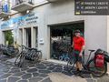
Ready for an adventure! @47.5859,1.3262

I'm outstanding in my field @47.5991,1.2823
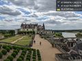
Château Royal d'Amboise @47.4142,.9865


Achievements
EdBordin earned the Bicycle geohash achievement
|
I'm choosing to claim the whole distance I cycled that day rather than work out what the round trip from Blois was (probably less than 10 km).