Difference between revisions of "2023-02-16 52 9"
(new report) |
(last man standing) |
||
| Line 28: | Line 28: | ||
{{land geohash|date=2023-02-16|latitude=52|longitude=9|name=[[User:Fippe|Fippe]]|image=2023-02-16 52 9 03 Geohash.jpg}} | {{land geohash|date=2023-02-16|latitude=52|longitude=9|name=[[User:Fippe|Fippe]]|image=2023-02-16 52 9 03 Geohash.jpg}} | ||
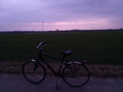
{{bicycle geohash|date=2023-02-16|latitude=52|longitude=9|distance=40 km|bothways=true|name=[[User:Fippe|Fippe]]|image=2023-02-16 52 9 01 Bicycle.jpg}} | {{bicycle geohash|date=2023-02-16|latitude=52|longitude=9|distance=40 km|bothways=true|name=[[User:Fippe|Fippe]]|image=2023-02-16 52 9 01 Bicycle.jpg}} | ||
| + | {{last man standing|date=2023-02-16|latitude=52|longitude=9|name=[[User:Fippe|Fippe]]}} | ||
__NOTOC__ | __NOTOC__ | ||
Latest revision as of 15:00, 19 March 2023
| Thu 16 Feb 2023 in 52,9: 52.2266531, 9.9076217 geohashing.info google osm bing/os kml crox |
Location
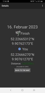
This Geohash is located on a field in Ahrbergen.
Participants
Expedition
In the evening, I cycled to Ahrbergen via Wülferode, the Bockmerholz forest, Ingeln, Hotteln and Gödringen. In the forest, Google Maps lured me onto a path that wasn't a path, but I managed to find the right path again.
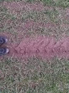
Outside of Ahrbergen, I located the coordinates on a field and recorded proof there. The sun was setting at this time.
Afterwards, I cycled back on a different route, via Sarstedt, Gödringen and Oesselse. This route would have almost given me a Tron achievement, had I not messed up early on in the Bockmerholz. (Between Ahrbergen and Sarstedt I was on different sides of the road, and I avoided crashes in Gödringen and Ingeln-Oesselse too.) But it was nice to see some new paths anyway!
Photos
Tracklog
Ribbons
Fippe earned the Land geohash achievement
|
Fippe earned the Bicycle geohash achievement
|
Fippe earned the Last man standing achievement
|


