Difference between revisions of "2023-07-19 53 9"
m (Updated photo file names) |
(Added photo captions) |
||
| Line 6: | Line 6: | ||
}} | }} | ||
== Location == | == Location == | ||
| − | In the middle of a crop field in Seester. | + | In the middle of a crop field in Seester, Schleswig Holstein. |
== Participants == | == Participants == | ||
| Line 25: | Line 25: | ||
== Photos == | == Photos == | ||
<gallery mode="packed" heights="140px"> | <gallery mode="packed" heights="140px"> | ||
| − | File:2023-07-19 53 9 - 01 On way - Broken down house.jpg | + | File:2023-07-19 53 9 - 01 On way - Broken down house.jpg | A broken down house on the way to the hash. |
| − | File:2023-07-19 53 9 - 02 On way - Pano of empty street .jpg | + | File:2023-07-19 53 9 - 02 On way - Pano of empty street .jpg | An empty street on the way to the hash - I love SH's landscape. |
| − | File:2023-07-19 53 9 - 03 On way - Bike ride to hash.png | + | File:2023-07-19 53 9 - 03 On way - Bike ride to hash.png | Bike ride activity on Rsge's watch after reaching near the hash. |
| − | File:2023-07-19 53 9 - 04 GPS evidence.png | + | File:2023-07-19 53 9 - 04 GPS evidence.png | GPS evidence of reaching the hash. |
| − | File:2023-07-19 53 9 - 05 Feet at hashpoint.jpg | + | File:2023-07-19 53 9 - 05 Feet at hashpoint.jpg | Rsge's feet (and drone) at the hash. |
| − | File:2023-07-19 53 9 - 06 Marker on ground.jpg | + | File:2023-07-19 53 9 - 06 Marker on ground.jpg | A small marker Rsge made out of straws at the hash |
| − | File:2023-07-19 53 9 - 07 Drone downwards.jpg | + | File:2023-07-19 53 9 - 07 Drone downwards.jpg | The hash from a bird's eye view, straight down. |
| − | File:2023-07-19 53 9 - 08 Drone photo south low.jpg | + | File:2023-07-19 53 9 - 08 Drone photo south low.jpg | The south of the hash via drone, flying low. |
| − | File:2023-07-19 53 9 - 09 Drone photo north low.jpg | + | File:2023-07-19 53 9 - 09 Drone photo north low.jpg | The north of the hash via drone, flying low. |
| − | File:2023-07-19 53 9 - 10 Drone pano south high.jpg | + | File:2023-07-19 53 9 - 10 Drone pano south high.jpg | A panorama of the south of the hash via drone, flying high. |
| − | File:2023-07-19 53 9 - 11 Drone photo south high.jpg | + | File:2023-07-19 53 9 - 11 Drone photo south high.jpg | The south of the hash via drone, flying high. |
| − | File:2023-07-19 53 9 - 12 Drone pano north high.jpg | + | File:2023-07-19 53 9 - 12 Drone pano north high.jpg | A panorama of the north of the hash via drone, flying high. |
| − | File:2023-07-19 53 9 - 13 Drone photo north high.jpg | + | File:2023-07-19 53 9 - 13 Drone photo north high.jpg | The north of the hash via drone, flying high. |
| − | File:2023-07-19 53 9 - 14 Drone 360 °.jpg | + | File:2023-07-19 53 9 - 14 Drone 360 °.jpg | A 360 ° photo at the hash. Special viewer needed. |
| − | File:2023-07-19 53 9 - 15 Rsge's bike before leave.jpg | + | File:2023-07-19 53 9 - 15 Rsge's bike before leave.jpg | Rsge's bike before leaving, looking in hash direction. |
| − | File:2023-07-19 53 9 - 16 Rsge before leave.jpg | + | File:2023-07-19 53 9 - 16 Rsge before leave.jpg | Rsge at his bike before leaving. |
| − | File:2023-07-19 53 9 - 17 Bike ride back home.png | + | File:2023-07-19 53 9 - 17 Bike ride back home.png | Bike ride activity total after getting home. |
| − | File:2023-07-19 53 9 - 18 Rsge's bike ride path.jpg | + | File:2023-07-19 53 9 - 18 Rsge's bike ride path.jpg | Rsge's bike ride path. Proof of Tron achievement. |
| − | File:2023-07-19 53 9 - 19 Dirty soles.jpg | + | File:2023-07-19 53 9 - 19 Dirty soles.jpg | Rsge's dirty soles after getting home. |
</gallery> | </gallery> | ||
| Line 59: | Line 59: | ||
[[Category:Expeditions with photos]] | [[Category:Expeditions with photos]] | ||
--> | --> | ||
| − | |||
[[Category:Coordinates reached]] | [[Category:Coordinates reached]] | ||
Revision as of 23:07, 19 July 2023

| Wed 19 Jul 2023 in 53,9: 53.7032615, 9.5889059 geohashing.info google osm bing/os kml crox |
Location
In the middle of a crop field in Seester, Schleswig Holstein.
Participants
Plans
Expedition
Rsge
Photos
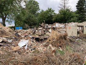
A broken down house on the way to the hash.
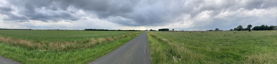
An empty street on the way to the hash - I love SH's landscape.
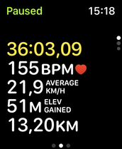
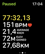
Bike ride activity on Rsge's watch after reaching near the hash.
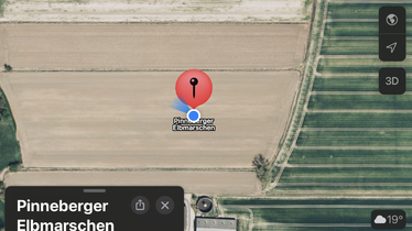
GPS evidence of reaching the hash.
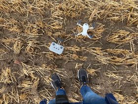
Rsge's feet (and drone) at the hash.
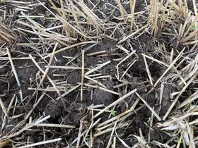
A small marker Rsge made out of straws at the hash
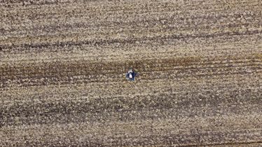
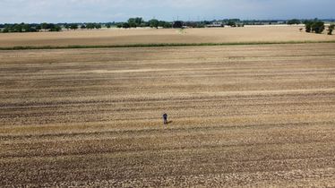
The hash from a bird's eye view, straight down.
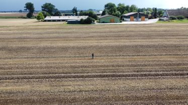
The south of the hash via drone, flying low.
The north of the hash via drone, flying low.
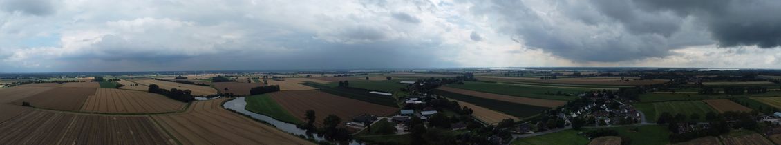
A panorama of the south of the hash via drone, flying high.
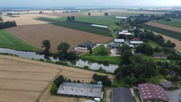
The south of the hash via drone, flying high.
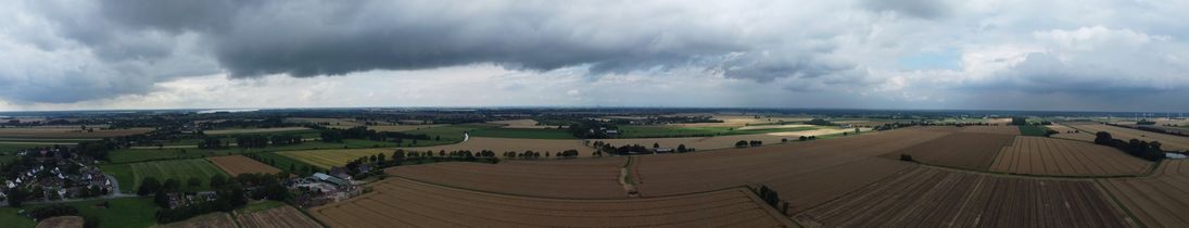
A panorama of the north of the hash via drone, flying high.
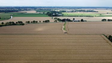
The north of the hash via drone, flying high.
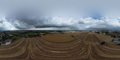
A 360 ° photo at the hash. Special viewer needed.
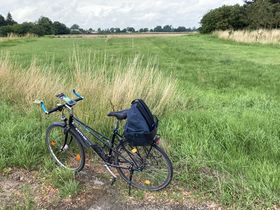
Rsge's bike before leaving, looking in hash direction.
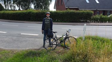
Rsge at his bike before leaving.
Bike ride activity total after getting home.
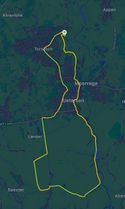
Rsge's bike ride path. Proof of Tron achievement.
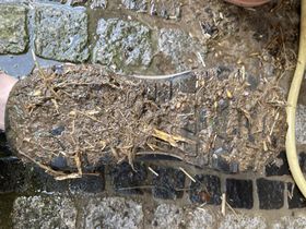
Rsge's dirty soles after getting home.


