Difference between revisions of "2023-07-29 58 5"
From Geohashing
(→Photos) |
(→Photos) |
||
| Line 40: | Line 40: | ||
Image:2023-07-29_58_5_Pica42_1690618236777.jpg|Lende [https://openstreetmap.org/?mlat=58.70301780&mlon=5.74634060&zoom=16 @58.7030,5.7463] | Image:2023-07-29_58_5_Pica42_1690618236777.jpg|Lende [https://openstreetmap.org/?mlat=58.70301780&mlon=5.74634060&zoom=16 @58.7030,5.7463] | ||
Image:20230729 095234.jpg|thumb|On the way to the hash | Image:20230729 095234.jpg|thumb|On the way to the hash | ||
| − | + | Image:20230729 095734.jpg|thumb|On the way to the hash, here I chose to walk around and rather climb over the stone fence | |
Revision as of 11:42, 29 July 2023
| Sat 29 Jul 2023 in 58,5: 58.7030055, 5.7463360 geohashing.info google osm bing/os kml crox |
Location
On a cow pasture at Lende in Time municipality, Rogaland, Norway
Participants
Plans
Expedition
Tracklog
Photos

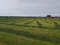
Lende @58.7030,5.7463
On the way to the hash
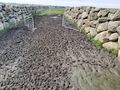
On the way to the hash, here I chose to walk around and rather climb over the stone fence


Achievements