Difference between revisions of "2023-09-05 47 8"
Globescorer (talk | contribs) (→Photos) |
(Categories) |
||
| (10 intermediate revisions by one other user not shown) | |||
| Line 13: | Line 13: | ||
== Expedition == | == Expedition == | ||
| − | + | ||
| + | And so it was. Exactly as I had planned, I cycled this route. On the way I fished a geocache and took a few photos from time to time. For the whole loop (15.0km) I needed 1h 17min. Since I only use the bike a few times and don't have a pro bike anyway, I'm glad I was able to cover the distance reasonably well. | ||
| + | |||
| + | I recorded the route using the ramblr app. But I still don't know how to include this data here... We'll see... | ||
| + | |||
| + | So I drove off from the small village of Niederwil. The trickiest thing was getting across the river without crossing paths, which would take away my chance at the TRON achievement. So I decided on the car bridge near Gütighausen on the way there and the well-known railway bridge on the way back. | ||
| + | |||
| + | From Wiki: | ||
| + | The principal civil engineering structure on the line is the [https://de.m.wikipedia.org/wiki/Thurbr%C3%BCcke_Ossingen Thurbrücke Ossingen], a 332 metres (1,089 ft) long and 42 metres (138 ft) high five-span truss bridge over the River Thur. | ||
== Photos == | == Photos == | ||
| Line 43: | Line 51: | ||
</gallery> | </gallery> | ||
[[File:2023-09-05 47 8 bicycle.jpg|500px]] my bicycle... | [[File:2023-09-05 47 8 bicycle.jpg|500px]] my bicycle... | ||
| + | |||
| + | ==Tracklog== | ||
| + | <gallery> | ||
| + | File:2023-09-05 47 8 TRON 1.jpg | ||
| + | File:2023-09-05 47 8 TRON 2.jpg | ||
| + | </gallery> | ||
==Achievements== | ==Achievements== | ||
| Line 57: | Line 71: | ||
{{land geohash|date=2023-09-05|latitude=47|longitude=8|name=[[User:globescorer|globescorer]]|image=2023-09-05 47 8 The Geohash.jpg}} | {{land geohash|date=2023-09-05|latitude=47|longitude=8|name=[[User:globescorer|globescorer]]|image=2023-09-05 47 8 The Geohash.jpg}} | ||
| − | + | __NOTOC__ | |
| − | [[Category: | + | [[Category:Expeditions]] |
| + | [[Category:Expeditions with photos]] | ||
| + | [[Category:Coordinates reached]] | ||
{{location|CH|ZH}} | {{location|CH|ZH}} | ||
Latest revision as of 09:06, 10 September 2023
| Tue 5 Sep 2023 in 47,8: 47.6204576, 8.7357352 geohashing.info google osm bing/os kml crox |
Location
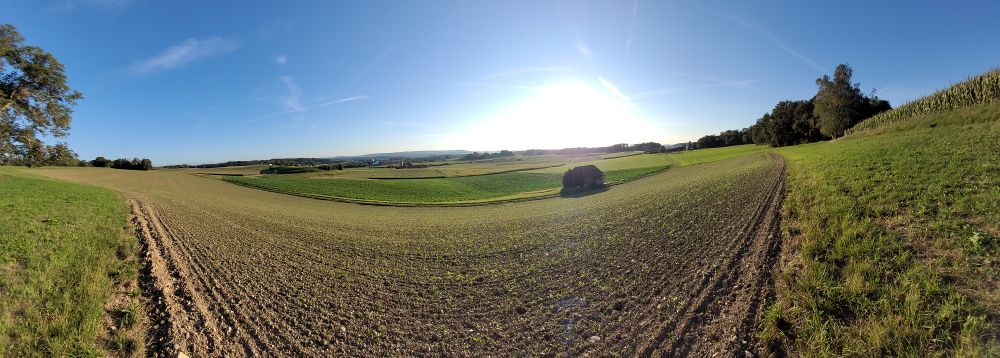
Located in a field near Ossingen (ZH), Switzerland.
Participants
Plans
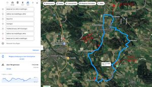
In the evening I want to achieve a geohash by bike for the first time. And this like a Tron! That would give me 2 new achievements. All in all, that's about 15km to ride. I'll get there around 6:45pm.
Expedition
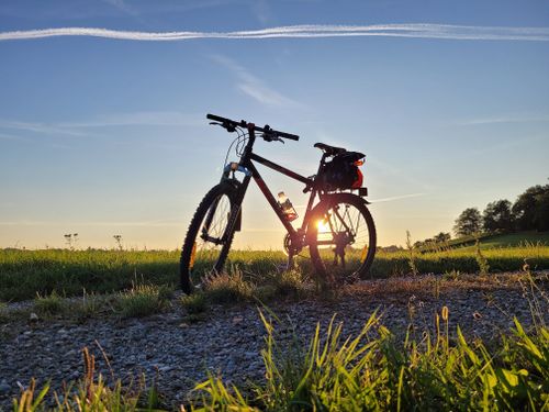
And so it was. Exactly as I had planned, I cycled this route. On the way I fished a geocache and took a few photos from time to time. For the whole loop (15.0km) I needed 1h 17min. Since I only use the bike a few times and don't have a pro bike anyway, I'm glad I was able to cover the distance reasonably well.
I recorded the route using the ramblr app. But I still don't know how to include this data here... We'll see...
So I drove off from the small village of Niederwil. The trickiest thing was getting across the river without crossing paths, which would take away my chance at the TRON achievement. So I decided on the car bridge near Gütighausen on the way there and the well-known railway bridge on the way back.
From Wiki: The principal civil engineering structure on the line is the Thurbrücke Ossingen, a 332 metres (1,089 ft) long and 42 metres (138 ft) high five-span truss bridge over the River Thur.
Photos
Tracklog
Achievements
globescorer earned the Bicycle geohash achievement
|
globescorer earned the Tron achievement
|
globescorer earned the Land geohash achievement
|


