Difference between revisions of "2023-09-15 51 11"
From Geohashing
(created) |
(→Photos) |
||
| Line 26: | Line 26: | ||
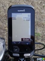
|Image:20230915-51N11E-02.jpg|Reached. | |Image:20230915-51N11E-02.jpg|Reached. | ||
|Image:20230915-51N11E-03.jpg|Hashpoint view. | |Image:20230915-51N11E-03.jpg|Hashpoint view. | ||
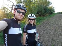
| − | |Image:20230915-51N11E- | + | |Image:20230915-51N11E-04.jpg|Hashers. |
}} | }} | ||
Revision as of 21:14, 15 September 2023
| Fri 15 Sep 2023 in 51,11: 51.0748902, 11.5555581 geohashing.info google osm bing/os kml crox |
Location
On a cropped field near Obertrebra (Weimarer Land, Thuringia, Germany).
Participants
Expedition
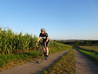
The geohash turned out to be a good destination for a short end-of-the-week bicycle ride for Manu and Reinhard. They enjoyed the evening sun and were pretty lucky to find an already cropped and dry field. Easy.
Tracklog
Photos
|


