Difference between revisions of "2023-12-12 32 35"
From Geohashing
(→Expedition) |
(→Ribbons) |
||
| Line 20: | Line 20: | ||
{{land geohash|date=2023-12-12|latitude=32|longitude=35|name=[[User:Yosef|Yosef]] and Sharkonaut}} | {{land geohash|date=2023-12-12|latitude=32|longitude=35|name=[[User:Yosef|Yosef]] and Sharkonaut}} | ||
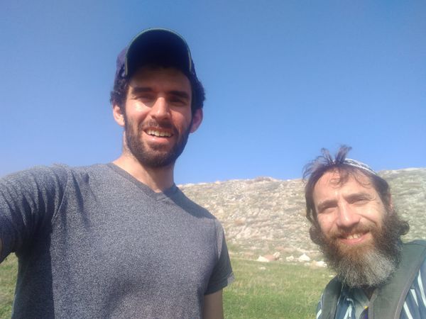
{{drag-along|partner=Sharkonaut|date=2023-12-12|latitude=32|longitude=35|name=[[User:Yosef|Yosef]]|image=2023-12-12 32 35 Selfie.jpg}} | {{drag-along|partner=Sharkonaut|date=2023-12-12|latitude=32|longitude=35|name=[[User:Yosef|Yosef]]|image=2023-12-12 32 35 Selfie.jpg}} | ||
| + | |||
| + | The hash point was ~160 meters below sea level so there should be an honorable mention for a low geohash. | ||
__NOTOC__ | __NOTOC__ | ||
Revision as of 19:35, 12 December 2023
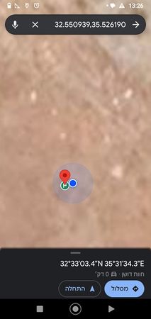
| Tue 12 Dec 2023 in 32,35: 32.5509421, 35.5261873 geohashing.info google osm bing/os kml crox |
Location
This Geohash is located next to a quarry near Beit Yosef.
Participants
- Yosef
- Sharkonaut
Expedition
Yosef (talk) 19:29, 12 December 2023 (UTC) encouraged Sharkonaut to meet him relatively early in the morning the Tel Aviv suburbs from which we drove across the WHOLE COUNTRY (fine it's not that big) to get to Beit Yosef. We parked the car and then wandered to the hash point. Sharkonaut thought it would be a good idea to jump a fence in the middle of a war while Yosef (talk) 19:29, 12 December 2023 (UTC) did not.
Photos
Ribbons
Yosef and Sharkonaut earned the Land geohash achievement
|
Yosef earned the Drag-along achievement
|
The hash point was ~160 meters below sea level so there should be an honorable mention for a low geohash.

