Difference between revisions of "Birmingham, Alabama"
imported>N76lima (Added photos of attempt) |
m (per Renaming Proposal) |
||
| (22 intermediate revisions by 10 users not shown) | |||
| Line 1: | Line 1: | ||
{{graticule | {{graticule | ||
| − | | | + | | lat= 33 |
| − | |n = [[Huntsville, Alabama|Huntsville | + | | lon= -86 |
| − | |ne = [[Rome, Georgia | + | | nw = [[Florence, Alabama|Florence]] |
| − | | | + | | n = [[Huntsville, Alabama|Huntsville]] |
| − | | | + | | ne = [[Rome, Georgia]] |
| − | | | + | | w = [[Tuscaloosa, Alabama|Tuscaloosa]] |
| − | |sw = [[Talladega National Forest]] | + | | name = [[Birmingham, Alabama|Birmingham]] |
| − | | | + | | e = [[Anniston, Alabama|Anniston]] |
| − | | | + | | sw = [[Talladega National Forest, Alabama|Talladega National Forest]] |
| + | | s = [[Montgomery, Alabama|Montgomery]] | ||
| + | | se = [[Auburn, Alabama|Auburn]] | ||
}} | }} | ||
| − | The Birmingham [[graticule]] is at | + | The Birmingham [[graticule]] is at {{Today's location|lat=33|lon=-86|text=latitude 33, longitude -86}}.The graticule contains most of the greater Birmingham metropolitan area, except for the extreme western suburbs. In addition, it extends northeastward to the outskirts of Gadsden, Alabama. |
The southern end of the Appalachian mountains extend into this graticule, making some spots difficult to reach, if not totally inaccessible. | The southern end of the Appalachian mountains extend into this graticule, making some spots difficult to reach, if not totally inaccessible. | ||
'''Today's Location:''' | '''Today's Location:''' | ||
| − | [ | + | [{{Today's location|lat=33|lon=-86|text=Birmingham, AL}}] |
== Activities == | == Activities == | ||
| − | + | 14 Dec 08 Today's site looks totally reachable. It's right off Slab Hill Road in Calera. It looks like a nice area to just hang out, even if it is a bit chilly. --Cougar Draven | |
| − | '''Saturday 28 June 08''' Today's site looks VERY reachable, off AL 174 between Branchville and Pell City. It appears to be nearly on Hearth Stone Dr. '''Update:''' Well, not exactly. Got within a couple hundred feet of it, but it is densely wooded. Bring a machete and your mosquito repellent. :-( --N76Lima | + | '''26 Jul 08''' Saturday Meet-up for our Graticule isn't going to happen at the calculated coordinates. It falls in the middle of the Childersburg Army Ammunition Plant grounds! --N76Lima |
| + | |||
| + | 23 Jul 08 Another good one to hash from the air! On the east side of lake Martin, in an area that doesn't look approachable via roads. A boat and then some hiking look to be the only way on the ground. <sigh> --N76Lima | ||
| + | |||
| + | 22 Jul 08 Today's site looks like a good one to hash from the air. <G> 100 meters from the nearest road, and "road" is used rather loosely in this case. --N76Lima | ||
| + | |||
| + | 21 Jul 09 Today's site is in the woods between Sylacauga and Alexander City. Doesn't look promising for a week day hash. --N76Lima | ||
| + | |||
| + | 20 Jul 08 Today's site is only a couple miles from yesterday's but it looks wooded on the satellite view. --N76Lima | ||
| + | |||
| + | ---- | ||
| + | |||
| + | '''[[2008-07-19 33 -86|19 Jul 08 Site Hashed!]]''' Made it there about lunch time. Mrs. Killingsworth, the nice, older lady that lives there, just could not understand why "the internet" was sending people to her house! --N76Lima {{land geohash | latitude = 33 | longitude = -86 | date = 2008-07-19 | name = N76Lima }} | ||
| + | |||
| + | 2 July 08 Today's site is close to the Bessemer Airport, and appears to be ON or very near Hwy 93 (AKA Cherokee Beach Rd.) just off Hwy 52 (Morgan Rd.) at Exit #6 on I-459. --N76Lima | ||
| + | |||
| + | 1 July 08 Today's site is about 1km South of Hwy 25, just west of Calera. It appears to be in the open from the satellite view. --N76Lima | ||
| + | |||
| + | ---- | ||
| + | |||
| + | '''[[2008-06-30 33 -86|30 June 08 Site Hashed!]]''' Just off 411/231 on County Hwy 33 is the Pine Bluff Missionary Baptist Church. Hash site is in adjoining field. {{land geohash | latitude = 33 | longitude = -86 | date = 2008-06-30 | name = N76Lima }} | ||
| + | [[Image:06-30-08_mailbox.jpg]] [[Image:06-30-08_GPS_sm.jpg]] | ||
| + | |||
| + | '''[[2008-06-29 33 -86|Sunday 29 June 08]]''' This may be the easiest access to a hash site we have had, yet! It is in a Trussville housing development. Go South at the Main Street traffic light in downtown Trussville on S. Chalkville Rd. -- after Queenstown Rd. intersection the name changes to "Roper Rd." It is only a couple miles to the subdivision. BE THERE!! '''Update:''' Skunked again! Nice homeowner gave permission to cross his lot into the woods behind the house. Quickly became as yesterday, no machete, bug repellent, etc. prevented penetration into the brush. Best access is off Scenic Ridge Dr., unless you want to hike in along the railroad tracks from out at Roper Rd. --N76Lima | ||
| + | [[Image:29_Jun_08_GPS.jpg]] [[Image:29_June_08_House.jpg]] | ||
| + | |||
| + | '''[[2008-06-28 33 -86|Saturday 28 June 08]]''' Today's site looks VERY reachable, off AL 174 between Branchville and Pell City. It appears to be nearly on Hearth Stone Dr. '''Update:''' Well, not exactly. Got within a couple hundred feet of it, but it is densely wooded. Bring a machete and your mosquito repellent. :-( --N76Lima | ||
[[Image:28_Jun_08_hash_site.jpg]][[Image:28_June_08_woods.jpg]][[Image:28_June_08_Street_sign.jpg]] | [[Image:28_Jun_08_hash_site.jpg]][[Image:28_June_08_woods.jpg]][[Image:28_June_08_Street_sign.jpg]] | ||
| Line 27: | Line 55: | ||
27 June 08 The hash site is almost within sight of the 23 June site at Logan Martin and I-20. This time it is on the North side of the freeway, and best accessed from Exit 158 and then going East towards the water. Looks like some residential development in the area, so it might be an easy walk from the street into someone's yard. The area looks cleared of trees on the satellite view. --N76Lima | 27 June 08 The hash site is almost within sight of the 23 June site at Logan Martin and I-20. This time it is on the North side of the freeway, and best accessed from Exit 158 and then going East towards the water. Looks like some residential development in the area, so it might be an easy walk from the street into someone's yard. The area looks cleared of trees on the satellite view. --N76Lima | ||
| − | 26 June 08 Today's hash site is local to Birmingham residents. A little bit of tromping through the woods looks to be needed. Just off I-459 (Hwy 280 exit is closest | + | 26 June 08 Today's hash site is local to Birmingham residents. A little bit of tromping through the woods looks to be needed. Just off I-459 (Hwy 280 exit is closest), possibly in a creek bed. --N76Lima |
25 June 08 Today's hash site looks very reachable. Just off I-65 at Mt. Olive Rd, it appears to be in a residential subdivision less than 3 blocks from I-65. --N76Lima | 25 June 08 Today's hash site looks very reachable. Just off I-65 at Mt. Olive Rd, it appears to be in a residential subdivision less than 3 blocks from I-65. --N76Lima | ||
23 June 08 Today's hash site is in the water of lake Logan-Martin near the I-20 bridge at Exit 162 east of Pell City. Lacking a boat, I am not going to try for this one. --N76Lima | 23 June 08 Today's hash site is in the water of lake Logan-Martin near the I-20 bridge at Exit 162 east of Pell City. Lacking a boat, I am not going to try for this one. --N76Lima | ||
| + | |||
| + | == Achievements == | ||
| + | {{Graticule unlocked|date=2008-06-30|latitude=33|longitude=-86|name=[[User:n76lima|n76lima]]}} | ||
== Local Geohashers == | == Local Geohashers == | ||
*[[User:erzeszut|erzeszut]] | *[[User:erzeszut|erzeszut]] | ||
*[[User:n76lima|n76lima]] | *[[User:n76lima|n76lima]] | ||
| − | |||
[[Category:Alabama]] | [[Category:Alabama]] | ||
| − | [[Category: | + | [[Category:Inactive graticules]] |
Latest revision as of 04:23, 20 March 2024
| Florence | Huntsville | Rome, Georgia |
| Tuscaloosa | Birmingham | Anniston |
| Talladega National Forest | Montgomery | Auburn |
|
Today's location: geohashing.info google osm bing/os kml crox | ||
The Birmingham graticule is at latitude 33, longitude -86.The graticule contains most of the greater Birmingham metropolitan area, except for the extreme western suburbs. In addition, it extends northeastward to the outskirts of Gadsden, Alabama.
The southern end of the Appalachian mountains extend into this graticule, making some spots difficult to reach, if not totally inaccessible.
Today's Location: [Birmingham, AL]
Activities
14 Dec 08 Today's site looks totally reachable. It's right off Slab Hill Road in Calera. It looks like a nice area to just hang out, even if it is a bit chilly. --Cougar Draven
26 Jul 08 Saturday Meet-up for our Graticule isn't going to happen at the calculated coordinates. It falls in the middle of the Childersburg Army Ammunition Plant grounds! --N76Lima
23 Jul 08 Another good one to hash from the air! On the east side of lake Martin, in an area that doesn't look approachable via roads. A boat and then some hiking look to be the only way on the ground. <sigh> --N76Lima
22 Jul 08 Today's site looks like a good one to hash from the air. <G> 100 meters from the nearest road, and "road" is used rather loosely in this case. --N76Lima
21 Jul 09 Today's site is in the woods between Sylacauga and Alexander City. Doesn't look promising for a week day hash. --N76Lima
20 Jul 08 Today's site is only a couple miles from yesterday's but it looks wooded on the satellite view. --N76Lima
19 Jul 08 Site Hashed! Made it there about lunch time. Mrs. Killingsworth, the nice, older lady that lives there, just could not understand why "the internet" was sending people to her house! --N76Lima
N76Lima earned the Land geohash achievement
|
2 July 08 Today's site is close to the Bessemer Airport, and appears to be ON or very near Hwy 93 (AKA Cherokee Beach Rd.) just off Hwy 52 (Morgan Rd.) at Exit #6 on I-459. --N76Lima
1 July 08 Today's site is about 1km South of Hwy 25, just west of Calera. It appears to be in the open from the satellite view. --N76Lima
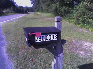
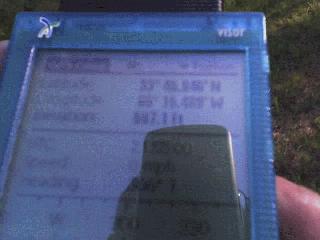
30 June 08 Site Hashed! Just off 411/231 on County Hwy 33 is the Pine Bluff Missionary Baptist Church. Hash site is in adjoining field.
N76Lima earned the Land geohash achievement
|
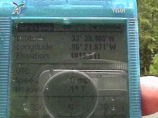
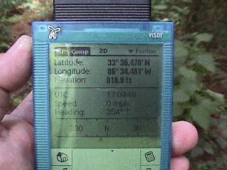
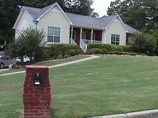
Sunday 29 June 08 This may be the easiest access to a hash site we have had, yet! It is in a Trussville housing development. Go South at the Main Street traffic light in downtown Trussville on S. Chalkville Rd. -- after Queenstown Rd. intersection the name changes to "Roper Rd." It is only a couple miles to the subdivision. BE THERE!! Update: Skunked again! Nice homeowner gave permission to cross his lot into the woods behind the house. Quickly became as yesterday, no machete, bug repellent, etc. prevented penetration into the brush. Best access is off Scenic Ridge Dr., unless you want to hike in along the railroad tracks from out at Roper Rd. --N76Lima
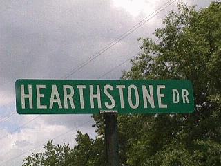
Saturday 28 June 08 Today's site looks VERY reachable, off AL 174 between Branchville and Pell City. It appears to be nearly on Hearth Stone Dr. Update: Well, not exactly. Got within a couple hundred feet of it, but it is densely wooded. Bring a machete and your mosquito repellent. :-( --N76Lima
27 June 08 The hash site is almost within sight of the 23 June site at Logan Martin and I-20. This time it is on the North side of the freeway, and best accessed from Exit 158 and then going East towards the water. Looks like some residential development in the area, so it might be an easy walk from the street into someone's yard. The area looks cleared of trees on the satellite view. --N76Lima
26 June 08 Today's hash site is local to Birmingham residents. A little bit of tromping through the woods looks to be needed. Just off I-459 (Hwy 280 exit is closest), possibly in a creek bed. --N76Lima
25 June 08 Today's hash site looks very reachable. Just off I-65 at Mt. Olive Rd, it appears to be in a residential subdivision less than 3 blocks from I-65. --N76Lima
23 June 08 Today's hash site is in the water of lake Logan-Martin near the I-20 bridge at Exit 162 east of Pell City. Lacking a boat, I am not going to try for this one. --N76Lima
Achievements
n76lima earned the Graticule Unlocked Achievement
|
