Difference between revisions of "2011-06-10 -8 114"
imported>Reinhard (new expedition) |
m (per Renaming Proposal) |
||
| (2 intermediate revisions by 2 users not shown) | |||
| Line 14: | Line 14: | ||
== Expedition == | == Expedition == | ||
| + | After their beautiful wedding on May 28th, Manu and Reinhard went on honeymoon to Bali, Indonesia. Right now they stay at the [http://www.dajuma.com/ Puri Dajuma Cottages] in Pekutatan, where some unlikely things came together. There was WiFi to check the daily geohashing coordinates, one could hire useable bicycles (hard to find on Bali) and the geohash fell on land and close to a road which wasn't far from Pekutatan. As Manu and Reinhard wanted to go on a bicycle ride this day anyway, they at least had to try to get to this hashpoint. | ||
| + | |||
| + | Reinhard planned a 45 km roundtrip, first climbing the village of Tista (750 m) and then passing the hashpoint. While they were closest to the spot on the road, some plantation workers came along, but weren't able to communicate with Manu and Reinhard, since they couldn't speak English. One of them "asked" Reinhard to take some pictures of him and obviously liked his sunglasses. Sadly, there was no way to ask them, whether it was okay to walk 100 m into the plantation and Manu and Reinhard weren't brave enough to just walk in, while the men were watching them, so they rode on 100 m, where they couldn't be seen and luckily found a small path helping to get closer to the hashpoint. It passed some property lines and just at the perfect distance met an other way, which lead directly to the hashpoint (+/- 10 m). Manu and Reinhard were happy to have reached a geohash so far from home, which was quite unforeseeable. Due to the strenuous uphill ride and the high temperature and humidity they were also pretty much exhausted, but the rest of the ride was almost only downhill, so they got back in the early afternoon after 45 km and 900 m ascent. | ||
== Photos == | == Photos == | ||
| Line 31: | Line 34: | ||
== Achievements == | == Achievements == | ||
| − | {{ | + | {{Graticule unlocked | latitude = -8 | longitude = 114 | date = 2011-06-10 | name = Manu and Reinhard }} |
[[Category:Expeditions]] | [[Category:Expeditions]] | ||
[[Category:Expeditions with photos]] | [[Category:Expeditions with photos]] | ||
[[Category:Coordinates reached]] | [[Category:Coordinates reached]] | ||
| + | {{location|ID|NU|BA}} | ||
Latest revision as of 05:54, 20 March 2024
| Fri 10 Jun 2011 in -8,114: -8.4155706, 114.9174601 geohashing.info google osm bing/os kml crox |
Location
On a banana/coffee/coco(?) plantation near Pekutatan on Bali, Indonesia.
Participants
Expedition
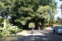
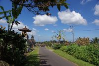
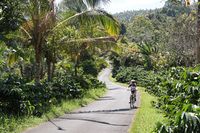
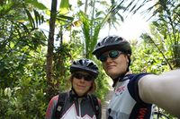
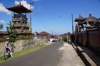
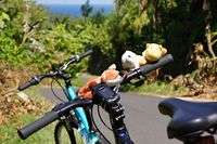
After their beautiful wedding on May 28th, Manu and Reinhard went on honeymoon to Bali, Indonesia. Right now they stay at the Puri Dajuma Cottages in Pekutatan, where some unlikely things came together. There was WiFi to check the daily geohashing coordinates, one could hire useable bicycles (hard to find on Bali) and the geohash fell on land and close to a road which wasn't far from Pekutatan. As Manu and Reinhard wanted to go on a bicycle ride this day anyway, they at least had to try to get to this hashpoint.
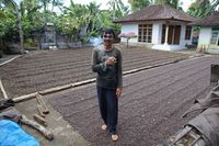
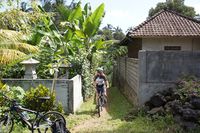
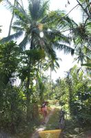
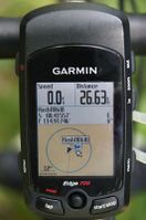
Reinhard planned a 45 km roundtrip, first climbing the village of Tista (750 m) and then passing the hashpoint. While they were closest to the spot on the road, some plantation workers came along, but weren't able to communicate with Manu and Reinhard, since they couldn't speak English. One of them "asked" Reinhard to take some pictures of him and obviously liked his sunglasses. Sadly, there was no way to ask them, whether it was okay to walk 100 m into the plantation and Manu and Reinhard weren't brave enough to just walk in, while the men were watching them, so they rode on 100 m, where they couldn't be seen and luckily found a small path helping to get closer to the hashpoint. It passed some property lines and just at the perfect distance met an other way, which lead directly to the hashpoint (+/- 10 m). Manu and Reinhard were happy to have reached a geohash so far from home, which was quite unforeseeable. Due to the strenuous uphill ride and the high temperature and humidity they were also pretty much exhausted, but the rest of the ride was almost only downhill, so they got back in the early afternoon after 45 km and 900 m ascent.
Photos
|
Achievements
Manu and Reinhard earned the Graticule Unlocked Achievement
|
