Difference between revisions of "2011-02-26 35 -111"
From Geohashing
imported>Wyle & RoadRunner |
m (per Renaming Proposal) |
||
| (One intermediate revision by one other user not shown) | |||
| Line 17: | Line 17: | ||
And since there's no other posting for this graticule, I guess this is ... | And since there's no other posting for this graticule, I guess this is ... | ||
==The Deflowering of the Flagstaff Graticule== | ==The Deflowering of the Flagstaff Graticule== | ||
| − | {{ | + | {{Graticule unlocked | latitude = 35 | longitude = -111 | date = 2011-02-26 | name = [[User:Wyle & RoadRunner|Wyle & RoadRunner]]}} |
<gallery widths="160px" align=center> | <gallery widths="160px" align=center> | ||
Image:2011-02-26_35_-111_sign.jpg|Flagstaff, Arizona | Image:2011-02-26_35_-111_sign.jpg|Flagstaff, Arizona | ||
| Line 27: | Line 27: | ||
[[Category:Expeditions with photos]] | [[Category:Expeditions with photos]] | ||
[[Category:Coordinates reached]] | [[Category:Coordinates reached]] | ||
| + | {{location|US|AZ|CO}} | ||
Latest revision as of 05:57, 20 March 2024
| Sat 26 Feb 2011 in Flagstaff: 35.5847362, -111.5654490 geohashing.info google osm bing/os kml crox |
Location
In the middle of cattle country
Participants
Expeditions
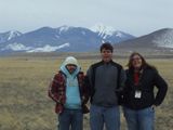
Traveled with my son, my daughter and her boyfriend from Tucson to Flagstaff for a day of skiing on Friday and discovered that the Saturday geohash point for this graticule wasn't too far away. Hijacked them all for the easiest geohash I've ever done. Dirt road off the highway almost said "geohashers welcome". When we started out, I started to realize that there might be some deep snow to overcome, but after dodging a few cows, it was a simple 800 meter walk on flat, open, dry ground to the spot. I'm sure the boyfriend is still asking why we did that. :) And since there's no other posting for this graticule, I guess this is ...
The Deflowering of the Flagstaff Graticule
Wyle & RoadRunner earned the Graticule Unlocked Achievement
|


