Difference between revisions of "2010-11-07 46 9"
From Geohashing
imported>Jiml (Add full Template) |
m (per Renaming Proposal) |
||
| (5 intermediate revisions by 3 users not shown) | |||
| Line 1: | Line 1: | ||
| − | |||
| − | |||
| − | |||
| − | |||
| − | |||
| − | |||
| − | |||
| − | |||
| − | |||
{{meetup graticule | {{meetup graticule | ||
| lat=46 | | lat=46 | ||
| Line 17: | Line 8: | ||
__NOTOC__ | __NOTOC__ | ||
== Location == | == Location == | ||
| − | + | [[wikipedia:Parpan|Parpan]] ([[wikipedia:Churwalden|Churwalden]]), [[wikipedia:Grisons|Grisons]], Switzerland | |
| − | |||
| Line 24: | Line 14: | ||
* [[user:crox|Crox]] | * [[user:crox|Crox]] | ||
* [[user:elisa|Elisa]] | * [[user:elisa|Elisa]] | ||
| − | |||
| + | == Plans == | ||
| + | We planned to go there and leave the hash before 14:00. | ||
| − | |||
| − | |||
== Expedition == | == Expedition == | ||
| − | + | An easily reachable hash in 46 9, less than half an hour away and reasonably compatible with our other plans, that was an opportunity not to be missed! | |
| − | + | We drove to Parpan and easily found what seems to be the parking for a ski resort in Winter, where we left the car. We were now about 150 m (horizontally) and 70 m (vertically) away from the hash. | |
| − | |||
| − | |||
| − | + | We followed the paths left by the cows, found the exact spot and took some pictures. One virgin graticule less! | |
| − | |||
| − | |||
| − | |||
| − | |||
| − | |||
| − | |||
| − | |||
| − | |||
| − | |||
| − | |||
| + | == Photos == | ||
| + | {{#vardefine:gaLines|2}} | ||
| + | {{#vardefine:gaWidth|250}} | ||
| + | {{#vardefine:gaHeight|230}} | ||
| + | {{Gallery2| | ||
| + | {{GalleryItem | File:2010-11-07_46_9-00-planning-DSC_8010.jpg | planning page }} | ||
| + | {{GalleryItem | File:2010-11-07_46_9-01-hash-DSC_8009.jpg | the hash is there, uphill }} | ||
| + | {{GalleryItem | File:2010-11-07_46_9-02-elisa-DSC_7995.jpg | [[user:elisa|Elisa]] at the hash }} | ||
| + | {{GalleryItem | File:2010-11-07_46_9-03-crox_elisa-DSC_8005.jpg | happy hashers at the hash }} | ||
| + | {{GalleryItem | File:2010-11-07_46_9-04-view-DSC_8006.jpg | view from the hash }} | ||
| + | {{GalleryItem | File:2010-11-07_46_9-05-gps_distance-DSC_7993.jpg | 2.59 m left }} | ||
| + | {{GalleryItem | File:2010-11-07_46_9-06-gps_coordinates-DSC_7994.jpg | 6 m accuracy }} | ||
| + | }} | ||
| − | |||
| − | |||
| − | |||
| + | == Achievements == | ||
| + | {{#vardefine:ribbonwidth|800px}} | ||
| + | {{Graticule unlocked | latitude = 46 | longitude = 9 | date = 2010-11-07 | name = Crox and Elisa }} | ||
| − | |||
| − | |||
[[Category:Expeditions]] | [[Category:Expeditions]] | ||
| − | |||
[[Category:Expeditions with photos]] | [[Category:Expeditions with photos]] | ||
| − | |||
| − | |||
| − | |||
| − | |||
| − | |||
[[Category:Coordinates reached]] | [[Category:Coordinates reached]] | ||
| − | + | {{location|CH|GR}} | |
| − | |||
| − | |||
| − | |||
| − | |||
| − | |||
| − | |||
| − | |||
| − | |||
| − | |||
Latest revision as of 06:00, 20 March 2024
| Sun 7 Nov 2010 in 46,9: 46.7609772, 9.5510646 geohashing.info google osm bing/os kml crox |
Location
Parpan (Churwalden), Grisons, Switzerland
Participants
Plans
We planned to go there and leave the hash before 14:00.
Expedition
An easily reachable hash in 46 9, less than half an hour away and reasonably compatible with our other plans, that was an opportunity not to be missed!
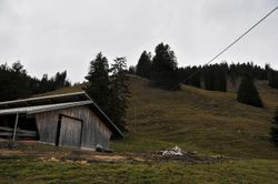
We drove to Parpan and easily found what seems to be the parking for a ski resort in Winter, where we left the car. We were now about 150 m (horizontally) and 70 m (vertically) away from the hash.
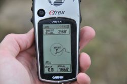
We followed the paths left by the cows, found the exact spot and took some pictures. One virgin graticule less!
Photos
|
Achievements
Crox and Elisa earned the Graticule Unlocked Achievement
|


