Difference between revisions of "2010-08-05 -42 147"
From Geohashing
imported>FippeBot m (Location) |
m (per Renaming Proposal) |
||
| (One intermediate revision by one other user not shown) | |||
| Line 26: | Line 26: | ||
== Achievements == | == Achievements == | ||
{{#vardefine:ribbonwidth|800px}} | {{#vardefine:ribbonwidth|800px}} | ||
| − | {{ | + | {{Graticule unlocked |
| latitude = -42 | | latitude = -42 | ||
| longitude = 147 | | longitude = 147 | ||
| Line 37: | Line 37: | ||
[[Category:Expeditions with photos]] | [[Category:Expeditions with photos]] | ||
[[Category:Coordinates reached]] | [[Category:Coordinates reached]] | ||
| − | {{location|AU|TAS}} | + | {{location|AU|TAS|HO}} |
Latest revision as of 06:08, 20 March 2024
| Thu 5 Aug 2010 in -42,147: -42.9250295, 147.3018619 geohashing.info google osm bing/os kml crox |
Location
Southeast part of Ridgeway park
Participants
Plans
Plan is to drive to near the park and walk the rest of the way
Expedition
Went mostly to plan. My GPS nav unit sucks, it showed a road continuing that was actually a driveway with nowhere to turn around before the gate.
Photos
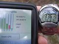
Proof
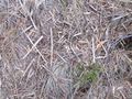
Marker


Achievements
Alh earned the Graticule Unlocked Achievement
|