Difference between revisions of "2010-07-22 44 -69"
imported>UncleOp (→Photos) |
m (per Renaming Proposal) |
||
| (9 intermediate revisions by 4 users not shown) | |||
| Line 1: | Line 1: | ||
| − | |||
<!-- If you did not specify these parameters in the template, please substitute appropriate things for IMAGE, LAT, LON, and DATE (YYYY-MM-DD format) | <!-- If you did not specify these parameters in the template, please substitute appropriate things for IMAGE, LAT, LON, and DATE (YYYY-MM-DD format) | ||
| Line 15: | Line 14: | ||
}} | }} | ||
| − | + | ||
__NOTOC__ | __NOTOC__ | ||
== Location == | == Location == | ||
| − | + | In Washington, ME, just off the road, to the east of a residence. Farther east, but not visible, is a lake. | |
== Participants == | == Participants == | ||
| Line 25: | Line 24: | ||
== Plans == | == Plans == | ||
<!-- what were the original plans --> | <!-- what were the original plans --> | ||
| + | [[User:UncleOp|Del]] decided late in the day that it would be fun to Just Do It. Next time he'll try to be more organized. | ||
== Expedition == | == Expedition == | ||
| − | + | [[User:UncleOp|Del]] was heading to a rehearsal of the annual [http://www.conductorsretreat.org/ Conductor's Retreat] and noticed that the hash was not far away. So he left early to do the hash during daylight. Arrived around 7pm, parked on the other side of the road, and wandered into the yard. The GPS - just a car-based TomTom GO-510 - didn't like walking, so based on home research, the location was really-really close. | |
| + | |||
| + | Next time should be with a group; solo wasn't all that interesting. | ||
| + | <!-- Nothing here currently > | ||
== Tracklog == | == Tracklog == | ||
<!-- if your GPS device keeps a log, you may post a link here --> | <!-- if your GPS device keeps a log, you may post a link here --> | ||
== Photos == | == Photos == | ||
| − | |||
<gallery perrow="3"> | <gallery perrow="3"> | ||
| Line 43: | Line 45: | ||
== Achievements == | == Achievements == | ||
{{#vardefine:ribbonwidth|800px}} | {{#vardefine:ribbonwidth|800px}} | ||
| − | + | {{land geohash | |
| − | {{ | + | | latitude = 44 |
| + | | longitude = -69 | ||
| + | | date = 2010-07-22 | ||
| + | | name = [[User:UncleOp|Del]] | ||
| + | }} | ||
| + | {{Graticule unlocked | ||
| latitude = 44 | | latitude = 44 | ||
| Line 51: | Line 58: | ||
| name = [[User:UncleOp|Del]] | | name = [[User:UncleOp|Del]] | ||
}} | }} | ||
| − | |||
| − | |||
| − | |||
| − | |||
| − | |||
| − | |||
| − | |||
| − | |||
| − | |||
| − | |||
[[Category:Expeditions]] | [[Category:Expeditions]] | ||
[[Category:Expeditions with photos]] | [[Category:Expeditions with photos]] | ||
| − | |||
| − | |||
| − | |||
| − | |||
| − | |||
| − | |||
[[Category:Coordinates reached]] | [[Category:Coordinates reached]] | ||
| − | + | {{location|US|ME|KN}} | |
| − | |||
| − | |||
| − | |||
| − | |||
| − | |||
| − | |||
| − | |||
| − | |||
| − | |||
Latest revision as of 06:09, 20 March 2024
| Thu 22 Jul 2010 in 44,-69: 44.2875466, -69.3982983 geohashing.info google osm bing/os kml crox |
Location
In Washington, ME, just off the road, to the east of a residence. Farther east, but not visible, is a lake.
Participants
Del, who added a bunch of the Maine graticules way back when and finally got around to doing a run.
Plans
Del decided late in the day that it would be fun to Just Do It. Next time he'll try to be more organized.
Expedition
Del was heading to a rehearsal of the annual Conductor's Retreat and noticed that the hash was not far away. So he left early to do the hash during daylight. Arrived around 7pm, parked on the other side of the road, and wandered into the yard. The GPS - just a car-based TomTom GO-510 - didn't like walking, so based on home research, the location was really-really close.
Next time should be with a group; solo wasn't all that interesting.
Photos
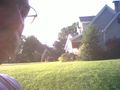
Del with house in background
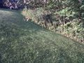
Boring picture of location
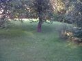
Another boring picture


Achievements
Del earned the Land geohash achievement
|
Del earned the Graticule Unlocked Achievement
|