Difference between revisions of "2012-03-02 51 21"
imported>Jpp (An expedition message sent via Geohash Droid for Android.) |
m (per Renaming Proposal) |
||
| (12 intermediate revisions by 3 users not shown) | |||
| Line 1: | Line 1: | ||
| − | |||
<!-- If you did not specify these parameters in the template, please substitute appropriate values for IMAGE, LAT, LON, and DATE (YYYY-MM-DD format) | <!-- If you did not specify these parameters in the template, please substitute appropriate values for IMAGE, LAT, LON, and DATE (YYYY-MM-DD format) | ||
| Line 15: | Line 14: | ||
}} | }} | ||
| − | + | ||
__NOTOC__ | __NOTOC__ | ||
== Location == | == Location == | ||
| − | + | In beautiful village of Piskórka - [http://en.wikipedia.org/wiki/Pisk%C3%B3rka] south of Warsaw, Poland. | |
| + | |||
| + | Located 20m east from local road, and about 300m south from local store "Zbyszek" where we bought orange juice, suspected to be Lithuanian. | ||
== Participants == | == Participants == | ||
| − | + | * [[User:Jpp]] with his beautiful wife (kind of romantic trip). | |
== Plans == | == Plans == | ||
| − | + | There was no plans at all. | |
| + | |||
| + | # At 2 PM [[User:Jpp]] discovered idea of GeoHashing. | ||
| + | # At 4 PM he convinced his wife to trip, although she not fully understand what all this geohashing is about. | ||
== Expedition == | == Expedition == | ||
| − | + | At 6.30 we ware in the car traveling to destination Piskórka (should be pronounced [PEESQRKA]. | |
| + | |||
| + | Target achieved at 7.30 PM. | ||
| + | |||
| + | Mission accomplished. Photo not very good, because I destroyed camera autofocus year ago, and don't have time to fix it. | ||
| + | |||
| + | This is our writing done by Android: | ||
| + | *First done -- [[User:Jpp|Jpp]] [http://www.openstreetmap.org/?lat=51.98642116&lon=21.00359912&zoom=16&layers=B000FTF @51.9864,21.0036] 19:47, 02 marca 2012 (CET) | ||
| + | |||
| + | Place was kind of field with nothing growing at the moment. Place was about 2 m away from the fence of next house, and very dark so we make photo and get back to the car. | ||
== Tracklog == | == Tracklog == | ||
| − | + | sorry, no log. | |
== Photos == | == Photos == | ||
| − | + | Sorry for no specific signs. Next time I'll get better camers | |
| − | |||
| − | |||
<gallery perrow="5"> | <gallery perrow="5"> | ||
| + | Image:Geohash_5120_piskorka.jpg | Told you - autofocus IS broken! | ||
</gallery> | </gallery> | ||
== Achievements == | == Achievements == | ||
{{#vardefine:ribbonwidth|800px}} | {{#vardefine:ribbonwidth|800px}} | ||
| − | |||
| + | {{land geohash | ||
| + | | latitude = 51 | ||
| + | | longitude = 21 | ||
| + | | date = 2012-03-02 | ||
| + | | name = Jpp | ||
| + | }} | ||
| + | {{Graticule unlocked | ||
| + | | latitude = 51 | ||
| + | | longitude = 21 | ||
| + | | date = 2012-03-02 | ||
| + | | name = Jpp | ||
| + | }} | ||
| − | |||
| − | |||
| − | |||
| − | + | [[Category:Poland]] | |
| − | + | ||
| − | [[Category: | ||
| − | |||
| − | |||
[[Category:Expeditions]] | [[Category:Expeditions]] | ||
| − | + | ||
[[Category:Expeditions with photos]] | [[Category:Expeditions with photos]] | ||
| − | + | ||
| − | |||
| − | |||
| − | |||
| − | |||
[[Category:Coordinates reached]] | [[Category:Coordinates reached]] | ||
| − | + | {{location|PL|W|PI}} | |
| − | |||
| − | |||
| − | |||
| − | |||
| − | |||
| − | |||
| − | |||
| − | |||
| − | |||
Latest revision as of 06:43, 20 March 2024
| Fri 2 Mar 2012 in 51,21: 51.9864140, 21.0036081 geohashing.info google osm bing/os kml crox |
Location
In beautiful village of Piskórka - [1] south of Warsaw, Poland.
Located 20m east from local road, and about 300m south from local store "Zbyszek" where we bought orange juice, suspected to be Lithuanian.
Participants
- User:Jpp with his beautiful wife (kind of romantic trip).
Plans
There was no plans at all.
- At 2 PM User:Jpp discovered idea of GeoHashing.
- At 4 PM he convinced his wife to trip, although she not fully understand what all this geohashing is about.
Expedition
At 6.30 we ware in the car traveling to destination Piskórka (should be pronounced [PEESQRKA].
Target achieved at 7.30 PM.
Mission accomplished. Photo not very good, because I destroyed camera autofocus year ago, and don't have time to fix it.
This is our writing done by Android:
- First done -- Jpp @51.9864,21.0036 19:47, 02 marca 2012 (CET)
Place was kind of field with nothing growing at the moment. Place was about 2 m away from the fence of next house, and very dark so we make photo and get back to the car.
Tracklog
sorry, no log.
Photos
Sorry for no specific signs. Next time I'll get better camers
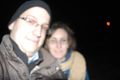
Told you - autofocus IS broken!

Achievements
Jpp earned the Land geohash achievement
|
Jpp earned the Graticule Unlocked Achievement
|