Difference between revisions of "Lemmenjoki, Finland"
From Geohashing
m (Marking as active due to a recent expedition) |
m (per Renaming Proposal) |
||
| (One intermediate revision by one other user not shown) | |||
| Line 40: | Line 40: | ||
== Notable Dates == | == Notable Dates == | ||
| − | {{ | + | {{Graticule unlocked |
| latitude = 68 | | latitude = 68 | ||
| longitude = 25 | | longitude = 25 | ||
| Line 48: | Line 48: | ||
}} | }} | ||
| − | [[Category: | + | [[Category:Inactive graticules]] |
[[Category:Finland]] | [[Category:Finland]] | ||
Latest revision as of 07:10, 20 March 2024
|
Latest Coordinates and Map Quick-Links | |
|---|---|
| Thursday 2024-11-28 | 68.6199548, 25.0330538 |
| Friday 2024-11-29 | 68.9938000, 25.7099028 |
| Porsangermoen West, Norway | Karasjok, Norway | 69,26 |
| Peltovuoma | Lemmenjoki | Hammastunturi |
| Kittilä | Unarin-Luusua | Sodankylä |
|
Today's location: geohashing.info google osm bing/os kml crox | ||
This graticule is located at 68,25. Today's location
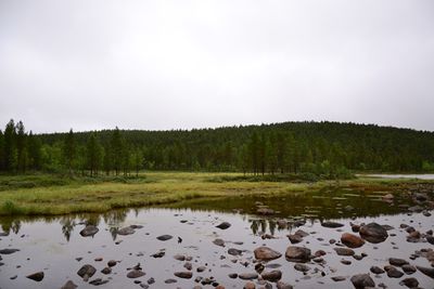
The biggest settlement in this graticule is the village of Pokka (population 7). The Finland's biggest national park, Lemmenjoki national park, lies within this graticule.
Note that the graticule is very distorted due to the proximity of North Pole. It won't even fit wholly in the default small map on the right.
Local Geohashers
None.
Meetups
- 1. 2015-08-02 Reached successfully by Pastori and The Wife
Notable Dates
Pastori earned the Graticule Unlocked Achievement
|
