Difference between revisions of "2024-05-02 -36 143"
([retro picture]Cheeriest war memorial ever) |
(→Expedition) |
||
| (21 intermediate revisions by 2 users not shown) | |||
| Line 1: | Line 1: | ||
| − | + | {{meetup graticule | |
| − | |||
| − | |||
| − | |||
| − | |||
| − | |||
| − | |||
| − | |||
| − | |||
| lat=-36 | | lat=-36 | ||
| lon=143 | | lon=143 | ||
| date=2024-05-02 | | date=2024-05-02 | ||
| − | }} | + | }} |
== Location == | == Location == | ||
| − | + | In some bush by the side of the road near Dunolly | |
== Participants == | == Participants == | ||
| − | + | [[User:Johnwrw|John]] | |
| − | + | ||
| + | == Expedition == | ||
| + | The recent dearth of good hashes near Melbourne was getting to me. At 11:30 the night before, I checked the hashes. Great, another one inside someone's house, this one in Point Cook. | ||
| + | |||
| + | But the next morning, I was still hankering for a hash. I turned my attention further afield, and I noticed this one near Dunolly in the St Arnaud graticule. This graticule had only been hashed in twice before, many moons ago. I had contemplated recently that if I were to get the Minesweeper achievement around Melbourne West, this graticule would be necessary, but I had no particular intentions or expectations to get it so soon. But here was my chance! It would only require a bit over 100km round trip by bike out of Kangaroo Flat on the outskirts of Bendigo (it being the closest I could get by train (not including the Maryborough line for which the one train a day (which I had used for [[2024-01-11_-37_143|this hash]]) had already left by the time I was planning this expedition)). | ||
| + | |||
| + | Further justification for taking the day off thesisizing was that I had agreed to join my mum for a few legs of her ride home from Canberra in a couple of weeks' time, so this would double as a necessary training ride. On top of this, Bridget was spending the night at Healesville for a work thing, so there was no impediment for this expedition stretching out into the evening. | ||
| + | |||
| + | At the time of planning, the 10:14am train to Bendigo was theoretically, but not feasibly catchable. I set my sights on the one an hour later. This wouldn't arrive until 12:50, so, including faff at the hash, it was looking quite unlikely to have over 100km done before sunset (around 5:30), which would have been preferable. I decided I wasn't too concerned though, I would bring my lights and reflective jacket, but still hopefully go fast enough to minimize the amount of country road night riding necessary. | ||
| + | |||
| + | I did a couple of final work things, and suddenly even the 11:14 train was looking dicey. I had a bit of leftover soup, threw generous amounts of food into a backpack, mixed up a few bottles of hydralyte (and threw in a couple more sachets for later refills), pumped up my tyres, and set off. A reasonably kind run with the lights meant I made the train at Footscray with about 5 minutes to spare. | ||
| + | |||
| + | On the train I started reading Ian Rankin's ''Mortal Causes'', which I had picked up in an op-shop recently for a few bucks, and I enjoyed being transported back to Edinburgh as I was transported forward to Bendigo. At Kangaroo Flat, I found a bakery for a spinach and ricotta roll and a curried veggie pastie for a final kick start. | ||
| + | |||
| + | The ride was pleasant. The Bendigo-Maryborough Rd (C277) was not too busy, but was well made and with a fair bit of reasonable shoulder. Cars passed only every few minutes, and gave me plenty of room. After a bit of bush to start, it was then flat paddocks. There were plenty of birds about, like galahs and eastern rosellas, but bronzewings and a large bird of prey (maybe a brown falcon) were highlights. There were a few billows of smoke around from farmers burning off the remnants of the crops, and I passed very close to one such farmer. Luckily the wind was blowing this smoke away from the road. | ||
| + | |||
| + | I got to the little town of Eddington, where I crossed the Loddon river, and was amused by the most light-hearted war memorial I've ever seen: A bale of hay with googly eyes and a cartoonish waving hand, accompanied by the message "Lest We Forget". | ||
| + | |||
| + | I was now getting closer to the hash. The easiest approach to the hash would have been along the main roads via Dunolly, but I wanted to save my first experience of the town as a post-hash reward. So I went left, cutting across hashwards via some gravel roads. I passed an old bloke coming the other way up one gravel road riding a tricycular cargo bike thing. I bade him a g'day and continued on my way. | ||
| + | |||
| + | Now I reached the patch of bush the the hash lay in, which I later found a sign calling the Mt Hooghly State Forest. There was a network of little tracks throughout, but the D222 was the one for me. I followed it along but as I was getting very close I was suddenly met with a barbed wire fence with some machinery behind and a "NO ENTRY without permission" sign affixed thereto. Oh no. What research I had done had been just on the feasibility of getting to Dunolly and back, I hadn't considered that the hash might not actually be accessible. A bit of bush just off a main road, surely I could just waltz on in. I consulted my map, and luckily at this juncture I was supposed to turn right anyway, and go parallel to this fence line. A bit further along, I found a gate and I was informed as to the reason for the fence. A sign proclaimed itself to be the Sydenham Hill Mine. This was, and still is, a gold-mining district. | ||
| + | |||
| + | The hash was a bit further along the fenceline, off any track now, but I was very unsure which side of the fence it was on. On the satellite image, I could in fact make out a fenceline, now I was looking for it. In fact, complicating things, I could make out two, possibly the fence itself and the shadow of its top rail. I couldn't tell which was which, but the hash apparently lay between the two lines. Meanwhile, my eyes could only detect a single fence in front of me. I got as close to the hash as I could, and the app briefly lit up green, but then seemed to decide I was about 4m short, and trying to hold my phone through the fence did little to improve things. | ||
| + | |||
| + | I was forced to consider trying to sneak under the gate. In defiance of the signs, but the place did seem deserted. I reckoned my chances of being caught extremely slim. I would still rather not have to. I tried moving away from the hash and back again a couple of times, approaching from different angles, and closing and reopening the app, and before I knew it, the app told me I was under a metre away. Good enough! No trespassing required! | ||
| + | |||
| + | I got onto the main road, and rode triumphantly into Dunolly, the town proclaiming itself on entry to be the home of gold & grain. Here, from a little IGA, I bought liquorice and pizza shapes for later, and a can of drink for now. I topped up my fluid supply, and ate baked potatoes and bean chilli I'd brought (leftovers from the night before) which was a more substantial meal than the fruit and muesli bars that had sustained me thus far. | ||
| + | |||
| + | Then I was on my way again. I decided that for a change I would head to Castlemaine for a train home. The signs were telling me that it was actually closer than Bendigo (but I knew it was still marginally further than Kangaroo Flat). The countryside was becoming more and more picturesque as the sunset neared (made extra colourful by the farmers' smoke in the air). I saw a live kangaroo which was a nice antidote to the few (smelly) dead ones I'd seen on the side of the road. As night fell, out came a marvellous display of stars to counterbalance the chill in the air that had also arrived. | ||
| + | |||
| + | What the signs hadn't told me though, was that the way to Castlemaine was considerably more hilly than the way I'd come. I was getting a bit dispirited slogging up the hill into Maldon in the dark with close to 100km on the legs already, but the liquorice got me to the top, and my reward there was cracking into the pizza shapes. The design of my Hey Reflecto vest, with its pocket being the entire interior of the garment, came into its own here. I could comfortably fit the whole bag of shapes in there, open at the top, so all the way down into Castlemaine I was constantly reaching in for an extra handful, and very few of the shapes actually successfully made it to Castlemaine. | ||
| − | + | I reached the station with about 20 mins to spare before a train. On the platform a man in a mobility scooter asked if I had a lock for my bike. I said no, meaning not on me, but immediately from somewhere in the scooter he produced the feeblest looking combination cable lock I've ever seen, for me to have. I thanked him for his kind offer, but clarified that I did actually have a lock at home. | |
| − | |||
| − | + | The train trip home was uneventful. I read more Rankin, and got back into Footscray just before 9pm. Including my trips to and from the station, I would have done just about 120km in total for the day. I got home, found something to constitute a dinner, and slept well that night. Just Bendigo itself, and Colac to go for the full minesweeper. | |
| − | |||
== Tracklog == | == Tracklog == | ||
| − | + | {{tracklog |Dunolly geohash.gpx}} | |
== Photos == | == Photos == | ||
| Line 32: | Line 52: | ||
Image:2020-##-## ## ## Alpha.jpg | Witty Comment | Image:2020-##-## ## ## Alpha.jpg | Witty Comment | ||
--> | --> | ||
| − | <gallery | + | <gallery mode="packed" heights="300px"> |
Image:2024-05-02_-36_143_Johnwrw_1714786798159.jpg|M towns | Image:2024-05-02_-36_143_Johnwrw_1714786798159.jpg|M towns | ||
| Line 43: | Line 63: | ||
Image:2024-05-02_-36_143_Johnwrw_1714786994516.jpg|Cheeriest war memorial ever | Image:2024-05-02_-36_143_Johnwrw_1714786994516.jpg|Cheeriest war memorial ever | ||
| + | |||
| + | Image:2024-05-02_-36_143_Johnwrw_1714787027506.jpg|Off the main road | ||
| + | |||
| + | Image:2024-05-02_-36_143_Johnwrw_1714787046147.jpg|Hmmmm | ||
| + | |||
| + | Image:2024-05-02_-36_143_Johnwrw_1714787056409.jpg|Success | ||
| + | |||
| + | Image:2024-05-02_-36_143_Johnwrw_1714787075164.jpg|Hooghly | ||
| + | |||
| + | Image:2024-05-02_-36_143_Johnwrw_1714787098920.jpg|Home of the gold and grain | ||
| + | |||
| + | Image:2024-05-02_-36_143_Johnwrw_1714787114782.jpg|Smoky sunset | ||
| + | |||
| + | Image:2024-05-02_-36_143_Johnwrw_1714787129603.jpg|Gps proof | ||
</gallery> | </gallery> | ||
== Achievements == | == Achievements == | ||
{{#vardefine:ribbonwidth|100%}} | {{#vardefine:ribbonwidth|100%}} | ||
| − | + | {{Minesweeper geohash | |
| + | |||
| + | | graticule = Melbourne West, Australia | ||
| + | | ranknumber = 6 | ||
| + | | ne = true | ||
| + | | e = true | ||
| + | | s = true | ||
| + | | se = true | ||
| + | | w = true | ||
| + | | nw = true | ||
| + | | name = John | ||
| + | }} | ||
__NOTOC__ | __NOTOC__ | ||
| − | |||
| − | |||
| − | |||
| − | + | [[Category:Expeditions]] | |
| − | |||
| − | |||
| − | |||
| − | |||
| − | |||
| − | |||
| − | |||
| − | |||
| − | |||
| − | |||
[[Category:Expeditions with photos]] | [[Category:Expeditions with photos]] | ||
| − | + | ||
| − | |||
| − | |||
| − | |||
| − | |||
[[Category:Coordinates reached]] | [[Category:Coordinates reached]] | ||
| − | + | {{location|AU|VIC|CG}} | |
| − | |||
| − | |||
| − | |||
| − | |||
| − | |||
| − | |||
| − | |||
| − | |||
| − | |||
| − | |||
| − | |||
| − | |||
| − | |||
| − | |||
| − | |||
| − | |||
| − | |||
Latest revision as of 06:02, 4 May 2024
| Thu 2 May 2024 in -36,143: -36.8882188, 143.7480178 geohashing.info google osm bing/os kml crox |
Location
In some bush by the side of the road near Dunolly
Participants
Expedition
The recent dearth of good hashes near Melbourne was getting to me. At 11:30 the night before, I checked the hashes. Great, another one inside someone's house, this one in Point Cook.
But the next morning, I was still hankering for a hash. I turned my attention further afield, and I noticed this one near Dunolly in the St Arnaud graticule. This graticule had only been hashed in twice before, many moons ago. I had contemplated recently that if I were to get the Minesweeper achievement around Melbourne West, this graticule would be necessary, but I had no particular intentions or expectations to get it so soon. But here was my chance! It would only require a bit over 100km round trip by bike out of Kangaroo Flat on the outskirts of Bendigo (it being the closest I could get by train (not including the Maryborough line for which the one train a day (which I had used for this hash) had already left by the time I was planning this expedition)).
Further justification for taking the day off thesisizing was that I had agreed to join my mum for a few legs of her ride home from Canberra in a couple of weeks' time, so this would double as a necessary training ride. On top of this, Bridget was spending the night at Healesville for a work thing, so there was no impediment for this expedition stretching out into the evening.
At the time of planning, the 10:14am train to Bendigo was theoretically, but not feasibly catchable. I set my sights on the one an hour later. This wouldn't arrive until 12:50, so, including faff at the hash, it was looking quite unlikely to have over 100km done before sunset (around 5:30), which would have been preferable. I decided I wasn't too concerned though, I would bring my lights and reflective jacket, but still hopefully go fast enough to minimize the amount of country road night riding necessary.
I did a couple of final work things, and suddenly even the 11:14 train was looking dicey. I had a bit of leftover soup, threw generous amounts of food into a backpack, mixed up a few bottles of hydralyte (and threw in a couple more sachets for later refills), pumped up my tyres, and set off. A reasonably kind run with the lights meant I made the train at Footscray with about 5 minutes to spare.
On the train I started reading Ian Rankin's Mortal Causes, which I had picked up in an op-shop recently for a few bucks, and I enjoyed being transported back to Edinburgh as I was transported forward to Bendigo. At Kangaroo Flat, I found a bakery for a spinach and ricotta roll and a curried veggie pastie for a final kick start.
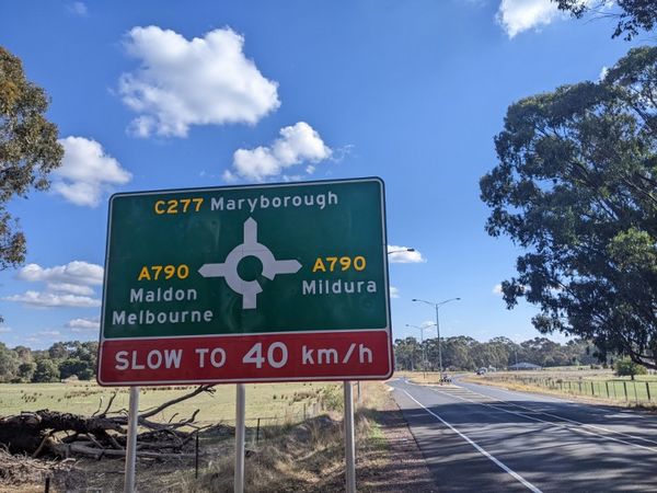
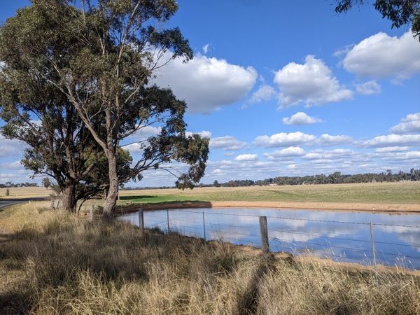
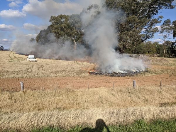
The ride was pleasant. The Bendigo-Maryborough Rd (C277) was not too busy, but was well made and with a fair bit of reasonable shoulder. Cars passed only every few minutes, and gave me plenty of room. After a bit of bush to start, it was then flat paddocks. There were plenty of birds about, like galahs and eastern rosellas, but bronzewings and a large bird of prey (maybe a brown falcon) were highlights. There were a few billows of smoke around from farmers burning off the remnants of the crops, and I passed very close to one such farmer. Luckily the wind was blowing this smoke away from the road.
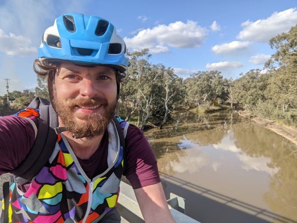
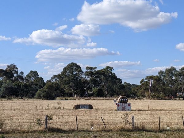
I got to the little town of Eddington, where I crossed the Loddon river, and was amused by the most light-hearted war memorial I've ever seen: A bale of hay with googly eyes and a cartoonish waving hand, accompanied by the message "Lest We Forget".
I was now getting closer to the hash. The easiest approach to the hash would have been along the main roads via Dunolly, but I wanted to save my first experience of the town as a post-hash reward. So I went left, cutting across hashwards via some gravel roads. I passed an old bloke coming the other way up one gravel road riding a tricycular cargo bike thing. I bade him a g'day and continued on my way.
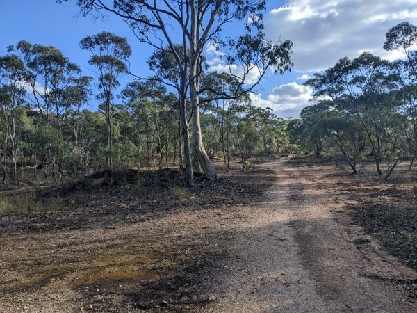
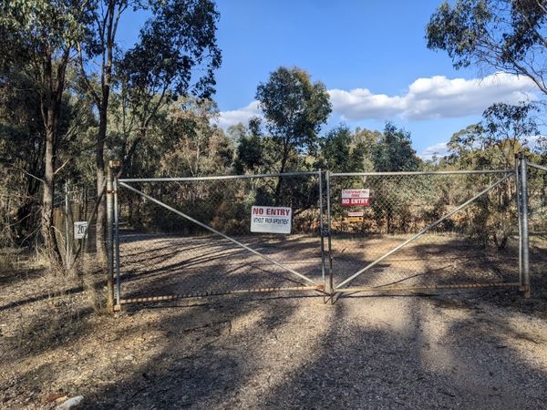
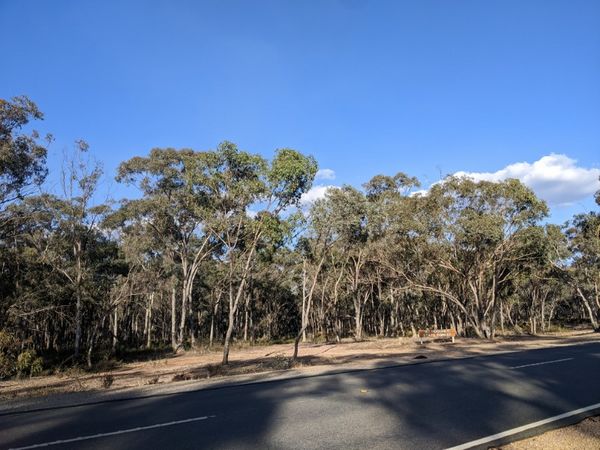
Now I reached the patch of bush the the hash lay in, which I later found a sign calling the Mt Hooghly State Forest. There was a network of little tracks throughout, but the D222 was the one for me. I followed it along but as I was getting very close I was suddenly met with a barbed wire fence with some machinery behind and a "NO ENTRY without permission" sign affixed thereto. Oh no. What research I had done had been just on the feasibility of getting to Dunolly and back, I hadn't considered that the hash might not actually be accessible. A bit of bush just off a main road, surely I could just waltz on in. I consulted my map, and luckily at this juncture I was supposed to turn right anyway, and go parallel to this fence line. A bit further along, I found a gate and I was informed as to the reason for the fence. A sign proclaimed itself to be the Sydenham Hill Mine. This was, and still is, a gold-mining district.
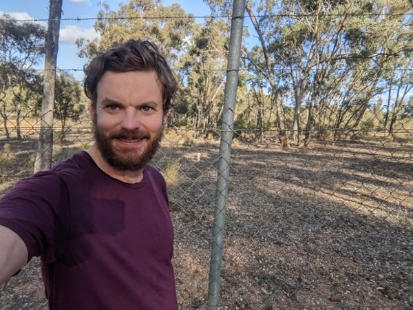
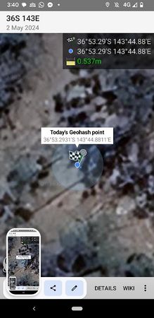
The hash was a bit further along the fenceline, off any track now, but I was very unsure which side of the fence it was on. On the satellite image, I could in fact make out a fenceline, now I was looking for it. In fact, complicating things, I could make out two, possibly the fence itself and the shadow of its top rail. I couldn't tell which was which, but the hash apparently lay between the two lines. Meanwhile, my eyes could only detect a single fence in front of me. I got as close to the hash as I could, and the app briefly lit up green, but then seemed to decide I was about 4m short, and trying to hold my phone through the fence did little to improve things.
I was forced to consider trying to sneak under the gate. In defiance of the signs, but the place did seem deserted. I reckoned my chances of being caught extremely slim. I would still rather not have to. I tried moving away from the hash and back again a couple of times, approaching from different angles, and closing and reopening the app, and before I knew it, the app told me I was under a metre away. Good enough! No trespassing required!
I got onto the main road, and rode triumphantly into Dunolly, the town proclaiming itself on entry to be the home of gold & grain. Here, from a little IGA, I bought liquorice and pizza shapes for later, and a can of drink for now. I topped up my fluid supply, and ate baked potatoes and bean chilli I'd brought (leftovers from the night before) which was a more substantial meal than the fruit and muesli bars that had sustained me thus far.
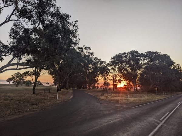
Then I was on my way again. I decided that for a change I would head to Castlemaine for a train home. The signs were telling me that it was actually closer than Bendigo (but I knew it was still marginally further than Kangaroo Flat). The countryside was becoming more and more picturesque as the sunset neared (made extra colourful by the farmers' smoke in the air). I saw a live kangaroo which was a nice antidote to the few (smelly) dead ones I'd seen on the side of the road. As night fell, out came a marvellous display of stars to counterbalance the chill in the air that had also arrived.
What the signs hadn't told me though, was that the way to Castlemaine was considerably more hilly than the way I'd come. I was getting a bit dispirited slogging up the hill into Maldon in the dark with close to 100km on the legs already, but the liquorice got me to the top, and my reward there was cracking into the pizza shapes. The design of my Hey Reflecto vest, with its pocket being the entire interior of the garment, came into its own here. I could comfortably fit the whole bag of shapes in there, open at the top, so all the way down into Castlemaine I was constantly reaching in for an extra handful, and very few of the shapes actually successfully made it to Castlemaine.
I reached the station with about 20 mins to spare before a train. On the platform a man in a mobility scooter asked if I had a lock for my bike. I said no, meaning not on me, but immediately from somewhere in the scooter he produced the feeblest looking combination cable lock I've ever seen, for me to have. I thanked him for his kind offer, but clarified that I did actually have a lock at home.
The train trip home was uneventful. I read more Rankin, and got back into Footscray just before 9pm. Including my trips to and from the station, I would have done just about 120km in total for the day. I got home, found something to constitute a dinner, and slept well that night. Just Bendigo itself, and Colac to go for the full minesweeper.
Tracklog
Photos
Achievements
John achieved level 6 of the Minesweeper Geohash achievement
|
