Difference between revisions of "2024-05-11 -36 144"
From Geohashing
Felix Dance (talk | contribs) (Corrected graticule (from -26 144)) |
(→Location) |
||
| (3 intermediate revisions by 3 users not shown) | |||
| Line 1: | Line 1: | ||
| − | {{meetup graticule|date=2024-05-11|lat=- | + | {{meetup graticule|date=2024-05-11|lat=-36|lon=144}} |
==Location== | ==Location== | ||
| − | Just off the | + | Just off the Bendigo Murchison road, near Rushworth |
==Participants== | ==Participants== | ||
| Line 7: | Line 7: | ||
==Expedition== | ==Expedition== | ||
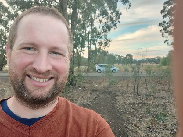
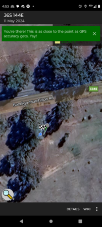
| − | + | Given we were already driving from my uncle's farm to Shepparton, this added nearly no distance to our trip, so getting the geohash was a no-brainer. Stopped the car, got out, jumped a country wire fence, achieved the hash, took the mandatory screenshot and selfie, and returned to the car and family. | |
==Photos== | ==Photos== | ||
| Line 22: | Line 22: | ||
[[Category:Coordinates reached]] | [[Category:Coordinates reached]] | ||
[[Category:Expeditions with photos]] | [[Category:Expeditions with photos]] | ||
| + | {{location|AU|VIC|CP}} | ||
Latest revision as of 09:19, 15 July 2024
| Sat 11 May 2024 in -36,144: -36.5800480, 144.9747232 geohashing.info google osm bing/os kml crox |
Location
Just off the Bendigo Murchison road, near Rushworth
Participants
Expedition
Given we were already driving from my uncle's farm to Shepparton, this added nearly no distance to our trip, so getting the geohash was a no-brainer. Stopped the car, got out, jumped a country wire fence, achieved the hash, took the mandatory screenshot and selfie, and returned to the car and family.

