Difference between revisions of "2023-09-30 39 -110"
From Geohashing
(Initial details) |
(photos) |
||
| (2 intermediate revisions by one other user not shown) | |||
| Line 1: | Line 1: | ||
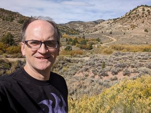
| − | + | [[Image:2023-09-30 39 -110 Grin.jpg|thumb|left]] | |
| − | + | {{meetup graticule | |
| − | [[Image: | + | | lat=39 |
| − | + | | lon=-110 | |
| − | + | | date=2023-09-30 | |
| − | |||
| − | |||
| − | |||
| − | |||
| − | | lat= | ||
| − | | lon= | ||
| − | | date= | ||
}} | }} | ||
== Location == | == Location == | ||
| Line 25: | Line 18: | ||
== Photos == | == Photos == | ||
| − | |||
| − | |||
| − | |||
| − | |||
<gallery perrow="5"> | <gallery perrow="5"> | ||
| + | Image:2023-09-30 39 -110 Grin.jpg | Grin | ||
| + | Image:2023-09-30 39 -110 Spot.jpg | Spot | ||
</gallery> | </gallery> | ||
| − | |||
| − | |||
| − | |||
| − | |||
__NOTOC__ | __NOTOC__ | ||
[[Category:Expeditions]] | [[Category:Expeditions]] | ||
| − | |||
[[Category:Expeditions with photos]] | [[Category:Expeditions with photos]] | ||
| − | |||
| − | |||
| − | |||
| − | |||
[[Category:Coordinates reached]] | [[Category:Coordinates reached]] | ||
| + | {{location|US|UT|DU}} | ||
Latest revision as of 17:45, 19 August 2024
| Sat 30 Sep 2023 in 39,-110: 39.8278284, -110.7885487 geohashing.info google osm bing/os kml crox |
Location
Just off US-191 at the south end of Duchesne county, Utah.
Participants
Plans
Drive down and arrive at about noon. Survey the site.
Expedition
Fairly uneventful. There were a few turnoffs that threw me for a loop.


