Difference between revisions of "2025-01-04 53 8"
Beardygrade (talk | contribs) (→Plans) |
Beardygrade (talk | contribs) (→Ribbons) |
||
| (One intermediate revision by the same user not shown) | |||
| Line 10: | Line 10: | ||
==Expedition== | ==Expedition== | ||
| + | The first streets I had to take (in a quiet living quarter, not much traffic) were still covered with snow and pocked with patches of ice. But they were manageable and shortly I reached a bike path treated with salt and easy to ride on. Even the road I dreaded the most (because it has no bike lane but thousands of potholes and sometimes very fast cars) was completely free of any solid form of water. | ||
| + | |||
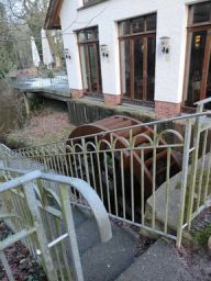
| + | For a while I followed the route I had taken on [[2024-12-30_52_8]]. After crossing the coastal canal I continued towards Achternmeer, then Westerholt and Oberlethe. There I turned right and then left onto "Töpfereiweg" (pottery road) which I would have to follow all the way. But I did not. For reasons unknown, I turned onto "Zum Hoop" (no translation here, dunno what it means). After a while it dawned on me that this could not be correct and I stopped to consult my phone. Indeed, this was the single most wrong direction I could have chosen. Of course, I would have liked to go for a lateral approach by turning right, and later right again, and telling myself that it was for the sake of the scenic landscape. But to the right there was only a very muddy and snowy track. Finally I decided to face the fact (once more) that my navigational skills might be in need of some more training, and I cycled back in my own tracks. Shortly after, I got to see a running (sort of) water mill and then reached "Fladderstraße" (again, no idea) which would lead me almost to the right spot. | ||
| + | |||
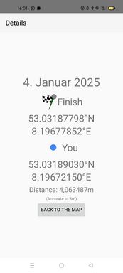
| + | But before I entered the forest "Tüdick" (you bet, no translation. It's like I was traveling in the most foreign country...), I passed a mysterious military site with some sort of missile/rocket/thing on a trailer. The road continued into the forest but here it consisted only of mud and water in various forms. Another turn to the right and after about 100 m I was almost there. The geohash would be some meters into the woods - on the other side of a deep ditch. Fortunately, some kind of flow regulation was conveniently located and made it possible for me to step over the ditch without getting wet. I reached the geohash at exactly 16:00 (whereas the actual proof screenshot is from 16:01). I waited about 15 minutes but no one showed up and finally I started the return journey. Since there was some daylight left, I decided to try some smaller roads and to look at a brickyard museum (closed) and a swimming lake (open, but occupied by a lot of geese who were presumably discussing whether they should continue into the south, considering the snow). | ||
| + | |||
| + | Now it was dark and the puddles started to freeze over. But the rest of the expedition went without accidents, too. | ||
==Photos== | ==Photos== | ||
| Line 32: | Line 39: | ||
{{bicycle geohash|date=2025-01-04|latitude=53|longitude=8|name=[[User:Beardygrade|Beardygrade]]|distance=18 km}} | {{bicycle geohash|date=2025-01-04|latitude=53|longitude=8|name=[[User:Beardygrade|Beardygrade]]|distance=18 km}} | ||
{{location|DE|NI|OL}} | {{location|DE|NI|OL}} | ||
| + | {{xkcd centurion | ||
| + | | count = 1 | ||
| + | | name = Beardygrade | ||
| + | }} | ||
Latest revision as of 22:27, 4 January 2025
| Sat 4 Jan 2025 in 53,8: 53.0318780, 8.1967785 geohashing.info google osm bing/os kml crox |
Location
In the forest "Tüdick", Wardenburg, Germany.
Participants
Plans
Yesterday we had the efficient combination of snowing, melting, and freezing while I had some errants to do in different parts of Oldenburg. It got monotonously more difficult to stay upright on the bicycle (partially because of some motorists who wouldn't in the least slow down on narrow streets). Yesterday evening, I was quite fed up with everything outdoors and almost categorically ruled out the possibility of trying to reach the saturday meetup.
But, it was not even a quarter of the distance of my last successful one! And peacefully located in a forest! And no wind today! And during the day most of the snow in my vicinity melted away! The beckoning voices in my head grew louder and the opportunity to actually reach a Saturday Meetup in time got more and more convincing. In the end, I convinced myself to give it a try. I would cancel immediately if the conditions turned out to be as bad as yesterday.
Expedition
The first streets I had to take (in a quiet living quarter, not much traffic) were still covered with snow and pocked with patches of ice. But they were manageable and shortly I reached a bike path treated with salt and easy to ride on. Even the road I dreaded the most (because it has no bike lane but thousands of potholes and sometimes very fast cars) was completely free of any solid form of water.
For a while I followed the route I had taken on 2024-12-30_52_8. After crossing the coastal canal I continued towards Achternmeer, then Westerholt and Oberlethe. There I turned right and then left onto "Töpfereiweg" (pottery road) which I would have to follow all the way. But I did not. For reasons unknown, I turned onto "Zum Hoop" (no translation here, dunno what it means). After a while it dawned on me that this could not be correct and I stopped to consult my phone. Indeed, this was the single most wrong direction I could have chosen. Of course, I would have liked to go for a lateral approach by turning right, and later right again, and telling myself that it was for the sake of the scenic landscape. But to the right there was only a very muddy and snowy track. Finally I decided to face the fact (once more) that my navigational skills might be in need of some more training, and I cycled back in my own tracks. Shortly after, I got to see a running (sort of) water mill and then reached "Fladderstraße" (again, no idea) which would lead me almost to the right spot.
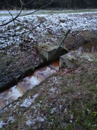
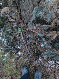
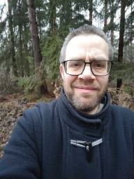
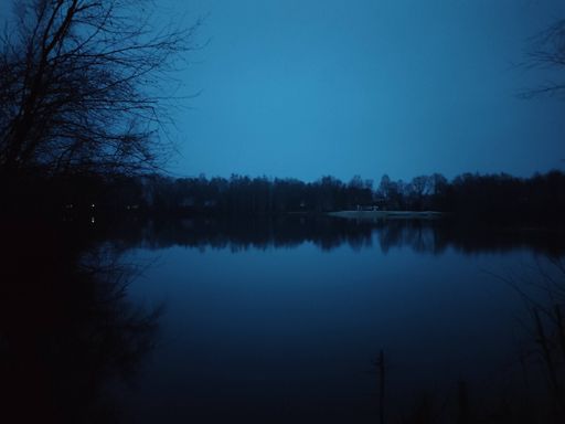
But before I entered the forest "Tüdick" (you bet, no translation. It's like I was traveling in the most foreign country...), I passed a mysterious military site with some sort of missile/rocket/thing on a trailer. The road continued into the forest but here it consisted only of mud and water in various forms. Another turn to the right and after about 100 m I was almost there. The geohash would be some meters into the woods - on the other side of a deep ditch. Fortunately, some kind of flow regulation was conveniently located and made it possible for me to step over the ditch without getting wet. I reached the geohash at exactly 16:00 (whereas the actual proof screenshot is from 16:01). I waited about 15 minutes but no one showed up and finally I started the return journey. Since there was some daylight left, I decided to try some smaller roads and to look at a brickyard museum (closed) and a swimming lake (open, but occupied by a lot of geese who were presumably discussing whether they should continue into the south, considering the snow).
Now it was dark and the puddles started to freeze over. But the rest of the expedition went without accidents, too.
Photos
Tracklog
Ribbons
Beardygrade earned the Land geohash achievement
|
Beardygrade earned the Bicycle geohash achievement
|
Beardygrade earned the xkcd Nullaturion achievement
|
