Difference between revisions of "2025-03-18 48 11"
From Geohashing
m (Location correction) |
|||
| Line 50: | Line 50: | ||
[[Category:Coordinates not reached]] | [[Category:Coordinates not reached]] | ||
[[Category:Not reached - No public access]] | [[Category:Not reached - No public access]] | ||
| − | {{location|DE|BY| | + | {{location|DE|BY|M|city=true}} |
Latest revision as of 04:52, 19 March 2025
| Tue 18 Mar 2025 in 48,11: 48.1605104, 11.4091869 geohashing.info google osm bing/os kml crox |
Location
On a schoolyard in Aubing
Participants
Expedition
- Iqui: Because school ended 15:30 today, I decided to drive to the hash immediately from there to not waste time. On the way I by lots of interesting places I hadn't seen before, and the sunny weather made everything look like spring already. It was only about 7°C outside though, and the temperature later decrease to as little as 2-3°C. Luckily I was at least semi-well prepared for this. Arriving at the hash-area, it was pretty clear that getting to the exact hashpoint would be impossible, but I still tried to get close to it. There was even a sign hung up on the fence of the school area that passing through would not be allowed, which is crazy because this was not a location you could easily get to, first having to cross a field and then making your way through some bushes. Another funny thing was that my way back was initially planned to be the exact one I drove to the hash, but because I drove the wrong way at two occasions and just decided to go with it both times, I almost ended up with a Tron-like route. Well not really, but it felt like it at least :=).
_
Photos

me at location

impressive view

proof 1

proof 2
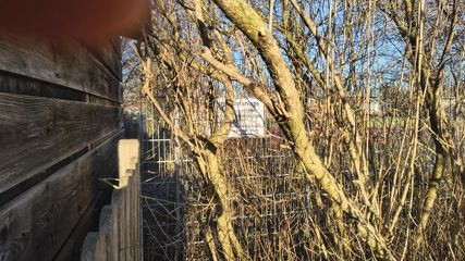
entering forbidden :(

location
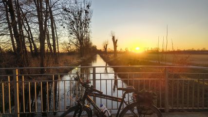
on the way back


Tracklog