Difference between revisions of "2008-10-25 38 -122"
From Geohashing
imported>Joannac (reached, after a bit of research) |
imported>FippeBot m (Location) |
||
| (One intermediate revision by one other user not shown) | |||
| Line 10: | Line 10: | ||
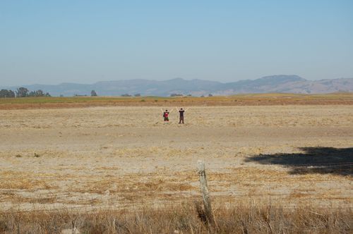
[[Image:2008-10-25 SantaRosa.JPG|left|500px]] | [[Image:2008-10-25 SantaRosa.JPG|left|500px]] | ||
| + | XX marks the spot! | ||
| + | |||
[[Category:Expeditions]] | [[Category:Expeditions]] | ||
[[Category:Expeditions with photos]] | [[Category:Expeditions with photos]] | ||
[[Category:Coordinates reached]] | [[Category:Coordinates reached]] | ||
| + | {{location|US|CA|SO}} | ||
Latest revision as of 00:32, 8 August 2019
| Sat 25 Oct 2008 in Santa Rosa: 38.2121877, -122.3687231 geohashing.info google osm bing/os kml crox |
Appears to be on a private farm, but I will pull to the side of Skaggs Island Road in the vicinity of the hashpoint. --Arkedius 06:23, 25 October 2008 (UTC)
XX marks the spot!
