Difference between revisions of "Vega, Texas"
From Geohashing
imported>Michael5000 m |
m (per Renaming Proposal) |
||
| (2 intermediate revisions by 2 users not shown) | |||
| Line 1: | Line 1: | ||
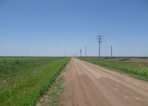
| − | [[File:2014-07-25 35 -102 (5).JPG|thumb|500 px|none|The | + | [[File:2014-07-25 35 -102 (5).JPG|thumb|500 px|none|The graticule is dominated by the flat agricultural land of the high plains.]] |
{{graticule | {{graticule | ||
| Line 15: | Line 15: | ||
}} | }} | ||
| − | The {{PAGENAME}} [[graticule]] is located around | + | The {{PAGENAME}} [[graticule]] is located around {{Today's location|lat=35|lon=-102|text=latitude 35, longitude -102}}. |
==Towns== | ==Towns== | ||
| Line 31: | Line 31: | ||
==Achievements== | ==Achievements== | ||
| − | {{ | + | {{Graticule unlocked |
| latitude = 35 | | latitude = 35 | ||
| longitude = -102 | | longitude = -102 | ||
Latest revision as of 03:28, 20 March 2024
| Clayton, New Mexico | Dalhart | Guymon, Oklahoma |
| Tucumcari, New Mexico | Vega | Amarillo |
| Clovis, New Mexico | Hereford | Plainview |
|
Today's location: geohashing.info google osm bing/os kml crox | ||
The Vega, Texas graticule is located around latitude 35, longitude -102.
Towns
- Vega, Texas
- Hartley, Texas
- Channing, Texas
- Adrian, Texas
Expeditions
- July 25, 2014 - Michael5000 reaches a hashpoint on a county road.
- July 12, 2010 - No Trespassing hash attempt by Icehawk78.
- March 12, 2010 - First Geohash recorded by Redassag02.
Achievements
Redassag02 earned the Graticule Unlocked Achievement
|
