Difference between revisions of "2009-02-04 52 8"
From Geohashing
imported>NWoodruff |
m |
||
| (One intermediate revision by one other user not shown) | |||
| Line 14: | Line 14: | ||
== Achievements == | == Achievements == | ||
| − | {{land geohash|latitude = 52|longitude = 8| date = 2009-02-04|name = Hoirkmann|image = 2009-02-04 52 8.JPG}} | + | {{land geohash|latitude = 52|longitude = 8| date = 2009-02-04|name = [[User:Hoirkmann|Hoirkmann]]|image = 2009-02-04 52 8.JPG}} |
{{Walk geohash|latitude = 52|longitude = 8| date = 2009-02-04|name = Hoirkmann}} | {{Walk geohash|latitude = 52|longitude = 8| date = 2009-02-04|name = Hoirkmann}} | ||
| Line 20: | Line 20: | ||
[[Category:Expeditions with photos]] | [[Category:Expeditions with photos]] | ||
[[Category:Coordinates reached]] | [[Category:Coordinates reached]] | ||
| + | {{location|DE|NW|GT}} | ||
Latest revision as of 12:41, 19 March 2022
| Wed 4 Feb 2009 in Bielefeld: 52.0505257, 8.3319136 geohashing.info google osm bing/os kml crox |
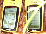
The hashpoint was in a field/small forest in my hometown, only a few minutes by foot.
Expedition
Unfortunately it was already dark when I started from my home, but half of the way was enlightened by streetlighting and the rest was easy enough to handle with a flashlight. As mentioned, the hash was in some kind of small forest next to a field and there was some kind of stable in the area. In the dark the only interesting thing I could find was some bird-winter-feeding-station, a few meters off the hash.
Achievements
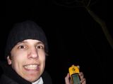
Hoirkmann earned the Land geohash achievement
|
Hoirkmann earned the Walk geohash Achievement
|

