Difference between revisions of "2009-02-16 57 18"
imported>Floffe (Initial edit, pictures missing) |
m |
||
| (6 intermediate revisions by 3 users not shown) | |||
| Line 11: | Line 11: | ||
The hash was located in Fole, 2km south-south-east of the church. [http://kartor.eniro.se/query?mop=aq&mapstate=8%3B18.56203044822313%3B57.63796264612581%3Bh%3B18.557420374146712%3B57.640100242305614%3B18.566627042550785%3B57.63583576471382%3B683%3B597&mapcomp=%3B%3B%3B%3B%3B%3B%3B%3B%3B%3B%3B%3B%3B%3B0%3B0%3B%3B%3B%3B0&what=map&searchInMap=1 Aerial photography] revealed it as located just outside a clearing off the fields. Since this was quite close to the bus route home from work, I decided to get off the regular bus, walk to the hash and back, and then hop on the next bus. Sunset was right around the time that I got off the bus, so to be on the safe side I decided to bring a reflecting vest for walking on the road. Luckily it was light enough to find my way to the hash, particularly with the 10-15cm of snow on the ground, but on the way back dark fell pretty quickly. On the walk back the vest turned out to be a good idea, as there was quite a few cars and properly dark, apart from the snow. | The hash was located in Fole, 2km south-south-east of the church. [http://kartor.eniro.se/query?mop=aq&mapstate=8%3B18.56203044822313%3B57.63796264612581%3Bh%3B18.557420374146712%3B57.640100242305614%3B18.566627042550785%3B57.63583576471382%3B683%3B597&mapcomp=%3B%3B%3B%3B%3B%3B%3B%3B%3B%3B%3B%3B%3B%3B0%3B0%3B%3B%3B%3B0&what=map&searchInMap=1 Aerial photography] revealed it as located just outside a clearing off the fields. Since this was quite close to the bus route home from work, I decided to get off the regular bus, walk to the hash and back, and then hop on the next bus. Sunset was right around the time that I got off the bus, so to be on the safe side I decided to bring a reflecting vest for walking on the road. Luckily it was light enough to find my way to the hash, particularly with the 10-15cm of snow on the ground, but on the way back dark fell pretty quickly. On the walk back the vest turned out to be a good idea, as there was quite a few cars and properly dark, apart from the snow. | ||
| − | The hash was actually pretty much on a path for small tractors or something similar, that went right up the side of the clearing. This ensured I didn't have to get into deep enough snow that it'd get annoying. Since I still don't have a GPS, the only proof I can offer of being on the hash will be rather long-winded with the walk there | + | The hash was actually pretty much on a path for small tractors or something similar, that went right up the side of the clearing. This ensured I didn't have to get into deep enough snow that it'd get annoying. Since I still don't have a GPS, the only proof I can offer of being on the hash will be rather long-winded with the walk there. |
| − | {{Public | + | {{Public transport geohash |
| latitude = 57 | | latitude = 57 | ||
| Line 24: | Line 24: | ||
}} | }} | ||
| + | |||
| + | == Pictures == | ||
| + | <gallery caption="" widths="250px" heights="200px" perrow="3"> | ||
| + | Image:20090216 57 18 road.jpg | Wintry road to walk on | ||
| + | Image:2009-02-16 sunset.jpg | A rather decent-looking sunset. Time to hurry up before it gets too dark! | ||
| + | Image:2009-02-16 eggs.jpg | Not open, so I couldn't buy any eggs | ||
| + | Image:2009-02-16 off the main road.jpg | Time to take a smaller road towards the forest. It's been driven enough to pack the snow a bit, luckily. | ||
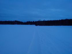
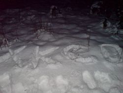
| + | Image:2009-02-16 at hash.jpg | This is pretty much right at the hash. There's a path here not on any map! | ||
| + | Image:2009-02-16 clearing.jpg | And this is the clearing to the west of the hash. | ||
| + | Image:2009-02-16 markings.jpg | Time to confuse people who'll walk past later on. | ||
| + | Image:2009-02-16 floffe.jpg | That's me. Phone camera isn't good for red-eye, but I did what I could to get rid of it. | ||
| + | Image:2009-02-16 bus.jpg | Time to catch the next passing bus to get home. | ||
| + | </gallery> | ||
| + | |||
| + | [[Category:Expeditions]] | ||
| + | [[Category:Expeditions with photos]] | ||
| + | [[Category:Coordinates reached]] | ||
| + | {{location|SE|I}} | ||
Latest revision as of 12:22, 19 April 2021
| Mon 16 Feb 2009 in Visby, Sweden: 57.6379620, 18.5620304 geohashing.info google osm bing/os kml crox |
Floffe
The hash was located in Fole, 2km south-south-east of the church. Aerial photography revealed it as located just outside a clearing off the fields. Since this was quite close to the bus route home from work, I decided to get off the regular bus, walk to the hash and back, and then hop on the next bus. Sunset was right around the time that I got off the bus, so to be on the safe side I decided to bring a reflecting vest for walking on the road. Luckily it was light enough to find my way to the hash, particularly with the 10-15cm of snow on the ground, but on the way back dark fell pretty quickly. On the walk back the vest turned out to be a good idea, as there was quite a few cars and properly dark, apart from the snow.
The hash was actually pretty much on a path for small tractors or something similar, that went right up the side of the clearing. This ensured I didn't have to get into deep enough snow that it'd get annoying. Since I still don't have a GPS, the only proof I can offer of being on the hash will be rather long-winded with the walk there.
Floffe earned the Public transport geohash achievement
|
Pictures
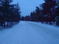
Wintry road to walk on
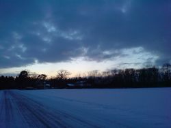
A rather decent-looking sunset. Time to hurry up before it gets too dark!
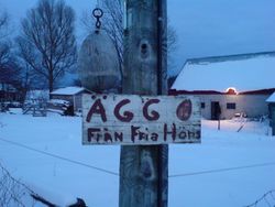
Not open, so I couldn't buy any eggs
Time to take a smaller road towards the forest. It's been driven enough to pack the snow a bit, luckily.

This is pretty much right at the hash. There's a path here not on any map!

And this is the clearing to the west of the hash.
Time to confuse people who'll walk past later on.
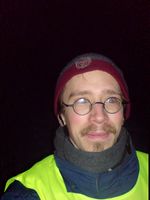
That's me. Phone camera isn't good for red-eye, but I did what I could to get rid of it.
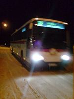
Time to catch the next passing bus to get home.


