Difference between revisions of "2009-03-14 41 -73"
From Geohashing
imported>Rgrossi (New page: {{meetup graticule | map=<map lat="41" lon="-73" date="2009-03-14" /> | lat=41 | lon=-73 | date=2009-03-14 | graticule_name=Danbury, Connecticut | graticule_link=Danbury, Connecticut }} =...) |
m |
||
| (3 intermediate revisions by 3 users not shown) | |||
| Line 15: | Line 15: | ||
==Pictures== | ==Pictures== | ||
| − | <gallery widths=" | + | <gallery widths="150px" heights="160px" perrow="3"> |
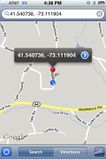
Image:2009-03-14 41 -73 p1.jpg|Map of the geohash location | Image:2009-03-14 41 -73 p1.jpg|Map of the geohash location | ||
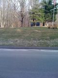
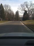
Image:2009-03-14 41 -73 p2.jpg|Looking east from the location | Image:2009-03-14 41 -73 p2.jpg|Looking east from the location | ||
| Line 25: | Line 25: | ||
[[Category:Expeditions]] | [[Category:Expeditions]] | ||
[[Category:Expeditions with photos]] | [[Category:Expeditions with photos]] | ||
| + | [[Category:Coordinates not reached]] | ||
| + | [[Category:Not reached - Technology]] | ||
| + | {{location|US|CT|NH}} | ||
Latest revision as of 19:43, 30 May 2022
| Sat 14 Mar 2009 in Danbury, Connecticut: 41.5407367, -73.1119046 geohashing.info google osm bing/os kml crox |
The Location
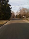
The town of Middlebury, Connecticut, in the middle of Carriage Drive.
The Geohash
Ryan went to the location at about 4:30 PM EDT. My phone showed me directly at the location, but when I got home and checked the map online it showed the location about 750 feet to the east.
