Difference between revisions of "2009-03-25 44 -92"
From Geohashing
imported>Josemite |
m |
||
| (4 intermediate revisions by 3 users not shown) | |||
| Line 1: | Line 1: | ||
{{meetup graticule | {{meetup graticule | ||
| − | | map=<map lat=" | + | | map=<map lat="44" lon="-92" date="2009-03-25" /> |
| lat=44 | | lat=44 | ||
| − | | lon=- | + | | lon=-92 |
| date=2009-03-25 | | date=2009-03-25 | ||
}} | }} | ||
| Line 9: | Line 9: | ||
| − | <gallery caption="Josemite and Axeman make their maiden hash" widths="200px" heights="200px" perrow="3"> | + | <gallery caption="[[User:Josemite|Josemite]] and Axeman make their maiden hash" widths="200px" heights="200px" perrow="3"> |
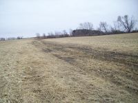
Image:2009-03-25_44_-92_Muddy_Farm.JPG|A rather nice view, aside from all the mud | Image:2009-03-25_44_-92_Muddy_Farm.JPG|A rather nice view, aside from all the mud | ||
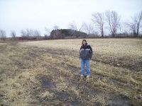
Image:2009-03-25_44_-92_Josemite.JPG|Standing in mud, as the geohash was in the middle of a mostly dried up stream(?) | Image:2009-03-25_44_-92_Josemite.JPG|Standing in mud, as the geohash was in the middle of a mostly dried up stream(?) | ||
| Line 16: | Line 16: | ||
[[Category:Expeditions]] | [[Category:Expeditions]] | ||
[[Category:Coordinates reached]] | [[Category:Coordinates reached]] | ||
| + | {{location|US|MN|DA}} | ||
Latest revision as of 23:19, 18 March 2022
| Wed 25 Mar 2009 in 44,-92: 44.5984076, -92.9809248 geohashing.info google osm bing/os kml crox |
Made our first geohash, ended up being a farm. Was cold, windy and muddy, as things just started melting the last week or so and then the temperature dropped back down to 34F at the time of our expedition. Ate at a nice place called Little Oscar's Restraunt in Hampton, they had a train going around the dining area and some tasty burgers with hashbrowns on top (which I failed to realize the irony of until now). Overall, looking forward to more hashing in the future, it's a nice way to explore the local area.
- Josemite and Axeman make their maiden hash

