Difference between revisions of "Mountain Home, Idaho"
From Geohashing
imported>ReletBot m (mv as per Naming conventions) |
m (per Renaming Proposal) |
||
| (22 intermediate revisions by 5 users not shown) | |||
| Line 1: | Line 1: | ||
| − | {{graticule | | + | {{graticule |
| − | This graticule is located at [[43,-115]]. [ | + | | lat= 43 |
| + | | lon= -115 | ||
| + | | nw = [[Payette, Idaho|Payette]] | ||
| + | | n = [[Crouch, Idaho|Crouch]] | ||
| + | | ne = [[Challis, Idaho|Challis]] | ||
| + | | w = [[Boise, Idaho|Boise]] | ||
| + | | name = [[Mountain Home, Idaho|Mountain Home]] | ||
| + | | e = [[Hailey, Idaho|Hailey]] | ||
| + | | sw = [[Grand View, Idaho|Grand View]] | ||
| + | | s = [[Glenns Ferry, Idaho|Glenns Ferry]] | ||
| + | | se = [[Twin Falls, Idaho|Twin Falls]] | ||
| + | }} | ||
| + | |||
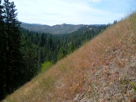
| + | [[File:2011-09-17 43 -115 4.JPG|550 px|none|thumb|Hilly terrain in the northern section of the graticule]] | ||
| + | |||
| + | This graticule is located at [[43,-115]]. {{Today's location|lat=43|lon=-115}} | ||
| + | |||
| + | == Expedition History == | ||
| + | |||
| + | ===[[2011-09-17 43 -115]]=== | ||
| + | |||
| + | [[User:Michael5000|Michael5000]] hiked to a hashpoint in the woods south of Idaho City. | ||
| + | |||
| + | ===[[2013-03-02 43 -115]]=== | ||
| + | [[User:Eldin|Eldin]] failed to reach the hashpoint because it was on an artillery range with no public access. | ||
| + | |||
| + | ===[[2013-03-08 43 -115]]=== | ||
| + | [[User:Eldin|Eldin]] took a pleasant nighttime walk in the desert to achieve the 2nd ever successful hash in this graticule. | ||
| + | |||
| + | ===[[2013-12-13 43 -115]]=== | ||
| + | [[User:Eldin|Eldin]] Hiked out into the desert NW of Mountain Home to reach this hash. | ||
| + | |||
| + | ===[[2020-05-01 43 -115]]=== | ||
| + | [[User:Penguins|Penguins]] took a "shortcut" to a hashpoint near Mores Creek | ||
| + | |||
| + | |||
| + | {{Graticule unlocked | ||
| + | | latitude = 43 | ||
| + | | longitude = -115 | ||
| + | | date = 2011-09-17 | ||
| + | | name = [[User:Michael5000|Michael5000]] | ||
| + | | image = 2011-09-17 43 -115 5.JPG | ||
| + | }} | ||
| + | |||
| + | |||
[[Category:Inactive graticules]] | [[Category:Inactive graticules]] | ||
[[Category:Idaho]] | [[Category:Idaho]] | ||
Latest revision as of 06:58, 20 March 2024
| Payette | Crouch | Challis |
| Boise | Mountain Home | Hailey |
| Grand View | Glenns Ferry | Twin Falls |
|
Today's location: geohashing.info google osm bing/os kml crox | ||
This graticule is located at 43,-115. Today's location
Contents
Expedition History
2011-09-17 43 -115
Michael5000 hiked to a hashpoint in the woods south of Idaho City.
2013-03-02 43 -115
Eldin failed to reach the hashpoint because it was on an artillery range with no public access.
2013-03-08 43 -115
Eldin took a pleasant nighttime walk in the desert to achieve the 2nd ever successful hash in this graticule.
2013-12-13 43 -115
Eldin Hiked out into the desert NW of Mountain Home to reach this hash.
2020-05-01 43 -115
Penguins took a "shortcut" to a hashpoint near Mores Creek
Michael5000 earned the Graticule Unlocked Achievement
|
