Difference between revisions of "2009-03-28 39 -86"
imported>ErWenn (New page: thumb|left {{meetup graticule | map={{#tag:map||lat=39|lon=-86|date=2009-03-28 }} | lat=39 | lon=-86 | date=2009-03-28 }} __NOTOC__ == Particip...) |
imported>FippeBot m (Location) |
||
| (9 intermediate revisions by 2 users not shown) | |||
| Line 13: | Line 13: | ||
== Plans == | == Plans == | ||
| − | + | This one was less than 6 miles from home, on the outer edge of a public golf course less than 10 feet from the road (as opposed to in a forest or corn field, like they usually are), so it would have been hard to justify ''not'' going. Determined to pick up the [[Picnic Geohash]] achievement despite the damp weather, Kira packed a sandwich and some snacks. I ([[User:ErWenn|Erik]]) felt no desire to eat a sandwich and we were running late, so we stopped to pick up Taco Bell on the way. I was also determined to get the [[Circus Geohash]] achievement, so I packed my sticks. (Some people call them "devil sticks", but others reserve that distinction for the tassel-less variety, calling these "flower sticks". I usually just call them "sticks".) We also noticed that there were some [[wikipedia:Geocaching|geocaches]] in the area, so I loaded those coordinates onto the GPS as well. | |
== Expedition == | == Expedition == | ||
| + | It was astonishingly easy to find, and probably would have been easy to find (and prove) without electronic assistance. It had stopped raining, but the ground was wet, a chilly wind was picking up, and the golfers in the distance seemed to be getting closer to the hole whose green we were behind, so the picnic and circus portions of the trip were brief. You can see full video of the sticking [http://www.qrivy.net/~hc/vids/2009-03-28_39_-86_stix.avi here]. | ||
| + | After the hash, we went on to successfully find one cache, although it had started raining by then. Only a few minutes away from a [[Drowned Rat Geohash]] achievement. | ||
== Photos == | == Photos == | ||
| Line 28: | Line 30: | ||
Image:2009-03-28_39_-86_proof.jpg | Proof! | Image:2009-03-28_39_-86_proof.jpg | Proof! | ||
</gallery> | </gallery> | ||
| + | |||
| + | {{Picnic | ||
| + | | latitude = 39 | ||
| + | | longitude = -86 | ||
| + | | date = 2009-03-28 | ||
| + | | name = Erik and Kira | ||
| + | | image = 2009-03-28_39_-86_Erik.jpg | ||
| + | | food = Taco Bell grilled taquitos, turkey-and-avocado sandwich | ||
| + | }} | ||
| + | |||
| + | {{Circus_geohash | ||
| + | | latitude = 39 | ||
| + | | longitude = -86 | ||
| + | | date = 2009-03-28 | ||
| + | | name = Erik | ||
| + | | image = 2009-03-28_39_-86_Erik_circus.jpg | ||
| + | | performance = sticks | ||
| + | }} | ||
| + | |||
| + | {{Hash collision | ||
| + | | latitude = 39 | ||
| + | | longitude = -86 | ||
| + | | date = 2009-03-28 | ||
| + | | name = Erik and Kira | ||
| + | | id = GCQ4ZP | ||
| + | | link = http://www.geocaching.com/seek/cache_details.aspx?guid=53646f18-32d5-41aa-a0c4-70d557aa85d3 | ||
| + | | distance = 740m | ||
| + | | honor = honorable mention | ||
| + | }} | ||
[[Category:Expeditions]] | [[Category:Expeditions]] | ||
| − | [[Category:Expeditions with photos]] | + | [[Category:Expeditions with photos]] |
| + | [[Category:Expeditions with videos]] | ||
[[Category:Coordinates reached]] | [[Category:Coordinates reached]] | ||
| − | [[Category:Meetup on | + | [[Category:Meetup on 2009-03-28]] |
[[Category:Meetup in 39 -86]] | [[Category:Meetup in 39 -86]] | ||
[[Category:Expeditions with dogs]] | [[Category:Expeditions with dogs]] | ||
| + | [[Category:Picnic achievement]] | ||
| + | [[Category:Circus geohash achievement]] | ||
| + | [[Category:Golf course]] | ||
| + | {{location|US|IN|MR}} | ||
Latest revision as of 02:30, 8 August 2019
| Sat 28 Mar 2009 in 39,-86: 39.2044679, -86.5471750 geohashing.info google osm bing/os kml crox |
Participants
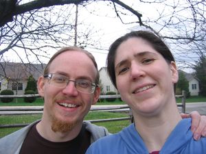
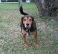
Erik, Kira, and Duncan.
Plans
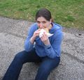
This one was less than 6 miles from home, on the outer edge of a public golf course less than 10 feet from the road (as opposed to in a forest or corn field, like they usually are), so it would have been hard to justify not going. Determined to pick up the Picnic Geohash achievement despite the damp weather, Kira packed a sandwich and some snacks. I (Erik) felt no desire to eat a sandwich and we were running late, so we stopped to pick up Taco Bell on the way. I was also determined to get the Circus Geohash achievement, so I packed my sticks. (Some people call them "devil sticks", but others reserve that distinction for the tassel-less variety, calling these "flower sticks". I usually just call them "sticks".) We also noticed that there were some geocaches in the area, so I loaded those coordinates onto the GPS as well.
Expedition
It was astonishingly easy to find, and probably would have been easy to find (and prove) without electronic assistance. It had stopped raining, but the ground was wet, a chilly wind was picking up, and the golfers in the distance seemed to be getting closer to the hole whose green we were behind, so the picnic and circus portions of the trip were brief. You can see full video of the sticking here.
After the hash, we went on to successfully find one cache, although it had started raining by then. Only a few minutes away from a Drowned Rat Geohash achievement.
Photos
Erik and Kira earned the Picnic achievement
|
Erik earned the Circus Geohash Achievement
|
Erik and Kira earned the Hash collision honorable mention
|


