Difference between revisions of "2009-05-16 49 8"
imported>Fivetonsofflax (→Photos) |
imported>FippeBot m (Location) |
||
| (2 intermediate revisions by one other user not shown) | |||
| Line 6: | Line 6: | ||
| date=2009-05-16 | | date=2009-05-16 | ||
}} | }} | ||
| − | |||
| − | |||
| − | |||
| − | |||
| − | |||
| − | |||
| − | |||
== Expedition == | == Expedition == | ||
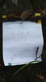
| + | [[User:Euterkuh|Euterkuh]] and [[User:fivetonsofflax|fivetonsofflax]] had originally planned to get the [[Bicycle geohash|Bicycle Geohash Achievement]], but since fivetonsofflax's bike was gone (disposed of by the janitor or stolen), we had to take the train. We went from Heidelberg main station to Neckargemünd and walked towards the hash from there, the distance being only about 1.7 km. Fivetonsofflax had seen a convenient road on Google Maps, but we weren't sure whether the one we were on was the right one. So after a little while, it was straight through the woods - [[2009-05-01 49 7|once again]]. About 800 meters from the hashpoint, we stumbled upon a nice but muddy path, on which we could walk until the point was in a distance of 70 meters. We went there, left a mark, took photos and entered the village of Waldhilsbach, from where we took the bus back to Neckargemünd. | ||
| − | + | At home, we made a nice plate of cake as a reward. | |
| Line 50: | Line 44: | ||
</gallery> | </gallery> | ||
| − | |||
| − | |||
| − | |||
| − | |||
| − | |||
| − | |||
[[Category:Expeditions]] | [[Category:Expeditions]] | ||
| − | + | [[Category:Expeditions with photos]] | |
| − | |||
| − | [[Category:Expeditions with photos]] | ||
| − | |||
| − | |||
| − | |||
| − | |||
| − | |||
[[Category:Coordinates reached]] | [[Category:Coordinates reached]] | ||
| − | + | {{location|DE|BW|HD}} | |
| − | |||
| − | |||
| − | |||
| − | |||
| − | |||
| − | |||
| − | |||
| − | |||
| − | |||
Latest revision as of 03:23, 8 August 2019

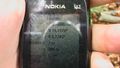
| Sat 16 May 2009 in 49,8: 49.3770048, 8.7785416 geohashing.info google osm bing/os kml crox |
Expedition
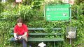
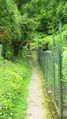
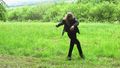
Euterkuh and fivetonsofflax had originally planned to get the Bicycle Geohash Achievement, but since fivetonsofflax's bike was gone (disposed of by the janitor or stolen), we had to take the train. We went from Heidelberg main station to Neckargemünd and walked towards the hash from there, the distance being only about 1.7 km. Fivetonsofflax had seen a convenient road on Google Maps, but we weren't sure whether the one we were on was the right one. So after a little while, it was straight through the woods - once again. About 800 meters from the hashpoint, we stumbled upon a nice but muddy path, on which we could walk until the point was in a distance of 70 meters. We went there, left a mark, took photos and entered the village of Waldhilsbach, from where we took the bus back to Neckargemünd.
At home, we made a nice plate of cake as a reward.
Photos
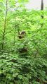
Into the forest!
A ferocious snail.
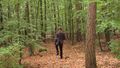
fivetonsofflax disappearing into the woods...
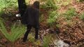
... crossing a rapid torrent...
... and playing a tree-xylophone.
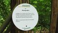
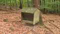
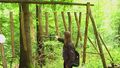
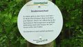
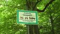
The "Path of the senses"
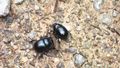
Dung beetles eating dung
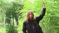
Ska! Ska! Ska!
Euterkuh at the hashpoint
Very stupid grin, indeed.

Here's to another succesful geohash.
No carriages allowed!
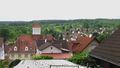
View on Waldhilsbach
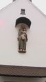
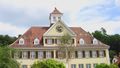
Slightly exaggerated town-hall (with maypole)

Some Scientology assholes in Heidelberg
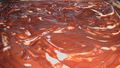
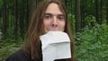
Delicious Donauwelle


