Difference between revisions of "2009-06-01 33 -84"
(New page: {{meetup graticule | map=<map lat="33" lon="-84" date="2009-06-01" /> | lat=33 | lon=-84 | date=2009-06-01 | graticule_name=Atlanta | graticule_link=Atlanta, Georgia }} == Graticule == ...) |
imported>FippeBot m (Location) |
||
| (7 intermediate revisions by one other user not shown) | |||
| Line 19: | Line 19: | ||
=== [[User:NWoodruff|NWoodruff]] === | === [[User:NWoodruff|NWoodruff]] === | ||
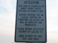
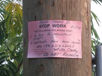
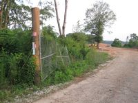
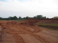
| + | Looking from the Google map, I originally though that this was a personal air field for someone that owned the property. It may have been looking at the map because there are straight paths cut in an "A" shape. When I got there it looked to be an abandoned work site. I noticed a sign that says that you could not enter for any illegal purpose. Geoshashing isn't illegal is it? The gate was wide open and there was a stop work notice posted on it. I assumed that with the gate wide open and sign stating no illegal entry that it was okay to go onto the property. | ||
| + | |||
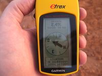
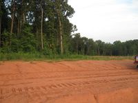
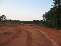
| + | There were numerous dirt roads that were made. I navigated several to find the closest point to the Geohash point. After driving around for several minutes I finally found one with only 20 feet to go. I hopped out and found the hash point with 2 feet to go. | ||
| + | |||
| + | I took a few pictures and then drove home to Norcross. | ||
== Gallery == | == Gallery == | ||
<gallery caption="Photo Gallery" widths="200px" heights="200px" perrow="3"> | <gallery caption="Photo Gallery" widths="200px" heights="200px" perrow="3"> | ||
| − | Image:2009060133-84NW01.JPG| | + | Image:2009060133-84NW01.JPG| Geohashing isn't illegal is it? |
| + | Image:2009060133-84NW02.JPG| Nothing has been done here since April 17th. | ||
| + | Image:2009060133-84NW03.JPG| The gate is wide open. | ||
| + | Image:2009060133-84NW04.JPG| 2.49 feet to go. Close enough. | ||
| + | Image:2009060133-84NW05.JPG| Looking west from the Geohash point. | ||
| + | Image:2009060133-84NW06.JPG| Looking east from the geohash point. | ||
| + | Image:2009060133-84NW07.JPG| Looking North from the geohash point. | ||
</gallery> | </gallery> | ||
| Line 34: | Line 45: | ||
[[Category:Coordinates reached]] | [[Category:Coordinates reached]] | ||
[[Category:Expeditions with photos]] | [[Category:Expeditions with photos]] | ||
| + | {{location|US|GA|HY}} | ||
Latest revision as of 03:41, 8 August 2019
| Mon 1 Jun 2009 in Atlanta: 33.5503778, -84.1673527 geohashing.info google osm bing/os kml crox |
Graticule
About
Expedition
NWoodruff
Looking from the Google map, I originally though that this was a personal air field for someone that owned the property. It may have been looking at the map because there are straight paths cut in an "A" shape. When I got there it looked to be an abandoned work site. I noticed a sign that says that you could not enter for any illegal purpose. Geoshashing isn't illegal is it? The gate was wide open and there was a stop work notice posted on it. I assumed that with the gate wide open and sign stating no illegal entry that it was okay to go onto the property.
There were numerous dirt roads that were made. I navigated several to find the closest point to the Geohash point. After driving around for several minutes I finally found one with only 20 feet to go. I hopped out and found the hash point with 2 feet to go.
I took a few pictures and then drove home to Norcross.
Gallery
- Photo Gallery
Achievements
NWoodruff earned the Land geohash achievement
|
