Difference between revisions of "2009-06-07 -34 150"
From Geohashing
(New page: {{meetup graticule | map=<map lat="-34" lon="150" date="2009-06-07" /> | lat=-34 | lon=150 | date=2009-06-07 }} This hash falls in the Pacific Ocean close to Tomb Thumb Island, just off t...) |
m |
||
| (9 intermediate revisions by 6 users not shown) | |||
| Line 7: | Line 7: | ||
This hash falls in the Pacific Ocean close to Tomb Thumb Island, just off the coast from Wollongong. | This hash falls in the Pacific Ocean close to Tomb Thumb Island, just off the coast from Wollongong. | ||
| − | It is located within the [[Wollongong, Australia|Wollongong]] graticule | + | It is located within the [[Wollongong, Australia|Wollongong]] graticule. |
| − | -34. | + | -34.455209°, 150.976742° |
| − | Map Reference: | + | Map Reference: {{egl|2009-06-08|-35|150|text=Official tool}} |
| − | [http://maps.google.com/maps?f=q&source=s_q&hl=en&geocode=&q=-34. | + | [http://maps.google.com.au/maps?f=q&source=s_q&hl=en&geocode=&q=-34.455209%C2%B0,+150.976742%C2%B0+&mrt=all&sll=-24.846565,135.703125&sspn=37.269963,79.101563&ie=UTF8&ll=-34.457314,150.909576&spn=0.268365,0.617981&z=11 Location in Google Maps]] |
| + | |||
| + | ==Participants== | ||
| + | *[[User:Mrchips0|Mrchips0]] | ||
| + | |||
| + | ==Achievement== | ||
| + | |||
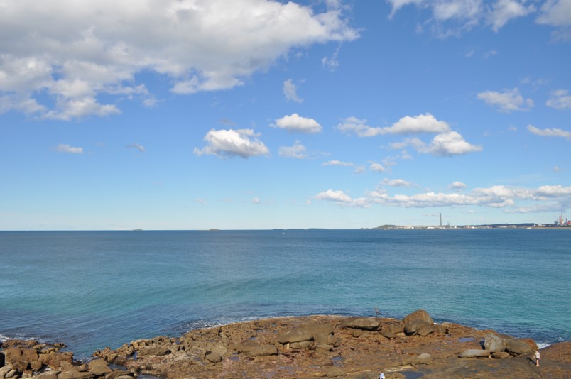
| + | This hash was only accessible by boat. And although the surf was pretty tame today, I wasn't paddling a canoe out to sea for the sake of a hash. Instead took a photo of the location from the Wollongong lighthouse. | ||
| + | |||
| + | [[Image:2009-06-07 Five Islands.JPG]] | ||
| + | [[Category:Expeditions]] | ||
| + | [[Category:Coordinates not reached]] | ||
| + | [[Category:Not reached - Mother Nature]] | ||
| + | {{location|AU|NSW}} | ||
Latest revision as of 22:38, 18 March 2022
| Sun 7 Jun 2009 in -34,150: -34.4552086, 150.9767424 geohashing.info google osm bing/os kml crox |
This hash falls in the Pacific Ocean close to Tomb Thumb Island, just off the coast from Wollongong.
It is located within the Wollongong graticule.
-34.455209°, 150.976742°
Map Reference: Official tool
Participants
Achievement
This hash was only accessible by boat. And although the surf was pretty tame today, I wasn't paddling a canoe out to sea for the sake of a hash. Instead took a photo of the location from the Wollongong lighthouse.
