Difference between revisions of "2009-06-17 51 11"
(2003) |
imported>FippeBot m (Location) |
||
| (6 intermediate revisions by 4 users not shown) | |||
| Line 5: | Line 5: | ||
| date=2009-06-17 | | date=2009-06-17 | ||
}} | }} | ||
| + | == Participants == | ||
| + | * [[User:Reinhard|Reinhard]] | ||
| + | == Expedition == | ||
Though this hashpoint wasn't very close to my home, I decided to use the expedition as my evening cycling training. After coming home from work, I ate some cake and got ready for the trip, which I started at 18:45 from Jena-Cospeda. Even on the shortest way, that I was going to take for my way there, it was more than 60 km, so, of course, I took lights with me and transparent glasses. Since (at least I thought) it was a warm day, I didn't take long clothes for arms and legs with me. | Though this hashpoint wasn't very close to my home, I decided to use the expedition as my evening cycling training. After coming home from work, I ate some cake and got ready for the trip, which I started at 18:45 from Jena-Cospeda. Even on the shortest way, that I was going to take for my way there, it was more than 60 km, so, of course, I took lights with me and transparent glasses. Since (at least I thought) it was a warm day, I didn't take long clothes for arms and legs with me. | ||
| Line 34: | Line 37: | ||
</gallery> | </gallery> | ||
| − | + | === Awards === | |
| + | {{Bicycle geohash | ||
| + | | latitude=51 | ||
| + | | longitude=11 | ||
| + | | date=2009-06-17 | ||
| + | | name=Reinhard | ||
| + | }} | ||
| + | |||
| + | |||
| + | [[Category:Expeditions]] | ||
| + | [[Category:Expeditions with photos]] | ||
| + | [[Category:Coordinates reached]] | ||
| + | [[Category:Expeditions with ticks]] | ||
| + | {{location|DE|TH|KYF}} | ||
Latest revision as of 03:59, 8 August 2019
| Wed 17 Jun 2009 in 51,11: 51.3287508, 11.1075645 geohashing.info google osm bing/os kml crox |
Participants
Expedition
Though this hashpoint wasn't very close to my home, I decided to use the expedition as my evening cycling training. After coming home from work, I ate some cake and got ready for the trip, which I started at 18:45 from Jena-Cospeda. Even on the shortest way, that I was going to take for my way there, it was more than 60 km, so, of course, I took lights with me and transparent glasses. Since (at least I thought) it was a warm day, I didn't take long clothes for arms and legs with me.
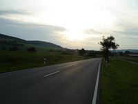
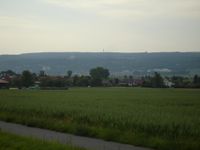
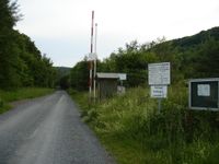
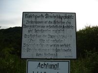
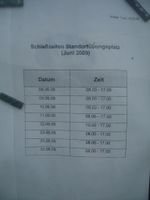
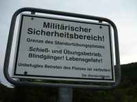
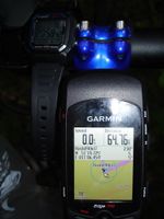
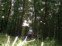
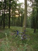
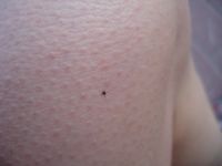
The way there went very well and I was quite satisfied with my pace (something >30 km/h), when I arrived near the hash in less than two hours. I had to leave paved roads and went further on a gravel road, that took me right to a bar, which wasn't down. That was, where the military drill ground began. I wouldn't have to go in very far, but at least a bit into the forest on my left. I was aware of the nearby caserne, but there was nothing to hear or to see. Nevertheless, I read the signs at the barrier carefully, in case it would have to be a no trespassing geohash. After reading I was sure, that today there should be no problem trespassing, since there were no trainings acoording to the timetable. Thus, I passed the bars and stepped into the wood. There was a good slope to climb, which apparently wasn't going to end before arriving the hash, which was still about 300 m away. Pushing and carrying the bike didn't make it easier. Bushwhacking seemed endlessly. I tried to walk through the deep grass at the edge of the forest after a while, but this wasn't less difficult and even didn't get me much closer to the hash, so I finally went back into the wood, sweating and thus struggling more and more with thousands of mosquitos. After doing so for about 13 minutes for a lousy distance of less than 500 m, I finally arrived at the place my Garmin told me today's hashpoint would be. I hurried taking photos, because not moving is the worst you can do, when being attacked by flying monsters. I figured out a small path with the help of the topographic map my Garmin displayed and even could cycle this one down quickly, back to the barrier and out of the military drill ground. Back in Seehausen, I checked my legs and arms for ticks and found two of them crawling on my skin. Hope there weren't any more ...
The more difficult part of this expedition took me half an hour, so it got 21:10 by now - time to change the glasses to transparent and prepare for switching on the lights, which I did after some kilometers. I thought, what a lucky guy am I, when a farming freight vehicle overtook me at the city limit of Kölleda, going at a pace of pretty much 50 km/h. I enjoyed its slip stream for 6 km till Großneuhausen, when I wanted to use an other way, different from the one I came before, that also the truck was going now. I didn't make it more than 250 m from the junction, when I noticed that I obviously had lost my taillight. I couldn't remember, when I last saw it, but knew that it might have been some time ago, since it's not very clever to look down to your seat post to see, whether your taillight ist still there and glowing, while you are following a truck at 50 km/h and at a distance of less than 3 meters. I decided, that it might be possible to find the red-glowing lamp in the dark night, which implied that it survived the drop. So I turned around, carefully looking for a red spot on the ground, always aware that I might be hard to spot by car drivers. My first hope was, that I lost it at the railroad crossing between Kölleda and Großneuhausen - didn't seem so. :( I went further to Kölleda, where I jumped off the sidewalk (it had a bike lane) to get behind the truck, before. It wasn't there either. Has somebody found and stolen ist? I asked a pedestrian with his dog, whether he had seen it - nope. :( I continued for an other 2 km, but then gave up and decided continuing the search would be useless. I also remembered that the rechargeable battery of my headlight wasn't about to light my way much more than 3.5 hours and I didn't want to also lose the guiding light of this one. Consequently, I turned around again and made it all the way back to Großneuhausen (having gone that 8 km now twice in each direction today) and decided to take the shortest way back then - which was the one that also the nice pulling truck chose about 40 min before. :-/ I had an other 40 km to go. This time always going far to the right or even stopping, when I heard a car coming from behind. Fortunately, there weren't more than 10 or 15 - not very astonishing, according to the time of day. It was after midnight, around 00:30, when I finally arrived home, still alive, after exciting 145 km.
Lessons learned:
- There's no stepping into the wood without getting attacked by ticks. Always check yourself after getting out of the wood!
- Always stay behind big cars while cycling, when you're able to keep up with them, even if you didn't intend to go their way!
- Never try to look for something you've lost! You won't find it! Accept that!
- Spare lamps are as important as spare tires, if you're going to go on a bike expedition that's not going to end before sunset.
- It might get colder in the night. Long clothes might be useful, but riding (esp. uphill) faster helps staying warm.
---Reinhard
- Photo Gallery
Awards
Reinhard earned the Bicycle geohash achievement
|
