Difference between revisions of "2009-07-04 44 -68"
imported>Simianfriend (New page: {{subst:Expedition | lat=44 | lon=-68 | date=2009-07-04 | graticule_link=Bangor, Maine }}) |
imported>FippeBot m (Location) |
||
| (6 intermediate revisions by 3 users not shown) | |||
| Line 1: | Line 1: | ||
| − | |||
| − | |||
| − | |||
| − | |||
| − | |||
{{meetup graticule | {{meetup graticule | ||
| lat=44 | | lat=44 | ||
| Line 10: | Line 5: | ||
}} | }} | ||
| − | |||
__NOTOC__ | __NOTOC__ | ||
== Location == | == Location == | ||
| − | + | Right along a pretty nice gravel road in the middle of Dedham, Maine. | |
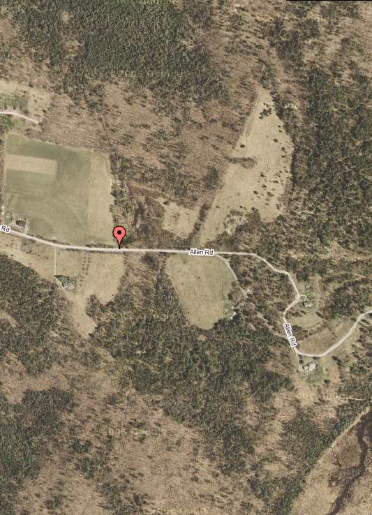
| + | [[Image:20090704_44N68W_OverviewMap.png]] | ||
== Participants == | == Participants == | ||
| − | + | [[user:simianfriend|SimianFriend (me)]], plus the family, dragged along on "one of dad's hobbies". They're learning not to ask too many questions. | |
== Plans == | == Plans == | ||
| + | There's a serious shortage of planning on these things thus far. | ||
| + | Next time, I promise - maybe someone else will show, eventually. But probably not unless the weather improves.... | ||
== Expedition == | == Expedition == | ||
| + | Rain, and plenty of it. Photos to come. Fortunately, this hash landed in a road, so no getting out of cars was required. It's been a rainy month or two. No one else showed up, probably due to it being Independence Day and folks having other things to do, or possibly because the rain was coming down in buckets. Not a good time to go out and meet new folks - the conversations are apt to be pretty terse, and only related to the current meteorological conditions, which are well known by that point. | ||
| + | Photos to come. Lovely place to go when it's clear. Nothing to see today, though. | ||
| − | |||
| − | |||
| − | |||
| − | |||
| − | |||
| − | |||
| − | |||
| − | |||
| − | |||
| − | |||
| − | |||
| − | |||
| − | |||
| − | |||
| − | |||
| − | |||
| − | |||
| − | |||
[[Category:Expeditions]] | [[Category:Expeditions]] | ||
[[Category:Expeditions with photos]] | [[Category:Expeditions with photos]] | ||
| − | |||
| − | |||
| − | |||
| − | |||
| − | |||
[[Category:Coordinates reached]] | [[Category:Coordinates reached]] | ||
| − | + | {{location|US|ME|HA}} | |
| − | |||
| − | |||
| − | |||
| − | |||
| − | |||
| − | |||
| − | |||
| − | |||
| − | |||
Latest revision as of 02:31, 6 August 2019
| Sat 4 Jul 2009 in 44,-68: 44.2025619, -68.8738082 geohashing.info google osm bing/os kml crox |
Location
Right along a pretty nice gravel road in the middle of Dedham, Maine.

Participants
SimianFriend (me), plus the family, dragged along on "one of dad's hobbies". They're learning not to ask too many questions.
Plans
There's a serious shortage of planning on these things thus far.
Next time, I promise - maybe someone else will show, eventually. But probably not unless the weather improves....
Expedition
Rain, and plenty of it. Photos to come. Fortunately, this hash landed in a road, so no getting out of cars was required. It's been a rainy month or two. No one else showed up, probably due to it being Independence Day and folks having other things to do, or possibly because the rain was coming down in buckets. Not a good time to go out and meet new folks - the conversations are apt to be pretty terse, and only related to the current meteorological conditions, which are well known by that point.
Photos to come. Lovely place to go when it's clear. Nothing to see today, though.