Difference between revisions of "2009-07-15 33 -84"
imported>NWoodruff m (→Gallery) |
imported>FippeBot m (Location) |
||
| (3 intermediate revisions by one other user not shown) | |||
| Line 44: | Line 44: | ||
Image:2009071533-84NW02.JPG| Time of the meetup. | Image:2009071533-84NW02.JPG| Time of the meetup. | ||
Image:2009071533-84NW03.JPG| Date of the meetup. | Image:2009071533-84NW03.JPG| Date of the meetup. | ||
| − | Image: | + | Image:IMG 0962.JPG| Stupid Grin™ |
Image:2009071533-84NW05.JPG| Picture of actual hash spot. | Image:2009071533-84NW05.JPG| Picture of actual hash spot. | ||
| − | Image:2009071533-84NW06.JPG| | + | Image:2009071533-84NW06.JPG| A picture from the hash point. |
| − | Image:2009071533-84NW07.JPG| | + | Image:2009071533-84NW07.JPG| A picture from the hash point. |
</gallery> | </gallery> | ||
| Line 53: | Line 53: | ||
{{land geohash | latitude = 33 | longitude = -84| date = 2009-07-15| name = NWoodruff}} | {{land geohash | latitude = 33 | longitude = -84| date = 2009-07-15| name = NWoodruff}} | ||
| + | {{Bicycle geohash | latitude = 33 | longitude = -84 | date = 2009-07-15 | name = NWoodruff | distance = 12.7 miles | ||
| + | }} | ||
[[Category:Expeditions]] | [[Category:Expeditions]] | ||
[[Category:Coordinates reached]] | [[Category:Coordinates reached]] | ||
[[Category:Expeditions with photos]] | [[Category:Expeditions with photos]] | ||
| + | {{location|US|GA|CB}} | ||
Latest revision as of 04:31, 8 August 2019
| Wed 15 Jul 2009 in Atlanta: 33.8763924, -84.4781617 geohashing.info google osm bing/os kml crox |
Graticule
About
This Geohash is just off the interstate almost on my way home. There should be no reason why I couldn't make it.
Expedition
NWoodruff
I left work around 5:30pm driving the normal way that I usually drive home. I get on Interstate 75 heading south towards Interstate 285 to go east. I make it 3 or 4 miles south on I-75 and then all of a sudden traffic ahead of me comes screeching to a halt.
It is normal for the south bound traffic to be moving about 30 to 40 mph at this time of day but not at a dead stop. I sit there for 5 to 10 minutes with no movement at all. I then start to move about 10 feet at the time. Another 10 minutes passes and I hear the traffic report on the radio that 4 cars are involved in a accident 5 miles ahead of me and 3 lanes of the 9 lanes of I-75 have been closed.
Not only are a 1/3 of the lanes closed, there are accidents occurring in the backwash of traffic. There are estimates on the radio of taking up to an hour to reach I-285.
I get out the trusty eTrex and look how far away the hash point it, 6.7 miles away. I see an off ramp from the interstate off in the distance. I have my bicycle with me in the back of my truck and maybe I should make this geohash a bicycle geohash.
20 minutes later and less than a mile, I make it to the off ramp. I pull into a fast food restaurant and again look at my trusty eTrex. The hash point is 5.7 miles away as the crow flies. I get my bicycle out and gear up.
The best part about this bicycle geohash is that most of the way to the hash point it was down hill.
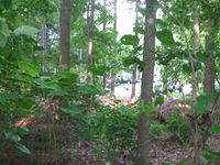
The ride turned out to be 6.3 miles from my bicycle computer. I found the hash point in between two apartment building in the woods.
Now to ride back to my truck and hopefully the 3 lanes that were blocked with the accident were now cleared.
It took me twice as long to ride back to my truck as it did to ride there because it was almost all up hill as I rode back. Total ride: 12.7 miles = 20.438709677362997 Km
Gallery
- Photo Gallery
Achievements
NWoodruff earned the Land geohash achievement
|
NWoodruff earned the Bicycle geohash achievement
|


