Difference between revisions of "2009-09-05 -36 174"
From Geohashing
imported>TunezNZ m |
|||
| (2 intermediate revisions by 2 users not shown) | |||
| Line 1: | Line 1: | ||
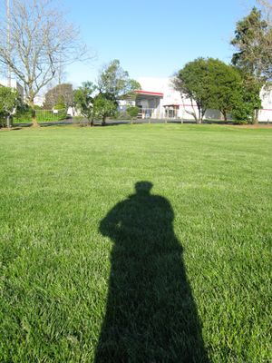
| − | + | [[Image:IMG 1983 -1024x768-.JPG|Shady Character|thumb|left]] | |
| − | + | ||
| − | [[Image: | ||
| − | |||
{{meetup graticule | {{meetup graticule | ||
| lat=-36 | | lat=-36 | ||
| Line 32: | Line 30: | ||
</gallery> | </gallery> | ||
| − | + | [[Category:Expeditions]] | |
[[Category:Expeditions with photos]] | [[Category:Expeditions with photos]] | ||
[[Category:Expedition without GPS]] | [[Category:Expedition without GPS]] | ||
[[Category:Coordinates reached]] | [[Category:Coordinates reached]] | ||
| + | {{location|NZ|AUK}} | ||
Latest revision as of 17:52, 19 April 2021
| Sat 5 Sep 2009 in -36,174: -36.9588002, 174.8889434 geohashing.info google osm bing/os kml crox |
Location
East Tamaki War Memorial park sports field
Participants
Plans
- TunezNZ - Go around 12 noon or after photography at 4pm
Expedition
- TunezNZ - Cruised in at around 4.05pm few people kicking a ball around so I remembered the gold excuse, " I'm doing location assigned photography ", Didn't really need it but I did take pics and kicked the ball back to the people twice. But was a good 3km detour on the way home.


