Difference between revisions of "2009-09-22 33 -84"
(→Expedition) |
imported>FippeBot m (Location) |
||
| (4 intermediate revisions by 2 users not shown) | |||
| Line 22: | Line 22: | ||
=== [[User:NWoodruff|NWoodruff]] === | === [[User:NWoodruff|NWoodruff]] === | ||
| − | I saw a road closed sign but nothing that said "No Trespassing" or any fence. | + | I saw a road closed sign but nothing that said "No Trespassing" or any fence[http://maps.google.com/maps?f=q&source=s_q&hl=en&geocode=&q=33.745487%C2%B0,+-84.107446%C2%B0+&sll=37.0625,-95.677068&sspn=41.003738,76.113281&ie=UTF8&ll=33.74479,-84.103861&spn=0.02109,0.037165&t=h&z=15&layer=c&cbll=33.744712,-84.103827&panoid=7cBS3KwIQzlqHRCeNyOYVg&cbp=12,259.41,,0,5]. I parked on the side of the road and walked 0.25 miles to find the hash point. The hash point was less than 300 feet off of the closed road. |
| + | |||
| + | I took a few pictures and then found what looked like brand new motorcycle tires. | ||
| + | |||
| + | I decided that I would do a Geotrash and take the motorcycle tires back to my truck. A nice way to clean up the property. You never know, they may even fit my motorcycle. | ||
== Gallery == | == Gallery == | ||
| + | <gallery caption="Photo Gallery" widths="200px" heights="200px" perrow="3"> | ||
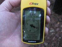
| + | Image:2009092233-84NW01.JPG| 2.07 feet to go. Close enough. | ||
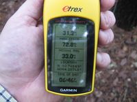
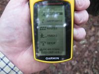
| + | Image:2009092233-84NW02.JPG| Time of the meetup. | ||
| + | Image:2009092233-84NW03.JPG| Date of the meetup. | ||
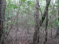
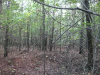
| + | Image:2009092233-84NW04.JPG| A picture from the geohash point. | ||
| + | Image:2009092233-84NW05.JPG| A picture from the Geohash point looking back towards the closed road. | ||
| + | Image:2009092233-84NW06.JPG| Me at the hash point with a bad hair day. | ||
| + | </gallery> | ||
== Achievements == | == Achievements == | ||
{{No trespassing | latitude = 33 | longitude = -84 | date = 2009-09-22 | name = LuxMundi }} | {{No trespassing | latitude = 33 | longitude = -84 | date = 2009-09-22 | name = LuxMundi }} | ||
| + | {{land geohash | latitude = 33 | longitude = -84| date = 2009-09-22| name = NWoodruff}} | ||
| + | |||
| + | [[Category:Expeditions]] | ||
| + | [[Category:Coordinates reached]] | ||
| + | [[Category:Expeditions with photos]] | ||
| + | {{location|US|GA|DA}} | ||
Latest revision as of 05:56, 8 August 2019
| Tue 22 Sep 2009 in Atlanta: 33.7454880, -84.1074455 geohashing.info google osm bing/os kml crox |
Graticule
Expedition
LuxMundi
I believe this property is part of the Dekalb County sanitation department, and is part of a large landfill.
I got to within about 300 metres, but decided not to chance it. I mean, if there is one group you don't want to make mad, it is the garbage men. Ask Homer Simpson.
NWoodruff
I saw a road closed sign but nothing that said "No Trespassing" or any fence[1]. I parked on the side of the road and walked 0.25 miles to find the hash point. The hash point was less than 300 feet off of the closed road.
I took a few pictures and then found what looked like brand new motorcycle tires.
I decided that I would do a Geotrash and take the motorcycle tires back to my truck. A nice way to clean up the property. You never know, they may even fit my motorcycle.
Gallery
- Photo Gallery
Achievements
LuxMundi earned the No trespassing consolation prize
|
NWoodruff earned the Land geohash achievement
|
