Difference between revisions of "2009-10-12 50 11"
imported>Reinhard (Undo revision 208783 by 85.214.92.81 (Talk)) |
imported>FippeBot m (Location) |
||
| (4 intermediate revisions by one other user not shown) | |||
| Line 1: | Line 1: | ||
| − | + | {{meetup graticule | |
| + | | map=<map lat="50" lon="11" date="2009-10-12" /> | ||
| + | | lat=50 | ||
| + | | lon=11 | ||
| + | | date=2009-10-12 | ||
| + | }} | ||
| + | == Participants == | ||
| + | * [[User:Reinhard|Reinhard]] | ||
| + | |||
| + | == Expedition == | ||
| + | It wasn't at all a day to do a bigger bike trip. It was Monday, it was raining the whole day with only some short breaks, it was cold (compared to last week) and since I went to work only at 9am, I had to work till about 6 pm. I really hoped, the weather would get better, because the hashpoint was just too nicely located on the middle of a road that was about a 50 km ride (each direction) from Jena. At 5:30 it was still raining and I thought I had to give up on that mission, but the sky became brighter again and when it was quitting time I set off towards the hashpoint at 6:15. The route was well prepared and stored in my Garmin. The roads, of course, were still wet, so it didn't take that long to make my shoes, socks and feet wet, too. (I can't remember, why I didn't bring my overshoes that morning.) After crossing Jena from the north end to the south end, it already became dark, but I was happy enough that there were still no rain clouds to spot. When I arrived at the hashpoint after 49 km two hours later, the nightly ceiling was still clear and stars were watching my GPS dance (roads were still wet though), that I could do without problems, because the road between Forstwolfersdorf and Rohna was straight and I didn't see any car while I was taking pictures and eating two cereal bars. I wasn't drinking any water from my bottle for the first 80 km (after which I took one swallow and ate two other cereal bars), because it was just cold and my body had enough to do with keeping warm itself. The steep road from Jena to Cosepda, where I live, was quite exhausting, and I was happy to arrive home about 10:50 after 101 km. | ||
| + | --[[User:Reinhard|Reinhard]] | ||
| + | |||
| + | |||
| + | <gallery caption="Photo Gallery" widths="200px" heights="200px" perrow="3"> | ||
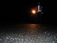
| + | Image:20091012-50N11E-01.jpg|Coordinates reached. | ||
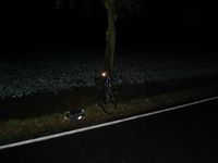
| + | Image:20091012-50N11E-02.jpg|Reinhard and his bike standing at the hashpoint on the road. | ||
| + | Image:20091012-50N11E-03.jpg|Tree standing 4 m from the hashpoint. | ||
| + | </gallery> | ||
| + | |||
| + | === Awards === | ||
| + | {{land geohash | latitude=50 | longitude=11 | date=2009-10-12 | name=Reinhard}} | ||
| + | {{Bicycle geohash | latitude=50 | longitude=11 | date=2009-10-12 | name=Reinhard}} | ||
| + | {{consecutive geohash | count=2 | latitude=51 | longitude=10 | date=2009-10-11 | name=Reinhard }} | ||
| + | |||
| + | |||
| + | |||
| + | [[Category:Expeditions]] | ||
| + | [[Category:Expeditions with photos]] | ||
| + | [[Category:Coordinates reached]] | ||
| + | {{location|DE|TH|GRZ}} | ||
Latest revision as of 06:18, 8 August 2019
| Mon 12 Oct 2009 in 50,11: 50.7435715, 11.9759053 geohashing.info google osm bing/os kml crox |
Participants
Expedition
It wasn't at all a day to do a bigger bike trip. It was Monday, it was raining the whole day with only some short breaks, it was cold (compared to last week) and since I went to work only at 9am, I had to work till about 6 pm. I really hoped, the weather would get better, because the hashpoint was just too nicely located on the middle of a road that was about a 50 km ride (each direction) from Jena. At 5:30 it was still raining and I thought I had to give up on that mission, but the sky became brighter again and when it was quitting time I set off towards the hashpoint at 6:15. The route was well prepared and stored in my Garmin. The roads, of course, were still wet, so it didn't take that long to make my shoes, socks and feet wet, too. (I can't remember, why I didn't bring my overshoes that morning.) After crossing Jena from the north end to the south end, it already became dark, but I was happy enough that there were still no rain clouds to spot. When I arrived at the hashpoint after 49 km two hours later, the nightly ceiling was still clear and stars were watching my GPS dance (roads were still wet though), that I could do without problems, because the road between Forstwolfersdorf and Rohna was straight and I didn't see any car while I was taking pictures and eating two cereal bars. I wasn't drinking any water from my bottle for the first 80 km (after which I took one swallow and ate two other cereal bars), because it was just cold and my body had enough to do with keeping warm itself. The steep road from Jena to Cosepda, where I live, was quite exhausting, and I was happy to arrive home about 10:50 after 101 km. --Reinhard
- Photo Gallery
Awards
Reinhard earned the Land geohash achievement
|
Reinhard earned the Bicycle geohash achievement
|
Reinhard earned the Consecutive geohash achievement
|


