Difference between revisions of "2009-11-01 45 6"
From Geohashing
imported>Crox m (added participants section for easier automated parsing) |
imported>FippeBot m (Location) |
||
| (One intermediate revision by one other user not shown) | |||
| Line 5: | Line 5: | ||
}} | }} | ||
| − | == | + | == Location == |
| − | + | [http://fr.wikipedia.org/wiki/Semnoz Montagne du Semnoz], near [http://en.wikipedia.org/wiki/Annecy Annecy] | |
==Participants== | ==Participants== | ||
| Line 36: | Line 36: | ||
[[Category:Coordinates reached]] | [[Category:Coordinates reached]] | ||
[[Category:Expeditions with photos]] | [[Category:Expeditions with photos]] | ||
| + | {{location|FR|74}} | ||
Latest revision as of 06:36, 8 August 2019
| Sun 1 Nov 2009 in 45,6: 45.8439523, 6.0992964 geohashing.info google osm bing/os kml crox |
Location
Montagne du Semnoz, near Annecy
Participants
Expedition
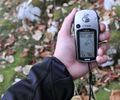
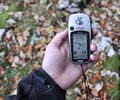
It wasn't raining yet and it looked like a good chance to get another virgin graticule achievement. I was hesitating between leaving the car at the top or the bottom of the mountain, and after looking at the "Terrain" view in Google maps I decided for the road going to the top of the mountain. That proved to be a good choice, as the hash turned out to be just one meter before a cliff... Of course had the hash been just slightly more on the West it would have been a different story.


