Difference between revisions of "2009-11-25 37 -122"
From Geohashing
imported>Jiml (Expand template) |
imported>FippeBot m (Location) |
||
| (5 intermediate revisions by 2 users not shown) | |||
| Line 1: | Line 1: | ||
| − | |||
| − | |||
| − | |||
| − | |||
| − | |||
{{meetup graticule | {{meetup graticule | ||
| lat=37 | | lat=37 | ||
| Line 13: | Line 8: | ||
__NOTOC__ | __NOTOC__ | ||
== Location == | == Location == | ||
| − | + | A turnout on Golf Links Road in Oakland. | |
== Participants == | == Participants == | ||
| + | * [[User:Anthony|Anthony]] | ||
| − | + | <!-- | |
== Plans == | == Plans == | ||
| + | --> | ||
== Expedition == | == Expedition == | ||
| + | The hashpoint is on a turnout along Golf Links Road in Oakland, which has an exit from I-580, so it's really easy to reach. It's also not a big detour from my usual commute home, so I got it on the way. Unfortunately, I got there at night, and wasn't able to get a picture of anything but the GPS unit, and even that wasn't very good. | ||
| − | + | I was really unprepared, but left an empty coke bottle with a piece of cardstock inside, with xkcd written on it. | |
| − | |||
| − | |||
| − | |||
| − | |||
| − | |||
| − | |||
| − | |||
| − | |||
| − | + | == Tracklog == | |
| + | I've posted a KMZ file of this expedition [http://danceslut.net/Geohash2009-11-25_37_-122.kmz here]. | ||
| − | + | == Photos == | |
| − | [[ | + | [[Image:IMG 5495.JPG|300px]] |
| − | |||
| − | |||
| − | |||
| − | |||
| − | |||
| − | |||
| − | |||
| − | |||
| − | |||
| − | |||
| − | |||
| − | |||
| − | |||
| − | |||
| − | |||
| − | + | [[Category:Expeditions]][[Category:Coordinates reached]] | |
| − | [[Category: | + | {{location|US|CA|AA}} |
| − | |||
| − | [[Category: | ||
| − | |||
| − | |||
| − | |||
| − | |||
Latest revision as of 06:56, 8 August 2019
| Wed 25 Nov 2009 in 37,-122: 37.7578183, -122.1379309 geohashing.info google osm bing/os kml crox |
Location
A turnout on Golf Links Road in Oakland.
Participants
Expedition
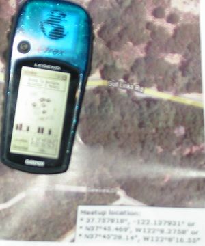
The hashpoint is on a turnout along Golf Links Road in Oakland, which has an exit from I-580, so it's really easy to reach. It's also not a big detour from my usual commute home, so I got it on the way. Unfortunately, I got there at night, and wasn't able to get a picture of anything but the GPS unit, and even that wasn't very good.
I was really unprepared, but left an empty coke bottle with a piece of cardstock inside, with xkcd written on it.
Tracklog
I've posted a KMZ file of this expedition here.
